Latest News: OUR AMAZING MARATHON IS NOW COMPLETE and we cross the finishing line in a beautiful and sunny Arisaig in the company of fantastic friends who walk the final stages with us and celebrate thereafter in a huge party atmosphere. (Refer Days 127 and 128 immediately below this summary for details of the latest leg of our expedition)
Total distance walked - 2,073 miles
Hostelries inspected - 160
__________________________________________
DETAILS OF THE LATEST LEG Days 127 and 128 Glenluig to Mallaig 01-020915 (Distance 26 miles - Elapsed Time 9 hours)
The last leg of the marathon walk around the whole Scottish Coastline is hugely different in that Kenny and Norman don’t only have the ever-reliable Stewart for company - a further five close friends walk with us on Day 1, with a whopping thirteen supporting us on our second day. The interest expressed by our followers over the last six years has been immense so it’s a real pleasure to complete our project with these guys alongside. It’s quite touching to note how they have put themselves out to accompany us – but, then again, it may just be that the post-walk dinner, the “wee swallies” and the party afterwards are actually the real attraction!
So, Day 1 starts off by dropping Aileen, Ian “Aitchy” Aitchison and Derek Brown at our start point on the road between Lochailort and Glenuig. It’s here that we finished off on our last walk in this area. Kenny then heads off to the railway station to round up Norman, Stewart and Al “The Sherpa” Reynolds, supplier of all things Talisker and Highland Park. While Aileen returns our car to the hotel, six of us fuel up by way of several drams, including of course, the Black Grouse from Aitchy’s impressive three pint hip flask, before setting off on the walk. After covering an initial four miles it seems appropriate to drop into the Lochailort Hotel for rehydration. It has, after all, been a tough 2,051 miles so far. Here we’re joined by Arthur and Anne Harkes.
The remainder of the afternoon simply involves a steady stroll of some ten miles, on and off road, to our accommodation at the Arisaig Hotel with an associated overflow into The Old Library. By this time, our group has grown even further, in the form of Bill and Barbara Angus. Aileen and her friend, Evelyn Budge, are already making in-roads to the hotel’s wine cellar - the party has started.
A dreich and rainy morning on our second day sees us killing time in the very acceptable company of Aitchy’s now famous and well-admired hipper, Al “The Sherpa’s” mobile bar and several cans of ale from the adjacent Spar shop. It’s all good preparation for this afternoon’s final walk from Mallaig to Arisaig. Jim Colford clearly senses the waft of alcohol and, as though by Harry Potter magic, arrives from his overnight stopover in Glencoe, apparently to chaperone us on the last leg of our journey, to partake of a few wee snifters. Eventually we make for Arisaig railway station where the Mallaig train’s arrival sees Anne coming off the train with a view to joining the walk later in the day. Kevin Molloy and Teresa Glynn, from the Emerald Isle, and who, to be sure, are already on the train, represent our first International walking buddies.
Our arrival in Mallaig sees the sun beating down on us and so, once again, we mitigate the potential effects of dehydration by taking on more essential liquid at The Marine bar. Then it’s upwards and onwards and we leave the town to the sight and sound of the Jacobean Steam Train impressively saluting our achievement as it hisses by. It’s all meant to happen. The underfoot walking conditions en-route are primarily an appealing mix of minor road and beach with the Silver Sands of Morar displaying astounding beauty as we stroll over the sand. Some three miles from Arisaig we’re met by Anne who ships in even more supplies of whisky and fizz – it’s that anti-dehydration thing again!
As we get closer to Arisaig, it’s deemed appropriate for the “main players” to deviate along a more definite coastal route while the remaining section of the infantry continues on the road to the eventual finishing point. Our progress along the coast proves more demanding than anticipated but, once again, that’s meant to be – it’s merely a repetition of the type of terrain that we’ve encountered throughout our walk.
Arriving at the finishing line in Arisaig, a swirling chequered flag greets us to mark our massive achievement - it’s absolutely superb!
The post-walk dinner and subsequent party is an epic affair that will be with us for ever. Our 2,073 miles and 160 pubs along the way may now seem like a distant memory ….. but it’s one to savour for ever!
Highlights:
OUR MARATHON WALK IS COMPLETE!.
Our fantastic friends go out of their way to join us on our last leg.
The end of walk dinner and party is absolutely superb.
We probably haven't taken in the magnitude of our achievement !
Lowlights:
ABSOLUTELY NONE.
Pub Ratings:
Lochailort Hotel, Lochailort (6)
Arisaig Hotel, Arisaig (9.5)
Marine Inn, Mallaig(4)
Photographs: My Pictures/ Coastal Walk Day 127 and 128 Glenluig to Mallaig 01020915
Introduction The purpose of this log is to record activities concerning Kenny Sword’s and Norman Turner’s walk around the Scottish coastline. The initiative to carry out this staged walk, probably taking us several years, came from a discussion with Morris Blair who, on retiring from the police force, set himself a challenge to do just that, accompanied by friends. Our aim is virtually identical and as such we are grateful to Morris and his walking colleagues for providing us with the details contained within the website http://www.walkingscotlandscoast.com/. The information therein has allowed us to minimise our planning effort and virtually tail-gate on to the website detail.
Since our retiral from a long career within Bank of Scotland (having primarily been involved in a world-class independent organisation rather than the ensuing mess that exists today) we have already done long and thoroughly enjoyable walks in the shape of The Speyside Way, The Cateran Trail, The St. Cuthbert’s Way and the Great Glen Way, a mere 73 mile jaunt from Fort William to Inverness. As is customary on these pre-defined trails, we are joined by our mate Stewart Coutts, another retiree from Bank of Scotland of yesteryear although mainly of Standard Life fame. Jim Colford, another Bank of Scotland stalwart, did the Speyside Way (our very first walk) with us but never came back. He obviously couldn't match Kenny's and Norman'superior fitness or else he simply got sore feet. Perhaps one day he'll join us for a leg of our Coastal Walk.
The banter, laughs and "wee swallies" along the ways and in the pubs of an evening have been immense and will certainly continue. It is hoped that the information within this blog will serve as a permanent record of our experiences as we eat up the magnificent Scottish coastline and appreciate the homeland that we so dearly love. We recognise that the great Scottish weather will, in itself, create a major challenge that will require our fitness levels to be high in order to cope with the conditions. Indeed, we are hell-bent on proving and maintaining our fitness levels and this is one of the main reasons for doing the walk. It is of note that before leaving home on Day 1, a typical dreich and misty Scottish morning, Norman telephoned to query whether we still wanted to set out on our mission. A no-brainer – of course we did! So, the story starts here.
Day 1 Berwick upon Tweed to St. Abbs (Coldingham) 160409 (Distance 18 miles - Elapsed Time 7 Hours)
Thursday, 16th April, 2009 sees us setting off for Berwick-upon-Tweed to walk to St. Abbs (Coldingham) on the first leg of our wee trip around Scotland’s coast. The weather is misty and damp but we are going ahead as the weather forecast predicts bus service to Berwick. The weather appears to be improving as we move south – or maybe that is simply wishful thinking and we are simply hoping it will get better and improvements will arrive mid-morning with a chance of sunshine. Norman picks me up in Bonnyrigg at 8.30 and we head off down to Coldingham. After getting our walking boots on in Coldingham car park we are invited to view the recently renovated village hall. Lottery funding was provided to help in the development and the end result is terrific. It’s like Kenny has returned to his homeland - but only temporarily.
Perryman’s bus arrives on schedule and off we go to Berwick arriving in Chapel Street at 10.30. A walk down Hyde Hill sees us at the start of our venture – or so we thought. We encountered a wee bit of a problem in getting out of the dock area (and we think we can walk all the way around Scotland?) as the signage was not too clever. However, we remedied the difficulty and simply headed along the famous Berwick Walls and northwards. Once we were out on the headland we quickly realised how fantastic it was to be out in the brisk sea air and sunshine (yes sunshine in Scotland). The walk towards Burnmouth pretty well followed the east-coast railway line while still remaining close to the water’s edge. The views over the cliffs were quite magnificent and the wild flowers (primroses, daffodils, cowslips etc) along the way were quite superb. Perhaps springtime is the best time for this type of walking so we were fortunate in that respect.
We crossed the English/ Scottish border in good time and after a short while went right down to shore level at Cowdrait. This little harbour village is a beautiful, picturesque and tranquill setting to the extent that Norman thinks he might even hire a holiday cottage here in the future. Norman suggested (well he would) that it might be an idea to have a refreshment at “The Gull’s Nest” (or as it’s now called “The First and Last”) pub. This turned out to be a good move and Norman’s dream came true in the shape of a superb cold pint of Belhaven Best. Then, after some thirty minutes or so, we were off towards Eyemouth, skirting the golf course and harbour area en-route. We couldn’t possibly go past Eyemouth without stopping for the obligatory fish supper which we ate on the promenade overlooking the bay watched over by two greedy herring gulls. Norman never even offered them any of his chips. Then it was off again towards Coldingham Bay via the Fort, Lincum and Mildown Beaches before dropping down at the Homeli Knoll and on to Coldingham Beach where the sands were quite magnificent and in splendid condition. Then it was onwards to St. Abbs and a final trek up the Creel Path to Coldingham and back to the car. Essentially however, we found a need to visit The Anchor Inn (purely for Kenny’s old time's sake of course). Who’s in the corner but Norman Sword – seems that he has inherited Kenny’s seat from year’s gone by! After a thirst quencher, or rather two, it was a case of into the car and a jaunt up the A1 after what can only be described as a fantastic first day’s walking around Scotland's coast. We look forward to more of this.
Highlights:
That pint at Burnmouth
The coastal scenery
The fish supper on the promenade at Eyemouth
The fact that Norman’s knee (bit problematic of late) stood up to a rigorous test.
Lowlights:
The panoramas would have been even better had the weather been better.
Pub Rating:
First and Last (previously Gull’s Nest), Burnmouth (7);
Anchor Inn, Coldingham (7)
Photographs: My Pictures/Coastal Walk Day1 Berwick to Coldingham 160409
Day 2 St. Abbs to Cove (Cockburnspath) 230409 (Distance 15 miles – Elapsed Time 6 hours)
It’s Thursday, 23rd April and one week on since we started out on our venture. Once again, the weather is a bit overcast but remember, this is Scotland. So off we go by car towards Cockburnspath where we get another Perryman’s bus, this time to St. Abbs to start the second stretch of our walk. The tiny fishing community of St. Abbs is looking fabulous and we have a short look around the village to appreciate the natural beauty and the cafes which have been developed in recent years. Norman even managed to take a photograph (certainly better than his attempts in Berwick). We head out towards the bay at Starney by way of the wee path just outside the village and make our way towards St. Abbs lighthouse. The views looking back towards St. Abbs and Eyemouth in the distance are quite magnificent even though the weather is not as bright as it could be. The screaming of the gulls along the way is noticeable – better than Norman’s singing though. Our lunch break comes in the form of a seat at beautiful Pettico Wick where we look north right up towards the Bass Rock and Torness which is certainly not built for aesthetic splendour. The Fife coast is visible even though it is not crystal clear. After 15/ 20 minutes it is up and on again in the direction of Lumsdaine and Dowlaw. This is a hard hike by now as the path is becoming less well-defined and we are “climbing” and descending some steep hills along the way. Norman is needing to be careful of his knee packing in. Kenny needs to be careful of that too as he doesn’t fancy carrying that fat lump over the braes. The coastal path is becoming non-existent and we are really choosing our own way although that is not a major issue as we are simply heading north, keeping the sea to our right. There are various choices for us. We stop to admire the ruins of Fast Castle perched on the cliff edge. How much longer will it sit there? Moving on we go towards Redheugh, displaying its superbly vivid red cliffs. This is news that the location was so called because of the colour of the rocks. We branch away from the clifftops and travel through Redheugh farm and back down towards the cliffs. From there it is on towards Pease Bay although we choose not to descend the steep cliffs on to the sands. When we reached Pease Bay caravan park we found to our delight that, surprisingly, there was a pub on site – ya byooty! But no, the place is closed as it has only just gone five o’ clock. Probably just as well as the pub was just a typical modern, characterless caravan site thing. Ah well, the pint will be better when we eventually get it in our hands. So we trudge on and hit the tiny fishing hamlet of Cove – the harbour is beautiful even though the tide is out. From here, where we have joined the Southern Upland Way for a very short spell, we head back to Cockburnspath after a tough, albeit enjoyable, day’s walking. We are really disappointed that there is no pub in the village to allow us to take a bit of relaxation (oh yes, and beer). After getting the walking boots off we make for East Linton and a very welcome pint at the Crown Hotel which turns out to be terrific.
Highlights:
The views along the way, particularly looking back towards St. Abbs.
The weather stayed fair yet again.
Our over-due pint at East Linton.
Lowlights:
The walk was a long haul with only a very short lunch stop.
We missed a stop off at a village along the way and must force ourselves to take a break in future (if only for foaming ale).
Pub Rating:
Crown Hotel, East Linton (8)
Photographs: My Pictures/Coastal Walk Day2 St.Abbs to Cockburnspath (Cove) 230409
Day 3 Cockburnspath (Cove) to Dunbar 070509 (Distance 12 miles - Elapsed Time 5.25 Hours)
Thursday, 7th May, 2009 and we’re off again, this time to Cockburnspath for the leg to Dunbar. Bear in mind that last week we walked more than 73 miles along the Great Glen Way yet here we are again, itching to get off on another walk. Norman drives to Dunbar and we pick up our now famous Perryman’s bus, to Co’path this time, for the start of our walk. Following the tail-end of the Southern Upland Way, coupled with the John Muir Way as necessary, we head northwards and after a couple of minor routing issues are soon on our way along the coast. Early in the walk we encounter a magnificent display and scent of wild garlic (excellent for Kenny's cooking by the way) at Bilsdean and the occasional waterfall through the woods which border the coastline. The weather is windy but really sunny and we are well sheltered from the elements on much of the walk. The imposing Torness power station is virtually always in view and the Blue Circle cement works is similarly obvious. Our path is pretty well varied and we have a share of river and woodland walking to break the obvious coastal paths and beaches. The beaches include pebble and sand, much of which is vivid white (who needs the Caribean). We choose to walk on the beach for much of the way which tests our levels of fitness pretty well. Lunch is taken sitting on the rocks at a beach immediately before we reach the very sandy cove at Thorntonloch. Although Torness overpowers the landscape it was pleasing to see that an upper and lower promenade had been developed to provide a super walkway around the power station and adjacent to the sea. From the end of the promenade we were able to hug the coastline all of the way towards Dunbar, via Barnes Ness lighthouse and onwards along the edge of Dunbar golf course. Following a gentle stroll through the harbour-side of the town we finished this leg of our venture at the swimming pool where the car was parked. All in all, another great days walking where, once again, we discovered parts of the coast, natural and otherwise, that we never knew existed.
Highlights:
The variety of walking terrain gave us a great mix and most certainly prevented any monotony developing.
Even though we hadn’t expected it, the path on the seaward side of Torness was actually very pleasant for walking and viewing.
The sight and smell of wild garlic as we left the Bilsdean area of Cockburnspath.
Today saw us putting a tick in the box, having completed the walk along the Berwickshire coast
Lowlights:
The pint of newly marketed Younger’s Best at the Black Agnes pub was disappointing – it was only £2 a pint mind you.
Pub Rating: Black Agnes, Dunbar (5)
Photographs: My Pictures/Coastal Walk Day3 Cockburnspath (Cove) to Dunbar 070509
Day 4 Dunbar to North Berwick 110509 (Distance 16.5 miles - Elapsed Time 6 Hours)
Monday, 11th May, 2009 sees us heading for North Berwick where we park the car before making for Dunbar by Eve bus services. We start walking just before 11.00 and take the footpath around the headland, admiring the views for miles, with nothing but beautiful blue skies around us. We hate this retirement – aye, right! Heading out around the side of Winterfield golf course we eventually come to Belhaven Sands where we are met by STV cameras who interview us about pollution on local beaches for that evening’s Scotland Today news bulletin. To think that we were virtually the only people (apart from a wind surfer and a couple of dogs) on such a massive expanse of sand and we come across television cameras – mind boggling! So after becoming TV personalities for the day it is back on our trek again, heading northwards. Unfortunately, we needed to leave the coastline and follow the trail of the John Muir Way for part of the route due to difficulties gaining access at Tyninghame House, which we had learned from Morris’s website. This meant that things were less interesting than we had hoped but we are sure that this is only one of many hazards that we will encounter as we progress around the coast. To get away from the John Muir Way, and return to the coast, we made our way towards Tyninghame House albeit skirting the estate to avoid any potential confrontation. Unfortunately, this meant that general access on our route was not by way of clearly marked paths thus forcing us to do a bit of scrambling around the edges of fields. At times this was far from pleasant. We eventually returned to the beach at Tyninghame and that was absolutely splendid in both views and good walking conditions. However, this didn’t last for long and, after deciding that the walk around the rocks was too dangerous, particularly with the tide coming in rapidly, we decided to back-track and move a bit further inland. Once more, we were forced into walking around the edge of fields in the absence of anything better (other than tarmac roads which we are trying to avoid). We had hoped to gain access to the cliffs at Tantallon Castle but were barred from doing so by what can only be described as beaurocracy. Once more, therefore, it was back to the road for a while before moving back cliffwards at the Glen golf course. From there it was a case of skirting the course before entering North Berwick along the road adjacent to the sea.
Highlights:
The weather and views were once again splendid.
Some fabulous hidden gems of beaches along the way.
Well, of course, being on the telly!
Lowlights:
Very limited pathways around the actual coast, causing us to move inland a wee bit or to scurry around the edges of fields.
The need to back-track on a few occasions.
Pub Rating: Nether Abbey Hotel (Fly Half Bar), North Berwick (7)
Photographs: My Pictures/Coastal Walk Day4 Dunbar to North Berwick 110509
Day 5 North Berwick to Port Seton 210509 (Distance 16.5 miles - Elapsed Time 6.5 Hours)
It’s now Thursday, 21st May, 2009 and this time we start out at North Berwick and head towards Port Seton. Public transport is the name of the game today and we take a train from Edinburgh to North Berwick, planning to catch a Lothian Region No. 26 at Port Seton to ship us back to Edinburgh. This leg proved to be a relatively easy, albeit enjoyable, day’s walking. Much of the earlier stage was on sand with us walking firstly on North Berwick beach and then on to the magnificent sands at Yellowcraigs. The fact that the tide was in made it a wee bit harder as we were forced to use the dry sand which was much more difficult to walk on and pretty tough on the leg muscles. Our walk was extended somewhat as we were unable to directly cross Aberlady Bay since the tide was in thereby causing us to veer a course around the bay. However, all was not lost as we had the opportunity to take a quick pint at the Aberlady Inn (for what it was worth). Walking onwards from Aberlady we skirted the golf courses at Kilspindie and Craigielaw and were fortunate enough to see a family of seals (well done eagle-eye Turner) playing in the sunlight on the sand bank just off the coast. From here to Port Seton, our walk entailed a mixture of sandy beach, pebble beach and solid ground in the form of the John Muir Way. Weatherwise, we encountered our first rain so far when the heavens opened up as we neared the end of our day. It was probably worse as we were scurrying over rock pools and seaweed while attempting to put on the waterproofs However, the rain didn’t last too long and we were dry again before hitting the Old Ship Inn at Port Seton.
Highlights:
The beauty of the beaches through East Lothian.
The weather was generally good and sunny.
The seals off Kilspindie were a joy to watch.
Lowlights:
Quite a bit of litter as we passed through Longniddry beach and neared Port Seton.
We weren’t able to see the submerged submarines in Aberlady Bay as the tide was in.
Pub Rating:
Aberlady Inn (6)
Old Ship Inn, Port Seton (7.5)
Café Royal, Edinburgh (8)
Photographs: My Pictures/Coastal Walk Day5 North Berwick to Port Seton 210509
Day 6 Port Seton to Silverknowes 260509 (Distance 17 - Elapsed Time 6.5 Hours)
We are back on public transport again on Tuesday, 26th May, this time taking a Lothian Region No. 26 to our start point at Port Seton. Arriving just before 11.00 on a fabulously sunny day we set off along a well defined tarmac path, which skirts the power station at Cockenzie, towards Prestonpans. The Prestonpans Murals are an interesting attraction depicting industries and life from yesteryear. As we head in the direction of Musselburgh we are fortunate that the tide allows us to walk along the seawall/ breakwater on the seaward side of an open cast mine and latterly the race course/ golf course. Had there not been an exit at the far end a long bit of back-tracking would have been required. Lunch time saw us having a break overlooking the harbour at Fisherrow where we are protected from the strong winds which are blowing down the Forth. After a short stop we are off again towards Joppa, Portobello and Seafield (this being by far the least attractive sight on our walk so far). The walks along the promenades at both Joppa and Portobello are easy but bracing given the strong headwinds. After moving on to Salamander Street in Leith we turn in the direction of Ocean Terminal and the Royal yacht Britannia. Being unable to completely skirt this area due to security restrictions we need to back-track to the main road which we follow all the way to Newhaven where Norman suggests an option of one of two pubs for a refreshment. Unable to make a decision we decide to visit both. We have a pint of fine Stewart’s Marathon ale (only went on sale last weekend) at the Starbank Inn. Another 100 yards along the road (mind we did have to cross it) sees us at the Old Chain Pier for another pint but neither the place nor the beer is a patch on The Starbank. Thereafter we head on towards what was our intended destination at Granton Harbour. However, we are feeling refreshed and the weather is splendid, apart from strong winds in our face, so we decide to keep going for approximately a further three miles along as far as Silverknowes which is a more convenient bus terminus. This additional three miles or so turned out to be a terrific walk through Gypsy Brae parkland and along the promenade. The view up the Forth is magnificent and both bridges look spectacular. All in all, another great days walking (and by now Norman is becoming more and more frightened at the thought of crossing the Forth Road Bridge on foot - think he’ll be wearing the parachute).
Highlights: The very well defined walkways at Port Seton and Prestonpans.
The Murals at Prestonpans.
The views up the River Forth, particularly as we moved into the Silverknowes area.
That pint of Stewarts at The Starbank Inn.
Another tick in the box for having completed the walk along the East Lothian coast.
Lowlights:
Seafield.
The walk into Ocean Terminal proved fruitless.
No pork pies from Anne – yet again!
Pub Rating:
The Starbank Inn, Newhaven (8)
Old Chain Pier, Newhaven (5)
Photographs: My Pictures/Coastal Walk Day6 Port Seton to Silverknowes 260509
Day 7 Silverknowes to Aberdour 040609 (Distance 19 miles - Elapsed Time 7 Hours (including beer stops))
Today our travel is a mixture of Lothian Region Transport buses and First Scotrail. Kenny takes a No. 29 all the way from Bonnyrigg to Silverknowes while Norman makes his way into the city centre and gets on the 29 there. Our journey back is by train from Aberdour. Norman probably didn’t sleep a wink last night over the thought of crossing the Forth Bridge on foot. He’s even been checking wind speeds so that tells a wee story. Pssst! – Kenny hasn’t let on that he can’t stand heights either as one wimp is enough to be walking with. So anyway, we rejoin our tracks, starting at Silverknowes where we finished off last week, and head out along the Forth in the direction of Cramond. We are unable to cross the River Almond here as the little ferry boat service which operated some time back appears to be no longer in existence. This forces us into walking alongside the Almond until we come out at the Cramond Brig Hotel from where we make our way back down to the coast at Eagle Rock. The views out over the Forth are splendid as we make our way along the water’s edge in the direction of Hound Point and Dalmeny House, skirting the golf course as we go. Barnbougle Castle sits magnificently overlooking the sea. From here we make our way to South Queensferry where we have a short lunch break overlooking the Forth Bridges – what a view! More positively however was Norman’s lunch box which included the famous, and fabulous, pork pie and a wee coconut cookie which Norman claims to have made - aye right. Well done Anne! Lunch is short as Norman wants to get that walk across the Forth Road Bridge over and done with – what a wimp. With this in mind we head off uphill to join the bridge and what a piece of cake that was even though Norman was white, shaking, petrified and never looked right nor left as we made our way northwards. But he did it so well done Auld Yin. From the north end of the bridge we made for the village of North Queensferry and stopped for a celebratory pint at the Ferryman’s Inn. Here we were approached by a Daily Record journalist and a photographer who interviewed us, outside the pub, regarding the current Gordon Brown political crisis. This continual press stuff is beginning to put pressure on us – even though we are stars. From here we join the Fife Coastal Path and make our way towards Inverkeithing which was our originally intended end point. However, being the fit young lads that we are we set our sites on going as far as Aberdour which we were told was a mere hop from Inverkeithing and Dalgetty Bay. This turned out not to be strictly correct as it was a fair hike, not helped by an unscheduled (we must have missed an FCP sign) trail for miles through a housing estate. Indeed, the later stages of the walk lost some of the natural coastal beauty as a result of circumventing a gas terminal and being forced on to minor tarmac roads for much of the way. However, we made it to Aberdour and were ready for a fine pint of real ale in the beer garden at the Aberdour Hotel.
Highlights:
The sight and proximity of both Forth Bridges sitting together - magnificent structures.
Yet again, the weather was excellent for walking.
Norman conquered the walk over the Forth Road Bridge.
The interview by the Daily Retard.
Lothian is now behind us (another tick in the box) and we are into Fife
Oh yes, that famous pork pie.
Lowlights:
There was a bit more walking on tarmac roads than we had expected.
Pub Rating:
Ferrybridge Inn, North Queensferry (7.5)
Aberdour Hotel, Aberdour (6.5)
Photographs: My Pictures/Coastal Walk Day7 Silverknowes to Aberdour 040609
Day 8 Aberdour to East Wemyss 080609 (Distance 16 miles - Elapsed Time 6 Hours (including beer stops))
Our preferred mode of transport today saw us taking a car to Aberdour, our starting point, and a local bus service from East Wemyss back to Aberdour at the end of the walk. The weather was ideal for walking with good strong sunshine backed by a slight breeze which was virtually perfect. This walk mainly saw us following the recognised Fife Coastal Path all of the way apart from minor personal changes to our route on occasion. The number of little picturesque villages along the way made this leg fantastically satisfying and interesting and we never became bored from having long spells with nothing to see or appreciate. Starting out at Aberdour and moving northwards along the beautiful Silver Sands, we soon hit Burntisland with its massive stretches of clean white sand. From here we walked via Pettycur Bay, and its mass of holiday caravans, mainly by the main road having been directed away from the water’s edge. On advice, we went back on to the coastline and headed towards Kinghorn which we approached via its beautiful wee harbour. Indeed, this is where we stopped for our lunch break, basking in the strong sunshine and protected from the wind by the high harbour wall. So, after a short break it was northwards once more, this time making for Kirkcaldy. This stretch of the walk was pretty ordinary although we did pass the prominent red sandstone ruins of Seafield Tower House (c. 1500) along the way. Kirkcaldy itself was, to say the least, not picturesque at all and we really just used the long promenade as a pass-through. Once again, we were on tarmac road (we reckoned that we had probably missed a FCP sign) until we decided to move into the lovely Ravenscraig country park which took us all the way into the surprisingly beautiful harbour village of Dysart, certainly a hidden gem and worthy of a few photographs. Having passed the now moth-balled Francis Colliery, our next port of call was West Wemyss where the Turner man felt the urge for a pint of his favourite Belhaven Best. However, investigation proved that the only pub in the village had closed down as had the hotel and shop. So, with this in mind, it was on to the next village of East Wymess which really was not a whole lot better - but it did have a pub. It was nothing to write home about although, to be fair, the beer was cold, wet and well kept. East Wemyss served as our stopping off point for today and so from here we took the local Stagecoach bus service back to Aberdour. After a lengthy, twisty journey we felt the need to stop off for another cold beer on the sun patio of the Cedar Inn – fantastic.
Highlights:
The beauty of the wee harbour villages along the way.
The weather was ideal for our walking.
Generally, the Fife Coastal Path was in very good order and well maintained.
Lowlights:
There were occasions where we directed on to tarmac roads a bit too much.
FCP signage could have been clearer at times (while in some sections it was excellent)
The disappointment of finding no pub in West Wymess
Pub Rating:
Central Hotel, East Wymess (6)
Cedar Inn Hotel, Aberdour (9)
Photographs: My Pictures/Coastal Walk Day8 Aberdour to East Wemyss 080609
Day 9 East Wemyss to Pittenweem 180609 (Distance 18 miles - Elapsed Time 7 Hours)
It’s another week so there’s another leg of Scotland to take on and this time we have an associate walker. Jim “no’ far off 60” Colford has decided that the the terrific enjoyment which we have experienced to date needs to be shared especially since the stretch of coastline we are tackling is pretty near his homeland of Leuchers/ St. Andrews. Jim also has the honour of being chauffeur for the day and picks us up in Colinton. He drops us at East Wemyss to restart our walk while he takes his car some four miles along the way to Leven (allegedly the plates of meat are potentially a bit fragile these days – must be all that golf) where it sits for the day. So, at this point Kenny and Norman are back on their own again and heading for the burgh of Buckhaven and Methil. This may well have been the least attractive area of our walk to date and it was great to get it over so early in the day. On reaching Leven we meet up again with Jim (suitably stuffed with Buckhaven black pudding rolls and coffee by this time) who is raring to hit the trail. From here we make for Lower Largo and meander through the village for a time. We come across a most fascinating and colourful sculpture by Alan Faulds (www.alanfaulds.co.uk), an Architectual Studies graduate from Strathclyde University. Still on the culture stakes we then find the house in which was born Alexander Selkirk – the first Robinson Crusoe – and the most famous person to come out of Lower Largo. A statue marks the thatched cottage where he was born. The son of a shoemaker, Selkirk left for a life at sea, and after a quarrel with the captain of the ship he was put ashore for four lonely years on the deserted island of Juan Fernandez. Continuing with our walk we head for Shell Bay before reaching the gorgeous villages of Earlsferry and Elie which effectively run into each other. Jim once more shows his value and recommends that we stop off for a beer at The Ship Inn, an old haunt in Elie. It meets all the expected criteria – cold beer, beer garden and view (magnificently looking over the vast area of beach). Restarting our walk we soon come across the now somewhat partially restored Ladies Tower just outside Elie. Built in the mid 18th century as a summerhouse, it also served as a changing room for Lady Jane Anstruther who was one of the early naturists. It is said that, when she went swimming naked in the bay, she sent a bell ringer around the town to warn residents to keep away. Aye right! Shortly after that we are hit with a 15 minute downpour (it didnae half sting Kenny’s scalded napper, by the way) which took us by surprise as we had only a short time back basked in the sunshine at The Ship Inn. However, the sunshine quickly returned. Moving onwards, we encountered the ruined St. Monans Castle and Dovecot and the beautiful village, albeit spoiled on the day with the dredging that was taking place in the harbour. It seemed also that the ugly and imposing shipyard structure, which has clearly been a source of employment in years gone by, is being demolished. That can only enhance the beauty of the village. From here it was a short and straightforward walk into Pittenweem. Before we entered the village, however, we walked past the historic windmill which had been used in days gone by to power the local saltpan process. This involved twenty-four hour working with women and children forming part of the workforce. There is still clear evidence today of the pan houses which existed. Unfortunately when we did reach Pittenweem, we had to have another pint to kill time before our Stagecoach bus arrived to take us back, via the beautiful Fife countryside, to Jim’s car at Leven. Jim might just have been smitten enough with the pleasures of this walk to seek a day-pass for a further leg – here’s hoping!
Highlights:
The wee fishing villages along this stretch were quite superb Jim’s company for the day was refreshing
The weather was kind to us once again and the sun shone for most of the way
Kenny had his photo taken today – proving that he is actually doing the walk
Jim was introduced to Ann’s famous pork pies
Lowlights:
Buckhaven and Methil were pretty ugly places
Pub Rating:
The Ship Inn, Elie (8)
The West End Bar, Pittenweem (7.5)
Photographs: My Pictures/Coastal Walk Day9 East Wemyss to Pittenweem 180609
Day 10 Pittenweem to St. Andrews 240609 (Distance 21 miles - Elapsed Time 8 Hours)
Well he couldn’t resist it could he. Jim obviously enjoyed last week’s walk so much that he pleaded on bended knees to let him do some more. “OK Jim, that’ll be fine as long as you take your car ….. and buy the beers … and the fish suppers and ….” . Great to see you back Jim. So this week we depart in thick fog and Kenny and Norman are deposited at the restart point in Pittenweem, by which time the sun is breaking through. Jim takes his car to Anstruther (or Enster as it is locally known) to buy his ham sandwich and two bottles of water, all for £2.95 by the way, while the professionals sweat it out on the first part of the leg towards Anstruther and the beautiful Cellardyke, scene of the bird flu incident. From here we head north east towards Crail, passing the impressive Caiplie Caves en route. We hit the village as a fleet of small fishing boats are queuing to enter the harbour with their day’s catch so we have lunch (including the famous pork pies which Norman battled through the fog to get before leaving home - what a hero), basking in the sunshine and watching the fishermen and artists at work. Pure heaven!
After our short break we are back on our feet and meandering through the lovely, neat little holiday village of Crail, having failed to find a suitable hostelry to quench our thirst. We are now heading for Fife Ness, the most easterly point ofFife, via the Kilminning wildlife reserve. For a while it looks like we will be engulfed in thick fog which is heading our way but that never materialises and in fact the sun appears stronger than ever. At Fife Ness we pass the lighthouse, coastguard station and wartime gun emplacement before wandering past the gorgeous little natural harbour. Skirting several top-notch golf courses we now make for the lovely, sandy Kingsbarns Beach before heading inland towards Boarhills where Jim assures us that there is a pub. However, even though we are parched and gasping for that pint of ice-cold lager, Jim has told us “ a wee porkie” and there is no such thing. Farewell Mr Colford – we’ll catch up with you when we finish our walk around Scotland.
So, it’s a deep breath and onwards towards the coast for the last five miles to St. Andrews. This turns out to be less picturesque than the previous sections of the Fife Coastal Path and is a fairly rough and difficult walk at times. Walking on the soft sand is hard going. Some two miles from St. Andrews a sign bars us from progressing along the beach at high tide resulting in Sherpa Kenny needing to identify an alternative way to drag Norman’s zimmer frame along. Thereafter, we come back down to sea-level and have a long, tired walk in the strong sunshine into St. Andrews. Jim’s local knowledge comes to the fore once again when we discover that his recommended pub, from his student days, has closed down. He really is doing well. Jim did, however, find us the Central Bar where our pint of ice-cold Fosters was treeeemendous and we slowly came back to life.
From here it’s off to the bus station to catch our transport to Anstruther for that famous fish supper (Oh, but first it’s a pint of ice-cool Carlsberg Gold – or rather two for Norman). For the record, Kenny stood in the chippy queue for forty minutes - but it’s Norman’s turn next year.
Highlights:
Yet again, the Fife villages are beautiful
Brilliant weather once more even though the day started with thick fog
The pints of ice-cool lager
That fish supper in Anstruther
Lowlights:
The disappointment of finding that there was no pub at Boarshill
We were knackered when we reached St. Andrews - we really must take breaks
Pub Rating:
The Central Bar, St. Andrews (8.5)
The Ship Inn, Anstruther (7.5)
Photographs: My Pictures/ Coastal Walk Day10 Pittenweem to St Andrews 240609
Day 11 St. Andrews to Dundee 020709 Distance 21 miles - Elapsed Time 7 hours)
It’s back to just Kenny and Norman this week and the weather is quite superb – sunny and temperatures exceeding 20° at 7 am. We’re off in the train to Leuchars from where we catch a connecting bus back to St. Andrews to start Day 11 of our walk. Leaving from the bus station we are soon on the Fife Coastal Path and passing the Old Course Hotel. Everyone seems to pose for photographs on the famous Hump Bridge which Norman advises saw Jack Nicklaus having his photograph taken whilst playing the 18th hole in his last ever British Open. Our pace is fast as we travel fairly well inland towards Guardbridge, crossing the River Eden as we enter the village. Just over a mile further on and we come to Leuchars, home of the famous 43 Squadron, as advised by The Mid, ex-aircraft engineer of Mad Mitch days. We skirt the airbase and hear the deafening roar of a Tornado as it takes off. Incidentally, we hear on the news that night that a Tornado has crashed near Arrochar some thirty minutes later and two aircraftsmen are killed. Could it have been that same aeroplane? Having left Leuchars we are on tarmac roads and come across Earlshall Castle before crossing beautiful meadows towards Tentsmuir Forest. Nature is at its best here and the butterflies, of various species, are abundant. Perhaps the climate change has not had such devastating effects after all. It is such a pleasure and a privilege to experience the peace within this area. Our lunch stop sees us basking in the sunshine at the picnic tables on the edge of the forest. From here we head over the white sandy dunes and on to the huge expanse of sand that is Tentsmuir beach – miles and miles of sand as far as the eye can see in both directions. One point of note is the huge family of seals, and of course the noise, which lie in the sunshine on a sandbank just off the beach. As we progress towards Tayport we are on a mixture of beach and forest paths and move at a fair pace on the latter. How young and fit these lads are. Perhaps the incentive is that ice-cold pint of Tennents at the Bell Rock Tavern. Thanks for the recommendation Morris. Then we move onwards alongside the River Tay and see the Tay Bridge and the skyscrapers of Dundee in the distance. Then we are on the bridge itself, a much longer walk than we anticipated. At the Dundee end of the bridge we meet up with two charming lady cyclists who have been to St Andrews and back (with lunch of course, as ladies do). They are enthralled with our venture and claim that they will read our blog (and even better, will leave a pint behind the bar at The Fisherman’s pub in Broughty Ferry. Next week will tell). From here we stop for a photo shoot alongside the famous Discovery which on this very day has re-opened to visitors following a two year restoration exercise. How eventful is that. The fabulous sunny weather has built up an even greater thirst for another cold pint in Tickety Boos in the Seagate area where we pick up our Megabus from Dundee to Edinburgh – we really are utilising all available means of transport. The real attraction for the vintage Mr Turner of course is that he can use his free bus pass – auld codger. Others are less fortunate and have to scrape a fare together.
Highlights:
Fantastic walking weather yet again
Yet another county, Fife, is behind us now
Our ice-cold lager - well, we can't have dehydration
Travel arrangements were spot on
Yet again .... well done Melton Mowbray
Lowlights:
The flies alongside Tentsmuir Forest
Pub Rating:
The Bell Rock Tavern, Tayport(7.5)
Tickety Boos, Dundee (8)
Photographs: My Pictures/ Coastal Walk Day11 St Andrews to Dundee 020709
Day 12 Dundee to Arbroath 090709 (Distance 18 miles - Elapsed Time 7 hours)
Today we head for Dundee to start our next leg of the coastal walk, this time to Arbroath. Travel is by Scotrail in both directions and we leave Waverley Station at 8.30, once more in bright sunshine. Kenny is in the shorts again but Norman has decided that to show his scabbie legs two weeks on the trot is too much for the people of Scotland so he's back in the longs. The train journey gives us the chance to admire - particularly along the Fife coastline - the many miles that we have trecked with so much enjoyment. We're in Dundee around one hour later and restart our walk from Discovery Point where we closed down last week. After meandering along the promenade for a short distance we come across His Majesty's Frigate "Unicorn", which launched in 1824 at Chatham, standing boldly on the river although she is now reduced to a mere tourist attraction. We are then diverted through the dock area towards the main road in the direction of Broughty Ferry. Our general impressions of this part of the walk certainly don't suggest anything of beauty but we recognise that this is a working city and we must take the rough with the smooth. We are soon back to more enjoyable walking conditions and use the combined walkway and cycle path which stretches along this part of the coast. We admire both Tay Bridges as we look back on Dundee and, across the river, Tayport and the Tayport High (or West) lighthouse which we had brushed past last week. Soon we can see Broughty Ferry more clearly with Broughty Castle standing proudly on the headland. Our mission this morning is to have a beer at the famous Fisherman's Tavern which so many people have told us about and we arrive here at 11.15. Thinking that we will be first into the pub we are proven wrong and there are several customers thirstier than us who have beaten us to it. We also discover that the pints which may have been left behind the bar by last week's ladies don't materialise. Ah well, we lived in hope! Whilst we consider that staff in the establishment could be a bit more welcoming we do find a couple of very friendly customers, strangely enough originating in Arbroath. The pints of "Barley to Beer" (from Bolton) and Greene King IPA are first class. From here it is onwards along the beach in the direction of Monifeith. We arrive at Barry Buddon point to find that our potential walk around this stretch of coast is barred by operations on the army firing range. It is simply "no go" so we continue on a recognised path adjacent to the east coast railway line all the way to Carnoustie. As we skirt Carnoustie golf course a firm hand-shake and a "well done" is a marker that we have now covered exactly 200 miles of our venture. Thereafter, our long walk into Arbroath is pretty tough in places with a mixture of walking on dry sand, pebbles and along the dunes. For as much as the journey is enjoyable it is, in our opinion, one of lesser beauty than we have experienced along, say, the Fife coast. So we hit Arbroath around five o' clock and pay a visit to Gayfield Park, home of Arbroath FC. The pitch looks splendid and we are advised later that the turf is reputed to be the best in Scotland and perhaps even the UK. Sir Alex Ferguson echoes this view. The Tuttie Neuk pub is directly across the road - an opportune stop for a pint of cold Tennents. Less than impressed with this hostelry we move on to The Smugglers which turns out to be quite superb. Mitch the barman couldn't be more helpful and even lays his laptop on the bar to show us, in detail, where we will go next week as we head for Montrose. He'll print out the details and pin them to the pub door for us to pick up next Thursday. What a gentleman! Mitch also sends us to the Golden Haddock for our fish tea although Jo - Aileen's work pal from Arbroath - has also recommended here. It is terrific and even better because Norman pays. Mitch also recommends the Victoria Inn - certainly different although the wee white Westie is a star - and the Station Bar where we have great craic with Susan who is serving the bar, and a local Celtic supporter. If you read this blog guys, we enjoyed the banter. With five minutes to go until train time Norman is dragged out of the pub and we leave for the station just across the road and our transport back to Edinburgh. Another fabulous day!
Highlights: The weather was once again fabulous even though we had a few spots of rain on two occasions
Transport by Scotrail was really efficient
The banter in the pubs, particularly at The Smugglers and The Station Bar was great
Lowlights:
The last part of the walk, from Carnoustie to Arbroath, was tough going
The beaches in that area were probably the dirtiest we've come across since leaving Berwick The Fisherman's Tavern, although quite good, didn't really live up to our expectations
Pub Ratings: Fisherman's Tavern, Broughty Ferry (8)
Tuttie Neuk, Arbroath (5)
Smugglers Inn, Arbroath (8.5)
Victoria Inn, Arbroath (6.5)
Station Bar, Arbroath (8)
Photographs: My Pictures/ Coastal Walk Day12 Dundee to Arbroath 090709
Day 13 Arbroath to Montrose 160709 (Distance 17 miles - Elapsed Time 7 hours)
We're back on our 8.29 train from Waverley station and heading to Arbroath this time. Arriving in the town, we make our way towards the harbour area and, in particular, The Smugglers Inn to see if Mitch has left our instructions beside the bins at the back of the pub as promised last week. Norman takes the lead in digging into the wheelie bins. (Psst - Kenny subtly wanders off to the front of the building to see if the details are pinned to the front door leaving Norman to rake the bins in full view of the fish processors next door). Times must be hard for ex-Bank of Scotland General Managers - the credit crunch really has bitten. The upshot is that there are no details so we push on with what we have. The walk out of Arbroath is super and the well-mowed grasslands add a wee caring touch. The views back towards the town are splendid in the strong sunshine as we climb steadily northwards towards Seaton Cliffs. Little fishing boats are checking lobster pots along the coastline while another accommodates a couple who are fishing with rods. The path along the clifftops is really well maintained and allows us to walk at a fast pace to mitigate any slow progress later in the day. The cliffs are spectacular and Steeple Rock, some two miles out of Arbroath, stands out quite magnificently. Around the four-mile point we can see Auchmithie in the distance and we are somewhat surprised to see how much of an agricultural village it is as we had expected all activity to be based on the fishing industry. Wrong again boys! We are too early for a drink at the famous But 'n Ben restaurant although we do take its photograph for the record. As we progress through the village we come across what we discover, from asking local residents, to be a water tank dating back to 1844. It is explained that a local entepreneur of that era sponsored a system which allowed water to be pumped from shore level to a reservoir above the village and, subsequently, to three water tanks spread around the village. Only one now remains. Our informer points us in the right direction which sees us moving on to what is virtually a dirt track to Lunan. Once we are out of Auchmithie we have apparent options for walking, as advised by the relatively new Angus Path information boards which are spread along the way. We choose to take the lesser paths (being the explorers that we are) rather than the more clearly defined "roadways". However, this proves to be a wrong choice as we discover that there is no Angus Path as defined and we are subjected to cornfields and overgrown ways which turn out to be damned tough and energy sapping. We even struggle to find anywhere decent to take a lunch stop and basically sit on a dyke amongst the long grass. However, the delivery of Ann's now famous Melton Mowbray pork pies gives us a bit of cheer. So after a short break we are once again battling our way through the Angus Jungle in search of what we anticipate is a beautiful Lunan Bay. Somewhat knackered we hit this huge expanse of sand and take relief from walking on good underfoot conditions. Lots of horsey activities are evident on the beach. Ahead of us, as we leave the sand, we have potential difficulties in the form of the Lunan Water and the rocks that follow thereafter. Sherpa Turner refers to his trusty Ordnance Survey map and suggests an alternative route to circumvent the issues. We agree on this and effectively follow a minor road past Red Castle to Montrose rather than tackling what is a potentially hazardous walk along the clifftops. Our walk now is steady and easy, apart from tiredness, as we move into Montrose town centre - not the bonniest place in the country - for our well earned ale and fish supper. In Montrose we are met by the prominent statue of Bamse, the heroic Norwegian St Bernard who went to sea with his master between 1937 - 1944. Bamse died and was buried in Montrose. It is at this point that Norman pays a visit to Arkwrights Stores to buy a new pair of walking socks as the residue from our rough walking has left his originals (and his feet and ankles) in a bit of a state. The originals are last seen humming away in a wastepaper bin in the centre of Montrose. A wee bottle of Pinotage on the train back to Edinburgh is the culmination of another great, albeit tough, day's walking.
Highlights:
Once again, we were so lucky with the weather and it was dry and sunny
Our train services came up trumps again Norman bought a new pair of walking socks
Lowlights:
The so called Angus Path just didn't exist even though it was widely advertised along the way The going was very tough in places in the absence of "paths"
Pub Ratings:
Market Bar, Montrose (6.5)
Ash, Montrose (6.5)
Royal Arch (8)
Photographs: My Pictures/ Coastal Walk Day13 Arbroath to Montrose 160709
Day 14 Montrose to Inverbervie 230709 (Distance 16 miles - Elapsed Time 6.5 hours)
The Happy Hikers must now be becoming known at Waverley Station and, once again,we are on the 8.29 train, this time heading for Montrose (via Dundee) for a walk to Inverbervie. We plan to take a bus from "Bervie" to Stonehaven for the return journey to Edinburgh. However, things get off to a fuzzy start as we learn that three trains are being merged into one as a consequence of an earlier signal failure. This means that the train will be stopping at more stations than anticipated placing our Dundee to Montrose connection in jeopardy. As we near Dundee we check with the conductor (as suggested by a delightful lady passenger who was on a days outing to Aberdeen) to see if our connecting train can be held up in view of this trains lateness. He checks our request out and, lo and behold, Scotrail go one better and advise over the tannoy that they will make an unscheduled stop at Montrose especially for us. Well done good old Scotrail. We arrive in Montrose in warm and sunny weather and immediately strip down to our tee shirts for a lengthy walk along the magnificent Montrose beach. Some two miles into the beach walk Kenny realises that the hat he bought at the weekend is missing - lost presumed dead. Ah well, back to Markies this weekend. We walk for around four or five miles before being diverted off the beach to circumvent the River North Esk. It is fascinating to watch salmon fishers netting on the river. Onwards, by way of a minor road, we stop off at the beautiful St. Cyrus Nature Reserve to have lunch at a great wee picnic table. Educational material illustrates how much the landscape has changed in the last 200 or so years through land erosion and climatic changes. Emphasis is placed on the wildlife present in the area and we note that peregrine falcons nest here. Twitcher Turner spots one flying past as we make our way along the cliff tops - what a terrific sight (the falcon, not Norman). From the clifftops we look back along St. Cyrus and Montrose beaches and see Scurrie Ness lighthouse, where we finished our walk last week, standing proud on the headland. Moving north, we descend slowly to the tiny Tangleha with its little boats bobbing in the water. Thereafter, we walk a few miles into the gorgeous fishing village of Johnshaven where we stop off for a well earned beer. Then it's on to another wee cracker in the shape of Gourdon where yes, we stop for another beer. In Kenny's case it is sorely needed as he has endured what he thought was the screeching of seagulls but, in fact, it turned out to be Norman practicing his "Jeannie's Black Ee" for next week's Lauder Common Riding. One to be missed! From Gourdon it is a steady and flat walk to Inverbervie where we have another beer (well, Norman's squacking is still playing havoc with the ears) at The Crown Hotel where we have a great blether with one of the regulars and pick up some advice for our next leg of the walk. Our bus to "Stoney" arrives dead on time and deposits us right outside The Station Hotel where we have our customary fish and chips - oh, and another pint - before our train shunts us back to a rainy Edinburgh.
Highlights:
The weather was again dry and sunny which was even better given that it was pouring of rain in Edinburgh
Scotrail were superb, making a special stop in Montrose to let us off the train
Walking conditions were good particularly on the sandy beaches
Lowlights:
We had a two minute shower of rain
Pub Ratings:
Anchor Hotel, Johnshaven (6.5)
Harbour Hotel, Gourdon (5)
Crown Hotel, Inverbervie (7.5)
Station Hotel, Stonehaven (8)
Photographs: My Pictures/ Coastal Walk Day14 Montrose to Inverbervie 230709
Day 15 and 16 Inverbervie to Aberdeen 10/110809 (Distance 35 miles - Elapsed Time 15.5 hours)
Monday, 10th August sees us leaving Edinburgh for the first of our overnight stays as the distance involved is too restrictive to pack worthwhile walking into one day. With this in mind we are off by train to Stonehaven from where we take an onward bus journey to Inverbervie, the stopping off point on our last leg. Contrary to local belief that we should exit the village by road we decide to make for the headland immediately outside the village, hugging the coast northwards from here. This is where we hit our first obstacle of the day and can't find the path out of the village - and these guys are intent on tackling the whole of Scotland! However, after our false start we are soon moving and making a steep ascent to the clifftops. Our early observations are that this is going to be tough as there is no defined path and we are left to determine our own route which involves exercising care as regular signage advises of EXTREME dangers towards the cliff edges. On occasions we are forced to go around the edge of fields which proves extra difficult where no harvesting has yet taken place. The views, however, are quite magnificent particularly given the dramatic nature and colour of the cliffs. So, after a pretty tough first few hours, we decide to stop for a pint at the Creel Inn. It's just a pity the selection of real ales isn't matched by some courtesy and manners from the staff in the pub. After a pint here we find that the weather has turned very wet and dreich but we drive onwards to the fabulous Fowlsheugh seabird reserve. The reserve is quite superb with RSPB making a magnificent job of availing "Joe Public" of such a facility. The number and variety of seabirds living on the sheer and dramatic cliffs is something else. On the downside however, Kenny still isn't able to catch sight of a real live puffin even though there is clear signage showing where the wee birds can be observed - wrong season perhaps. Outwith the limits of the bird reserve, walking conditions start to verge on the very dangerous. At one stage Sherpa Turner suggests turning back to find an alternative route as things are getting tougher as we face electric fences, barbed wire and sheer drops. However, the ever-athletic, supple and superbly fit Kenny demonstrates how it is done and assists to ensure that Norman's goolies are neither electrocuted nor impaled on the barbed wire fence. After getting through this terrain we eventually come upon the unbelievable sight of Dunnotar Castle (in recent times, the scene of Shakespearean films) basking in the strong sunshine out on the headland. Absolutely splendid. Of the huge numbers of tourists virtually none are UK based - how sad. Moving northwards from here is easy and by way of a purpose-built path we are soon alongside the imposing Stonehaven War Memorial which looks right over the town. It is at this point that Aitchy calls to arrange a meet-up with he and daughter Leigh at the Ship Hotel on the harbour. As ever, Aitchy knows everyone and it is here that we meet Mabel and Ali, that well-known angling consultant. What the hell is that! After a few beers and in the knowledge that Kenny and Norman couldn't manouvre their way out of Inverbervie, Aitch and Leigh provide a personal delivery of the incumbent hikers to Arduthie House, this evening's accommodation. Approximately seventeen minutes later we're out again and making for the Belvedere Hotel for dinner. Thereafter, and under considerable duress, it is the Hook and Eye where Nicole supplies us with an ample modicum of malt whisky (oh yes, and beer for Norman). All of this should ensure that a good night's sleep will be had ..... but not when Stoney seagulls are around. So, tired because of the gulls (psst and Kenny's snoring) we meet up once again with Aitch - our second Friend of the Coast - for an early start on our long walk to Aberdeen. He is invaluable as, apart from his knowledge of local points of interest, he guides us over Stonehaven Golf Course and away from parts of the cliffs which would be insurmountable. Beyond the golf course things are even tougher than yesterday and we are virtually hacking our way through brambles, nettles, boulders and whatever else as we squeeze our way past a bison (apparently dangerous) field enclosure which has done nothing to aid walkers. What's wrong with cows and pigs and sheep anyway. Now at Muchalls, we drive on towards Newtonhill and subsequently Portlethen Old Village, scene of Aitchy's first house. By pure coincidence, The Neuk is the pub where Aitchy played darts most Saturday evenings so we have to stop for lunch in the interest of old times. If truth be told we panic when the pub is shut - but then it opens at midday, some twenty minutes later. Phew! As we leave the pub we are met by two soaking wet young ladies who are walking from Aberdeen to Stonehaven in aid of Marie Curie so we are able to provide a donation and warn them of the conditions they face as they go southwards. We ourselves are now off in the direction of Findon and through Aitchy's knowledge and Morris Blair's website we are able to circumvent both the firing range and quarry which would have caused additional effort. We reach what was the wee fishing village of Cove where Aitch tells us that Aberdeen is virtually joined on and is just around the corner - aye right! So after several "just around the corners" we eventually hit Nigg Bay with its array of redundant ships which are cost effectively lying out of port. Somewhat knackered and after a fair long trek we reach the Granite City and its absolutely buzzing harbour area. Recession, what recession. Thereafter it's "just over the bridge" to Aitchie's Bar - well where else - for ice-cold Tennents and stovies before taking the train back to Edinburgh. Meanwhile Aitchy is lying in his perfumed jacuzzi before Norman and Kenny have reached Stoney. Get these hip flasks replenished for your next leg Aitch!
Highlights:
The dramatic and natural cliff scenery was quite superb
Fowlsheugh bird reserve was out of this world
Dunnotar Castle in the sunshine was a sight to behold
Aitchy's company was great particularly as he had his hip flasks with him
Lowlights:
Walking conditions were really difficult, and indeed dangerous, in places
Aberdeen wasn't really just around the corner
Pub Ratings:
Creel Inn, Catterline (5.5)
Ship Hotel, Stonehaven (7)
Belvedere Hotel, Stonehaven (7)
Hook and Eye, Stonehaven (8)
The Neuk, Portlethen Old Village (8)
Aitchie's, Aberdeen (8.5)
Photographs: My Pictures/ Coastal Walk Day15 and 16 Inverbervie to Aberdeen 110809
Day 17, 18 and 19 Aberdeen to Peterhead 14/160909 (Distance 44 miles - Elapsed Time 19 hours)
After a break of a few weeks due to holidays the walkers are off again on their pursuit of the Scottish Coast. The now considerable distance from home makes it better to find overnight accommodation and walk for more than one day. With this in mind, our preferred option on this occasion is to hike for three days, staying away for two nights. So, we catch the 7.30 train from Edinburgh to Aberdeen, the point where we finished our last leg. Our plan is to walk to Peterhead over the three days although only as far as the village of Newburgh on Day 1. Once again, Aitchy meets us at the railway station – he really has got the bug for this walking lark – along with future son-in-law Lee who is desperately keen to have the privilege of an entry on our blog. So off we meander, heading towards the harbour area where Aitchy enthusiastically points out sites of interest while Lee points out pubs where he plays his darts matches. Gotta bit o’ culture this lad! Our first photographic opportunity is at the original Round House harbour control tower where Aitchy accepts his momentous award in recognition of his Friend of the Coast status. The Press and Journal are unavailable so we rely on Lee demonstrating his photographic skills. Marching onwards we head along the Beach Boulevard although stop opposite the San Siro, aka Pittodrie, for Lee and Kenny, those famous Dons supporters, to have their photographs taken. At the 4.5 mile point we stop off at the Don View in Bridge of Don for a wee refresher given the length of walk ahead. It’s at this point that Lee decides to call it a day although he did manage to walk to the bus stop, all on his own. Tough lad that! Furthermore, Kenny and Norman decide that his efforts probably deserve Friend of the Coast status so he is similarly rewarded. Norman, Kenny and Aitch are now on their own again and make their way to the magnificent stretch of beach that will virtually take us all the way to Newburgh – sand, sand and more sand, and beautiful. Beyond that, helicopters are flying overhead at fifteen minute intervals as they shuttle “oilies” back and forth to rigs far out in the North Sea. Aitchy points out the helicopter schedules which become even clearer to us on days two and three. Coming off the beach at the River Ythan estuary we come across families of seals basking on the fabulous dunes that form our entry point to Newburgh, after walking 16.5 miles. We feel the need to take another thirst quencher at Briggies Inn. From here we hot-foot it further into the village to the Udny Arms Hotel to meet Leigh, who is delivering Norman and Kenny to their overnight accommodation (she knows how easily we get lost) at St. Olaf’s Hotel in Cruden Bay. Day 2 sees Norman and Kenny taking a local service bus from Cruden Bay back to Newburgh to restart the walk. From here we plan to walk back to Cruden Bay. Early in this leg we walk through Forvie Nature Reserve which houses the largest British breeding colony of eider ducks. This is only part of the story as, apart from the splendour of the dunes themselves, there are all forms of bird life including the highest concentration of herons that we have seen and dippers, swans, gulls etc. Further along, beyond the Sands of Forvie and Hackley Bay we encounter buzzard, deer and scores of hairy hoobits amongst other forms of nature. It is this kind of event that makes our walking so enjoyable. Moving on, we come across the gorgeous little coastal village of Collieston which is, next week, losing its only village shop as the current owner is retiring after 48 years and no-one wants to take on the business. Yet another victim of modern society. We break through the 300 mile barrier at Old Slains Castle where we toast our achievement so far with a wee dram out of the hipper. Today’s walk is becoming much tougher than yesterday’s beach walk and we are encountering severe undulations over rocks and heavy undergrowth. Paths are becoming non-existent and we are forced into making our own decisions on where we walk. Kenny becomes the hero as we cross into a field to find a sheep stranded with its head through a barbed wire fence. Wow, what an opportunity for an Aiberdeen supporter. However, more focused on shaving Bah Bah’s life, the hero of the day sets about ripping away the offending wool and dragging the poor animal backwards to freedom. What a pillar of the community. Walking from here certainly becomes even more difficult until we reach the superb Cruden Bay and its miles of golden sands and sheltering dunes. A light shower of rain accompanies us through the village to our hotel although we can’t complain as it has been beautifully sunny up until now. Our walk for today has seen us cover fifteen miles. On our third day we leave Cruden Bay by way of the harbour area and head for Peterhead. A local lady who is out walking her dog gives us all the village gossip and suggests a direction towards “new” Slains Castle which will prevent us having a false start. At the castle we are sent on a bit of a false loop which adds some distance but gives us an opportunity to marvel at the architecture which sadly is the subject of political battles and is suffering physically as a consequence. The walking has now deteriorated into something very dangerous and we are walking very close to sheer drops from difficult underfoot conditions. Norman “cannae look doon” cos he's a wimp. On the positive side, the rock formations are arguably the most impressive we have come across so far. Moving beyond Bulmers of Buchan we come to the impressive Pot with its stunning pool and circle of rocks and the Caves which lie a bit further north. Much is made of the Longhaven Nature Reserve but this turns out to be a bit of a disappointment where even common seabirds are in short supply. Our trek from here to Boddan is really tough and certainly without any indication of paths and this turns out to be one of our biggest challenges yet. The village itself is not a place of beauty. The remaining journey to Peterhead looks fairly straightforward but we are proven wrong and surprisingly we need to involve ourselves in a bit more scrambling before we walk into Peterhead by way of the main road. After 44 miles walking over the last three days we are ready for the comfortable and pleasant bus journey back to Aberdeen for our train to Edinburgh.
Highlights:
The dunes and long stretches of sandy beaches were a pleasure to walk
Forvie Nature Reserve with its associated wildlife was superb
The deer that arose immediately in front of us was nature at its best
Slains Castles were stunning
The company was, once again, terrific
Our associate "Friends of the Coast" are growing
Lowlights:
On some stretches walking conditions were verging on dangerous
Pub Ratings:
Don View, Bridge of Don (6)
Briggies Inn, Newburgh (5)
Udny Arms, Newburgh (5.5)
St.Olaf's Hotel, Cruden Bay (8)
Red House Hotel, Cruden Bay (4.5)
Kilmarnock Hotel, Cruden Bay (5.5)
Seaview Bar, Boddam (4)
Photographs: My Pictures/ Coastal Walk Day17 to 19 Aberdeen to Peterhead 140909
Day 25/26/27 Peterhead to Whitehills 140610 (Distance 50 miles - Elapsed Time 20 hours)
After an enforced winter break from our venture on the north-east coast Kenny and Norman head to Peterhead to restart our walk on that stretch. Reaching our start point is by way of an early morning train journey from Edinburgh to Aberdeen and a connecting bus service therafter. Once we are on the road, the walk sees us meander around the docks and we head out of town on the promenade where Norman is nearly savaged by a ferocious wee Lakeland Terrier (surely it wouldn't sink its gnashers into these horrible legs). We are soon celebrating with a wee dram after breaking through the 400 mile barrier - Slainte - quite an achievement especially for an auld codger like Norman. It's virtually beach all the way today and soon we identify the St. Fergus Gas terminal, home to four major oil companies and where almost half of the UK's gas is pumped ashore. Shortly after passing the plant, the prominent sight of Rattray Head lighthouse, the first ever to have a siren gog horn, stands before us.
Our route along the beautiful and expansive beach is interupted when we need to circumvent the river mouth at Strathbeg Loch nature reserve. Depending on season, this facility is famous for pink-footed geese and migrating birds but at this time it is merely populated by the happy walkers and countless scurrying rabbits. After 15 miles walking we hit the wee fishing village of St.Combs, our base for the night.
Day 2 sees us leaving St. Combs and almost immediately approaching the bonnie village of Inverallochy via the edge of the golf course, the beach, and in Norman's case, a steaming pile of doggie-do. From here we go straight through "The Broch" towards Kinnaird Head and the quaint little adjunct of Broadsea before skirting Fraserburgh Bay en-route to Sandhaven, with it's enormous ex-herring harbour, and Rosehearty (where our hero Spud Talbot-Ponsonby had her money and personal belongings stolen - not surprisingly from what we saw). From here we set our sights on the fabulous village of Pennan, scene of recent cliff erosion and the famous Burt Lancaster "Local Hero" phone box. Naturally, the boys are photographed at the phone box. Disaster almost occurs at the local Pennan Inn as Norman claims to face starvation when the gas burners in the kitchen fail. However, the delightful host Nicki and husband Peter come up trumps and rustle some food together. Our last leg of the day sees us climb (or is it crawl) the steep hill out of Pennan and onwards in the direction of Gardenstown where we have overnight accommodation at Kathleen Smith's Bed and Breakfast establishment after a twenty three mile hike. Unfortunately, there is no more beer nor food as the only hotel in the village shuts on a Tuesday. Effectively, Gardenstown is shut - must do better!
Our next day starts with an exhausting climb out of the village, a walk which would do justice to a military training exercise. We have a strict public transport deadline and storm along tarmac roads in the direction of MacDuff and then on the short distance to the lovely town of Banff. Our final leg sees us reach our target in the village of Whitehills, well ahead of schedule, where the thirst-quenching extra-cold Tennents lager goes down like nectar.
Highlights:
It's great to be back on the north-east coast after our enforced winter divertion
The weather, once again, was so kind to us and we had ideal walking conditions
Some fantastic beaches and the approach to Fraserburgh was exceptional
Pennan, and the fabulous inn, sticks firmly in our mind - pity about the steep walk in and the steeper walk out (mind you, beer wine and a guid dram always helps)
Lowlights:
Much of our walk was on tarmac road which played hell with Kenny's blistered feet
Some less than attractive villages along the way - who mentioned Rosehearty?
Expensive bus fares - it's a' right for over 60's Mr T
Pub Ratings:
Tufted Duck, St. Combs (4)
Bay Hotel, Rosehearty (3)
Pennan Inn, Pennan (8)
Seafield Arms Hotel, Whitehills (6)
Photographs: My Pictures/ Coastal Walk Day25 to 27 Peterhead to Whitehills 140610
Day 28/29/30 Whitehills to Findhorn 190710 (Distance 53 miles - Elapsed Time 21 hours)
We're itching to explore more of the fabulous Morayshire Coast and, additionally, to catch sight of the famous dolphin population that frequents the area. So, off we go on the 07.30 train from Edinburgh to Aberdeen where we catch an onward two-hour bus journey to Whitehills, west of Banff, our last finishing point. Just as we step off the bus the rain starts giving us an insight of what we are to expect in the next couple of days - we've had the weather too good for too long!
Our first five mile stretch takes us to Portsoy with its quaint and picturesque 17th century fishing harbour. We are soaked and decide to step out of the rain and take in a beer at the Station Hotel where Norman and Stewart shacked up during a golfing break a few years back. One beer is quite enough in this so-so bar and we are soon heading westwards over the cliffs towards Sandend Bay. We continue along the beach, past the mothballed Cutty Sark distillery (but now reborn as Glenglassaugh) and into the wee village of Sandend. Thereafter, we go past the splendid ruins of Findlater Castle en-route to Cullen, home of the famous cullen skink soup.
Two minky whales are in the bay at Cullen but our chances of seeing them are destroyed when a couple of jet skiers creat havoc in the bay and chase away the mammals. Put them against the wall we say. Imminent thunder and lightning storms over Portknockie, our first night's destination, see us "sprinting" the last mile and a half - destroying Norman in the process - to arrive at our hotel just as the heavens open. John Scott, the owner, welcomes us wholeheartedly with a good local bar, fine reasonably priced food and a terrific local clientele allowing us to pick up lots of information about the locality. We learn, for example, that the three-manned fishing boats resident in the village are currently picking up £30,000 to £40,000 a week through fishing squid in the firth for export to the Spanish markets. Times are hard in this industry right enough.
We take time out in the evening to admire the unbelievable sunset, from orange hues to vivid reds, and the backdrop that is the Black Isle and Caithness. It's these natural wonders that make our venture so worthwhile.
After John sets us on our way we start off by climbing the splendid Bow Fiddle Rock in search of dolphins but, once again, without success. Our next port of call is the beautiful fishing village of Findochty - in the early morning sunshine it looks fabulous. Moving onwards, we go through the much less attractive establishments of Buckpool, Buckie, with its subset of old villages, and Portgordon before joining the Speyside Way where our walking ventures started four years ago. It's here that Norman, alias Colonel Blink, thinks that he has lost his watch when applying sun cream some two mile back. However, all is well and the said timepiece is located. Age isn't easy!
The Speyside Walk takes us through forest land until we hit Spey Bay. Excitement meets us here and suggests that there are dolphins in the bay although we still don't see any. Imagination we think! A fair diversion inland is necessary to get us over the mouth of the River Spey and we are directed through Garmouth where we stop of at the Garmouth Hotel to replenish the beer tanks. We alert Grant Spence, the proprietor, to the complimentary entry on Morris Blair's website following a recent visit to the hotel. Grant is well happy! Our journey from here takes us to the gorgeous, albeit sleepy, village of Kingston which is quite magnificent in the sunshine. We leave Kingston via the beach and walk all the way into Lossiemouth, our next overnight stop, via the water's edge, entering the town on its eventual fabulous golden sands after a mere 21 mile stroll.
Our third day turns out to be quite demanding as a result of the rough clifftop terrain for much of the way (where and what is this Moray Coast Path by the way?) coupled with incestant heavy rain. Our route to Burghead via the small villages of Covesea and Hopeman is tough and in some parts dangerous. We eventually reach a dreich and drab Burghead where we can't even get a coffee let alone a beer. Kenny establishes that the imposing structure as we enter the village is the country's biggest maltings (supplying the area's many whisky distilleries) but trying to educate Norman on the finer points of such matters is not easy. He assumes Kenny has enquired as to the whereabouts of the next pub - bear in mind he is from Lauder!
The road out of the village is probably the best you can say about the place and we are more than happy to head our last seven miles along the beach towards our final destination of Findhorn. This is where we clock up 500 MILES of our venture and where we should be having a dram to celebrate our achievement. However, the rain is so heavy, and we are so drenched, that we make do with a fabulous big plate of cullen skink at the Crown and Anchor in Findhorn. These boys are going soft!Our return journey sees us taking a bus to Forres, a train to Inverness and a subsequent train to Edinburgh.
Highlights:
The Moray Coast is something very special with some beautiful villages
The sunset at Portknockie was quite superb
The golden sands on this coast make for some great walking
Local friendships along the way were fantastic
Lowlights:
The official Moray Coast Way is not all it is cracked up to be and is only randomly signposted
The wet weather was an obstacle to our enjoyment of the scenery
We still haven't seen the dolphins
Pub Ratings:
Station Hotel, Portsoy, Glencaple (6)
Victoria Hotel, Portknockie (9)
Garmouth Hotel, Garmouth (8)
Steamboat Inn, Lossiemouth (5)
Crown and Anchor, Findhorn (8)
Photographs: My Pictures/ Coastal Walk Day28 to 30 Whitehills to Findhorn 19 - 210710
Day 30/ 31/ 32 Findhorn to Inverness 06 - 080910 (Distance 49.5 miles - Elapsed Time 19 hours)
It's Monday, 6th September 2010 and our fantastic progress is measured by the location of our next destination, Inverness. We take an early-morning train from Edinburgh and, after arriving in the city, make an onward link rail journey to Forres with a short bus ride thereafter to the beautiful Findhorn Bay where our last walk ended. It is a blistering heat and in total contrast to the incessant horizantal rain that welcomed us to Findhorn on our previous leg. Such is our Scottish weather. Surprisingly for us, we actually take time to admire the wee village and its surrounds, having been in no mood to do so last time around.
Moving on with our walk, we stop off for a time at the apparently famous Findhorn Foundation with its strict eco approach to life. Clearly, there is more emphasis placed on the environment than the appearance of the inhabitants and Norman's grey, or is it white, thatch blends in well with that of the locals. After managing to smuggle him out of the camp and back into society we make progress around the east side of the bay albeit mainly on minor roads as high tide makes it virtually impossible to walk on the foreshore. It seems like a fine idea to stop off at The Abbey Inn in Kinloss, just outside the airbase, for a pint of Caledonian Autumn Red ale. Clearly, from observation and local comments, a withdrawal of the airforce presence at Kinloss or Lossiemouth would be total devastation for the surrounding area. Are you listening Messrs Cameron and Clegg? We go along the south side of the bay where we pass the Benromach distillery - unfortunately closed although we keep it in mind for this evening - and over the level crossing on the A96 to take us into Forres and our first night's accommodation at Catherine Bain's Springfield B&B.
It's another fine day as we leave Forres on Tuesday morning for our long walk to Nairn. This section of the walk is varied with a great mix of forest, beach, sand dune, salt marsh and minor roads. With this comes a variety of nature and we consider ourselves privileged to witness a red squirrel, seals (they never do like having their photograph taken) and a myriad of seabirds including oyster catchers, greylag geese and numerous cheeky wee ringed plovers. The fungi in Culbin Forest are out of this world and some quite magnificently coloured toadstools stand proudly along the way. Moving out of the forest the salt marshes give us fantastic walking conditions and fabulous views over the Black Isle on which we are now able to pick out landmarks. As we walk westwards the prominance of wooden posts which acted as wartime anti-aircraft devices are more and more evident and form a feature of the landscape rather than a blot. We approach Nairn along the huge expanse of natural white sand that is typical of the Moray coast. The absence of a decent hostelry in the town centre leads us into a beeline for the Braeval Hotel, our second night's accommodation, which turns out to be a CAMRA pub of the year - six fonts of real ale ..... ya beauty!
Day three sees us immediately approaching a huge expanse of beach directly beneath our hotel and, with the tide being out, we make speedy progress on the firm sand. We are aware of the need to look out for "dead ends" which may force us to back-track. However, even with this in mind, we hit just that problem when the in-rushing tide presents us with a need to strip off the boots and socks, and wade. This causes no problem for the "grey thatch" but the short-legged Kenny finds it necessary to back-track as an alternative to drowning. Obviously the distance he walks is therefore so much greater than Norman's limited mileage. Given knowledge of obstacles on this part of the coast we choose to do much of today's walk on minor roads to minimise difficulties. Fort George, home to the Black Watch regiment, represents a fair midway point for today and we take a short detour to have a quick look at the establishment, if for nothing else than to say we've seen it.
Where possible, we walk close to the water's edge although the emerging high tide forces us, once again, on to the road. Our intention of stopping off for a refreshment at Ardersier is abandoned when we find nowhere decent, indeed at all, to take a thirst-quenching stop. A further initiative to have a break at Castle Stuart is thwarted when we find that the castle is merely a private residence guarded by electronic gates and apparently vicious dogs. There is no alternative to us keeping going towards Inverness and we decide to take to the fields and pebbly shoreline in the direction of Arturlie Point, a beautiful wee coastal hamlet looking at its very best in the now strong sunshine. From here, we are back on minor roads until we divert once again on to pebbles - ouch, the feet are hurting now - circumventing the sewage works (what a pong!) on the outskirts of the city. The final approach is a long haul alongside the motorway and therefore none too pleasant a walk. The pint of ice-cold lager at The Snow Goose, some two miles before the city centre, is pure ecstacy and prepares us for our final spurt to Inverness railway station.
Highlights:
The magnificent weather gave us a full appreciation of the splendid Morayshire coast
Findhorn was an altogether different village from our last leg of the walk when it poured with rain
Some terrific nature to be seen along the way
Six real ale fonts at the Braeval Hotel in Nairn
Lowlights:
We would have preferred less road walking but circumstances dictated otherwise
There were very few villages in which to stop off along the way
We still haven't seen the dolphins - but we live in hope
Oh yes, and that Scotland game!
Pub Ratings:
Abbey Inn, Kinloss (5)
Ramnee Hotel, Forres (6) - five blends of Benromach
Braeval Hotel, Nairn (8)
Snow Goose, Inverness (7)
Photographs: My Pictures/ Coastal Walk Day31 to 33 Findhorn to Inverness 06 - 080910
Day 33 and 34 Inverness to Cromarty 10 - 111010 (Distance 27 miles - Elapsed Time 11 hours)
This leg of our walk turns out to be complex for a number of reasons. Firstly, a back injury to Norman (washing his car would you believe - that's the last time he is doing anything as dangerous as that) causes a late decision on whether or not we do the walk. Secondly, a scheduling issue forces us into starting out on a Sunday when the first train to Inverness doesn't leave Edinburgh until 09.25. This causes a sprint at the far end given the limited daylight hours within which to reach Fortrose, our overnight destination. Plus, there are further issues as the finale to this write-up shows.
However, we go for it and arrive in Inverness in glorious sunshine just after one o' clock, heading out of the railway station at a rate of knots towards the Kessock Bridge. Norman is starting to shake more visibly and turns greyer as we climb the bridge steeply above the Beauly Firth. However, his colour returns as we descend towards the delightful North Kessock en-route to Charlestown from where we make for the charming wee village of Munlochy. We have chosen to take a sensible and considered approach, sticking to minor roads to avoid mishaps that would eat into our valuable time. Leaving Munlochy in search of an apparent disused railway track we are soon privileged to look over the gorgeous, blue Munlochy Bay. Eventually we find some remnants of the railway although, shortly after, we are forced back on to a minor road for our walk into Avoch, perched in the autumn sunshine on the side of the firth. Our walk on the main road from Avoch to Fortrose is, on one hand, beautiful with the sparkling Moray Firth to our right albeit a bit scary with the amount of Sunday traffic thundering past us.
We do, however, arrive in daylight, if only just, at The Anderson Hotel in Fortrose. Following great food in the hotel restaurant we have the bonus of a fine selection of real ales and, as an added bonus, the pleasure of a folk shindig where the local musicians turn up to have a bit a free session.
Monday morning sees us leaving "The Anderson" and heading alongside the golf course towards Chanonry Point lighthouse in frosty conditions (and Kenny is still in the shorts). It is here that we catch sight of the dolphins that we have been looking for all along the east coast. Rewarded at last! Our preferred option today is to keep to the beach as much as possible and, while we reach Rosemarkie on sand and pebbles, it becomes progressively harder thereafter. There is a fair bit of scrambling, rock climbing and off-beach hacking through bracken until we arrive at Eathie Beach. At this point we decide to simplify things and climb steeply up a cliff path and follow a small tarmac road as far as Eathie Mains. Here we turn off once again towards the coast to loop around the Sutors of Cromarty and into the village of Cromarty itself
As we approach Cromarty Norman raises alarm bells as he is worried that we have not yet seen the Cromarty ferry which will (or so we think) transport us across the firth to Nigg tomorrow morning. His fears are confirmed when we discover that the ferry has not operated all summer in view of engineering problems. On the "good news" we learn that a replacement ferry arrived yesterday ........ and the "bad news" - it won't run until June 2011. Nothing like a bit of service! Given that our only realistic alternative option involves a 35 mile detour around the Cromarty Firth our decision is to cut short our current venture and return to Inverness and then Edinburgh tonight. We are bitterly disappointed that we have failed to reach Tain which was to serve as a convenient restart point as we progress along the east coast.
Highlights:
Our first visit to the Black Isle was made even better by the fine autumn sunshine. The sight of dolphins in the Moray Firth was terrific.
The Anderson Hotel was a great stop-over with super real ale and entertainment.
The coastal villages along the way once again proved to be superb
Lowlights:
The hard going on the beach from Rosemarkie to Eathie
The absence of a Cromarty Ferry which forced us into submission
Pub Ratings:
Anderson Hotel, Fortrose (9)
Royal Hotel, Cromarty (4)
Snow Goose, Inverness (7)
Photographs: My Pictures/ Coastal Walk Day 34 and 35 Inverness to Cromarty 10-111010
Day 44 and 45 Cromarty to Tain 15/ 160611 (Distance 33 miles - Elapsed Time 12 hours)
The leg of our walk that was abruptly interrupted on the Black Isle in October when the Cromarty ferry service was surprisingly suspended is, once again, very much alive as we enthusiastically head north-eastwards to restart our walk in that area. We take the train to Inverness for an onward bus journey to Cromarty although our plans are almost scuppered at stage one as the train is running thirty minutes late, theoretically meaning that we will miss our connection. Contingency arrangements are in place, however, when Vanessa and Cindy, who have been on a bi-monthly visit to their hairdresser in Edinburgh (accompanied, of course, by copious amounts of Prosecco and food) kindly give us their rail tickets which may be useful in the event of us needing Scotrail to provide a taxi to our final destination. However, an impressive sprint to the bus sees us boarding by the skin of our teeth - athleticism indeed!
So, after a night's accommodation at Denoon House we stroll down to the ferry terminal to catch the early morning boat which takes us over the Cromarty Firth to Nigg, leaving the Black Isle in our wake. On the Tarbat Peninsula we head off eastwards in the direction of Castlecraig when, shortly into the journey, Norman spots dolphins in the firth - a terrific sight. On reaching Castlecraig, we head due north towards the village of Nigg, avoiding gullies on the coast which we know will cause access difficulties. We break through the 700 mile barrier outside the old church in the village and have a dram from the hipper to celebrate the achievement. Well done Kenny and Norman!
Moving back towards the coast we are delighted to come across the beautiful Seaboard villages of Shandwick, Balintore and Hilton. Finding such previously unknown treasures makes our venture so worthwhile and thoroughly satisfying. Our morning efforts earn us a beer (well actually, two) at the recently renovated Balintore Harbour Inn where Shona and, to a lesser extent, her customers provide us with terrific local information. Moving on, we find the Mermaid of the North on the foreshore at the village of Hilton as we make our way on a mixture of grass path and seashore, walking adjacent to the sea, towards Rockfield. Progressing on to the clifftops we find Tarbat Ness lighthouse and its two distinct red bands posing majestically at the very north of the peninsula. From here, we travel south-westwards by minor road into Portmahomack and our overnight stopover at the Castle Hotel.
Leaving "The Port", we take a well sign-posted route towards Inver, the underfoot conditions varying between grass, seaweed, pebble and sand. Some way along the route, however, we are forced on to the road as military operations are taking place on the coastal fringes and the area is therefore regarded as "no go". Nearing Tain, we consciously make our way back to the coast in an effort to approach the town from the golf course and beach. Our final leg across the River Tain suspension bridge is disappointingly halted as the bridge has been closed, being in a potential state of collapse. So, right at the death we are forced into a bit of backtracking to find an alternative route. Arrrrggh - we need beer!
Our long journey home is by way of train from Tain to Inverness and a subsequent connection to Edinburgh.
Highlights:
The ferry trip over the Cromarty Firth in the sunshine.
Finding the "Seaboard Villages" was a real bonus.
Coming across dolphins and a majestic buzzard on a fence post emhasised how proud we are of our wildlife.
Getting back up to the north-east coast removed the frustration of our unfortunate experience last year.
Lowlights:
Delays on the northbound (and indeed the southbound) train were somewhat frustrating.
Very disappointing pubs in Tain.
Pub Ratings:
Balindore Harbour Inn, Balindore (9)
Castle Hotel, Portmahomack (7)
Royal Hotel, Tain (5)
Star Inn, Tain (3)
Saint Duthus Inn, Tain (3)
Photographs: My Pictures/ Coastal Walk Day 44 and 45 Cromarty to Tain 15-160611
Day 46 and 47 Tain to Golspie 29/ 300611 (Distance 29 miles - Elapsed Time 9 hours)
Taking advantage of Scotrail's Club 55 deal we are off once more to the north-east coast, travelling from Edinburgh to Inverness by train with an onward bus link, in the interests of an earlier start, to Tain where we finished our last walk. Like two school kids we sit upstairs on the bus - right in the front seats of course - and appreciate the magnificent views as far as our eye can see. A local gentleman on the bus gives us an interesting insight into the area's geography and berates the political decisions which have resulted in an employment decimation, commencing in the Thatcher era.
Heading westwards out of Tain we soon come across the Glenmorangie Distillery and yes, the correct thing to do is to pop in for a couple of drams - one matured in port wood and the second in sherry. Superb! Suitably set up we head along the road towards the A9 and the Dornoch Bridge from where we look down the magnificent Dornoch Firth towards Tarbat Ness lighthouse which we passed on our last leg. Parked right in the middle of the bridge is a lonely hearse with a coffin on board which we believe might just be someone being given a last look down the firth. The things we see on our travels! Coming off the bridge we move onwards along Cuthill Links and on to the beach which proves to be a mixture of sand, seaweed, mud and the more difficult walking conditions of pebbles. Thereafter, a minor road through the golf courses sees us effortlessly drifting into the lovely town of Dornoch. A quick pint is the order of the day before finding our accommodation for the night.
After an evening meal and a walk around the town we decide on a visit to the Dornoch Castle Hotel where Scottie the bar manager, and quite superb whisky connoisseur and host, provides us with more than an adequate modicum of malts which we have not even heard of. The effects are self-evident overnight when Norman loses his bearings somewhat and scratches his way around the walls in search of an overnight relief (this is he who has the cheek to complain about Kenny's snoring)! "The Castle" also proves a source of Fawlty Towers entertainment when a "loving" Canadian couple who purport to be getting married in Edinburgh the following day fall out big style after what seems to be a bit of over-embibing. Scottie - did they ever make up?
An early start the following morning takes us around Dornoch Point and on to the magnificent Dornoch Sands for a couple of miles walk into Embo from where we reach the mouth of Loch Fleet with the tiny village of Littleferry, a short stones-throw away, at the other side of the water. However, reaching Littleferry involves a nine mile stroll around the loch, mainly by way of minor roads, the horribly dangerous A9 for a spell, and paths through Balblair Woods. This poses no overhead whatsoever as the views around, and across, the loch are simply out of this world as evidenced by the ruins of Skelbo Castle, the imposing monument to the first Duke of Sutherland (deemed responsible by many for much of the Highland Clearances) which overlooks Golspie and the surrounds, and Dunrobin Castle. On the nature front, there is a real bonus when we catch our first ever sighting of a green woodpecker in Balblair Woods.
We have a short stop at Littleferry and have a wee blether with a fisherman who is landing a catch of crabs and lobsters. He tells us that the wee ferry over the firth hasn't operated for over 100 years - and here was us thinking that we had done badly in missing the Cromarty Ferry! The walk from here to Golspie is a very satisfying and sunny jaunt along the un-waymarked, albeit open, headland before approaching the village by way of the golf course.
After a couple of refreshments at the Stags Head our train from Golspie to Inverness and subsequently Edinburgh completes a most satisfying outing
Highlights:
These drams at the Glenmorangie Distillery.
That whisky session and the banter in the Dornoch Castle Hotel was amazing.
The walk and the views around Loch Fleet were unbelievable.
Seeing "Woody", our green woodpecker.
The weather was pretty near perfect for walking.
Establishing how near we are to completing the East Coast section of our walk.
Lowlights:
Walking on the A9 was not pleasant.
The pubs in Dornoch were disappointing (apart, of course, from the fabulous Dornoch Castle Hotel).
Pub Ratings:
Dornoch Inn, Dornoch (3)
Dornoch Castle Hotel, Dornoch (9)
Stags Head, Golspie (5)
Photographs: My Pictures/ Coastal Walk Day 46 and 47 Tain to Golspie 29-300611Day 48 to 51 Golspie to Keiss 25/ 280711 (Distance 71 miles - Elapsed Time 26 hours)
Given the complexities involved in reaching Golspie in Sutherland we decide to take the car, rather than public transport, for our latest four-day jaunt along our beautiful coastline. Accordingly, we leave Edinburgh at 7 a.m. and arrive in a heavy shower of rain at our starting point some four hours later. All is not lost however as we devour Anne's famous Melton Mowbray pies while the rain eases a bit. Then it's on with the waterproofs - well in Kenny's case that is - as we hit the trail and walk across the bridge over the Golspie Burn in the direction of Brora.
Underfoot walking conditions are good as we move northwards on a straightforward grass verge which skirts the pebble beach. Soon we are at the fantastic Dunrobin Castle where we are privileged to witness a falconry display in the castle grounds. After passing through the seaward side of Brora we follow the beach all the way to Helmsdale using a combination of pebbles and long expanses of sand. However, a need to wade through two burns as they enter the sea leads to a pretty tough and uncomfortable first day's eighteen miles which ends in Helmsdale, the scene of an 1868 gold rush (and even today visitors still head for the village in the hope of making a fortune).
Day 2 sees us taking the car to Dunbeath from where we catch a bus back to Helmsdale. Firstly, however, we buy our "Avon Skin so Soft" - Norman smells so much better by the way - to counteract the midges which have decided to eat us for breakfast. On the strength of local advice we follow the old road out of the village even though it adds a bit to our day's walking. Anything that takes us off the A9 is welcome although we consider that walking along the clifftops is not an option as the numerous gullies are clearly prohibitive.
Today we are in "culture mode" and decide to view the Highland Clearance Village at Badbea where we are appalled to learn of the treatment dished out to locals forced from the glens by wealthy landlords who, additionally, had the audacity to burn the homes of those who were fighting to protect these unscrupulous aristocats. It turns our stomachs. Moving onwards we walk through the gorgeous Berriedale. Arriving at today's destination of Dunbeath, birthplace of Neil Gunn the author, Norman suggests that we visit the impressive Heritage Centre (and even pays Kenny's entrance fee ...... probably only because there are reduced charges for retirees mind you!) After visiting the beautiful wee Dunbeath Harbour with its imposing castle we take our car to Wick, our home for the next two nights.
Day 3 sees us taking a service bus back to Dunbeath where the bulk of our walking is on the A99. We hit our 800 mile mark at Lybster and toast our achievement with a good dram. Immediately following this we take a detour off the road to allow us to call on a couple of Anne's friends who turn out to be a most hospitable couple and supply us with an ample modicum of Tullibardine whisky and freshly-baked shortbread. Oh, nearly forgot, Norman also gets wellied into a mammoth trough of Mince 'n Tatties - and we still have 16 miles to go today. Where does the boy put it? After a walk down the steep brae (and all the way up again) to view the harbour we are back on the A99. Our next bit of culture spotting sees us at the Whalego steps which comprise 365 steps down the cliff to the harbour below. The local caretaker educates us on the fishing and taxation history which surrounded the industry in years gone by. His passion for his subject matter is impressive although we go off the guy when he tells us that we still have seven miles to go until we arrive in Wick. We are in no rush though and stop for necessary beverages and food at The Old Smiddy Inn at Thrumster. A great wee hostelry which simply does what's on the tin! Another important refreshment stop at Mackay's Hotel in Wick concludes our day's walking.
Our fourth day involves us taking our car northwards to the small village of Keiss from where we take a bus back to Wick to start this part of the leg. It is satisfying to find that it is possible to walk off-road all of the way after passing through the villages of Papigoe and Staxigoe although we do have to fight our way through corn fields and scale dykes at various points. There is a great deal to occupy our attention as we spend some time at Noss Head lighthouse while, additionally, taking in Sinclair and Girnigoe Castles and the splendid Ackergill Tower. Excitement prevails when Kenny turns round to see a massive black bull and its hareem of cows thundering behind us. With a few choice expletives we are off at a rate of knots which defies our age and hurdle a gate to safety. Phew, close shave that one!
A viewpoint makes our day as we can clearly see Duncansby Head and the Orkney Island of South Ronaldsay a mere nine miles up the coast. A long haul along the beautiful Caribbean-like beach sees us arriving back at Keiss, exactly 71 miles from our starting point. Well done Kenny and Norman - great achievement!
Highlights:
Storming through the 800 mile barrier - we can smell that 1,000 mile mark.
Seeing Duncansby Head lighthouse and South Ronaldsay (Orkneys) confirms that we've almost "killed" the east coast.
Walking in the most northerly Scottish county is yet another achievement.
Terrific harbour villages along the Sutherland and Caithness coastline.
The superb wildlife along the way continues as we see huge numbers of seals, buzzards, weasels and wrens amongst other species.
Apart from the early part of Day 1, the weather was pretty near perfect for walking.
Lowlights:
Walking on the A9 and A99 was less than pleasant.
Wick was a major disappointment as we had expected something much more attractive. Generally, pubs on this leg were very average.
That bull!
Pub Ratings:
Belgrave Arms Hotel, Helmsdale (4)
Breadalbane Hotel, Wick (3)
The Old Smiddy, Thrumster (8)
Mackays Hotel, Wick (8)
Photographs: My Pictures/ Coastal Walk Day 48 to 51 Golspie to Keiss 25-280711
Days 79 to 82 Keiss to Dounreay 200812-230812 (Distance 60 miles - Elapsed Time 22.5 hours)
After our recent walks on the south-west and west coasts of Scotland we decide to restart in the north-east of the country with a view to completing the east coast stretch of our venture. Accordingly, it’s a very early start and we leave Edinburgh at 6.00 a.m. on a five and a half hour car trip to the Caithness fishing village of Keiss. The journey is without incident and we arrive at our start point right on schedule. A weather forecast which advised that we would have a clear and sunny day is widely off the mark however and we start walking in thick, rolling mist.
Starting off at the lovely wee Keiss harbour we walk north-eastwards though a series of fields, tackling the many barbed-wire fences which become a real hindrance, soon reaching the ruins of Keiss Castle sitting prominently on the cliff edge. Before long, we have eased our way on to cliff tops where the underfoot conditions are a variety of undergrowth, moor and scrubland and we recognise very quickly that care needs to be exercised in view of the many really deep and vertical gullies (geos) which are in abundance. It is such a pity that the inclement weather is impeding our views of the dramatic views and rock formations around us.
Our previous experiences show that Caithness is proud of its heritage and this is reinforced on arrival at the Nybster Broch historical site with its array of cairns and memorials, generally well annotated to provide appropriate background information. Pushing onwards we pass the sandy Freswick Bay and Skirza Head and eventually the magnificent Stacks of Duncansby peering through the thick mist. Clearly visible as we look seawards are the “boiling” boars or currents that ravage the Pentland Firth. A final push sees us arriving at Duncansby Head lighthouse where we have a wee dram to celebrate our fantastic completion of the east coast. That’s us done with the east coast and the south coast – we’re getting there!
Turning westwards along the north coast we are instantly stunned by a total transformation in terrain as we encounter the beautiful white sands and low-lying rock formations. If only the sun was shining to show off the natural splendour! Weaving our way around the headland we arrive at the famous John o’ Groats for an overnight stay at the Seaview Hotel. A subsequent bus journey back to Keiss allows us to transfer our car to John o’ Groats in readiness for use the next morning.
Day 2 sees us driving to Brough from where we catch a bus back to John o’ Groats. The weather is much better today and we have our first decent view of the Orkney Islands with the outline of the Old Man of Hoy noticeable on the north-western corner of the island. The island of Stroma is closer, and therefore clearer, and a history lesson is provided by way of a sign en-route to the Gill’s Bay ferry terminal. Walking today is a mixture of road and headland where underfoot conditions, once again, are mainly moorland of varying degrees of ease. We get back on to minor roads as we approach the Castle of Mey which the Queen Mother was responsible for saving from ruin and where she spent many happy years. Passing through Skarfskerry we continue along road and scrubland before completing our day back at Brough where the car awaits us for a short journey to Scotland’s most northerly town, Thurso. Our accommodation for the next two nights is at the super Murray House guest house.
On our third day we take a bus from Thurso to Brough, where we finished off yesterday, and generally use the B855 road all the way to Dunnet Head lighthouse, the most northerly point on the British mainland. From the viewpoint, even though the weather is not crystal clear, we are able to look towards the Old Man of Hoy, Scapa Flow and Cape Wrath (perhaps it’s not that far away after all) in the far west. Leaving the lighthouse, we come down the west coast of the peninsula on dense, open moorland from where we drop down to the village of Dunnet. The magnificent sands at Dunnet Bay allow us some relief from the moorland we have experienced over the last few days and give us a good three miles of good walking conditions. Murkle Bay on the northern side of Castletown provides a decent expanse of flagstones which similarly form a great basis for making speedy progress. Passing alongside Thurso Castle and the harbour we end Day 3 in the town.
It’s an early morning start on Day 4 and we drive to Dounreay Power Station, park the car and take a worker’s bus back to Thurso. From here we follow the esplanade and take the beach all the way to the fishing village/ ferry terminal of Scrabster before climbing up on to the cliff tops and onwards in a northerly direction to Holborn Head. Thereafter, it’s more of our old moorland as we walk due west via Brims Ness and the ruins of Brims Castle before arriving at the quaint wee ruined St. Mary’s chapel. From here our way is impeded significantly by a wind farm development and we are forced through fields, and, of course, these damned fences, before joining the A836 for a long and final trek to Dounreay, our final destination.
Our car journey back to Edinburgh is a long and weary six hours.
Highlights:
We are absolutely delighted to have completed the East Coast leg of our walk.
Reaching Dunnet Head, the most northerly point of the British Isles, is a great feeling.
The passion of the Caithness people in displaying their history is impressive.
We were very fortunate with the weather as we missed the local thunderstorms which surrounded the area in which we walked.
That's one less long journey to the North Coast to do.
Lowlights:
The thick mist on Day 1 spoiled our views somewhat.
The long journeys to and from Caithness were a bit arduous.
Pub Ratings:
Seaview Hotel, John o' Groats(5)
Commercial Bar, Thurso (8)
Photographs: My Pictures/ Coastal Walk Day 79 to 82 Keiss to Dounreay 20230812
Days 89 to 92 Dounreay to Laid 15-180413 (Distance 72 miles - Elapsed Time 22.5 hours)
The second of this year’s coastal walks sees Kenny, Norman and Stewart (he obviously enjoyed our last outing and has come back for more pain and abuse even though he has very recently reached the ripe old age of 65) heading for Dounreay, the point at which our last venture on the north coast ended. Given the significant distance involved, we travel by bus from Edinburgh to Thurso, arriving a “day early” in order to maximise the time available for actual walking. Local bus services are virtually non-existent in the area resulting in us hiring two cars to shuttle between the various stop-off points along our route.
So, on our first walking day, one car is parked at Aultiphurst while the other takes us back to our start point at Dounreay Power Station. The early part of our westerly walk is mainly on the A836 and, once we pass the bonnie wee village of Reay and thereafter, Melvich, the road meanders over moorland, offering no protection from the gale force winds that are hitting us full-on. It had been our intention to veer off-road before Melvich to follow the Halladale Bridge and burn but, unfortunately, we miss the relevant turn-off. However, this is merely a minor hiccup and far less severe than our disappointment at finding the Melvich Hotel closed when we are in need of sustenance. From the village of Strathy we turn northwards on a minor road towards Strathy Point with its lighthouse sitting precariously on the cliff edge. The uninterrupted eastward view towards Dounreay shows very clearly how far we have walked in a short space of time. These boys don’t hang about.
From the lighthouse approach road we decide to take to the moor and headland and skirt the Strathy Peninsula by way of the cliff tops all the way back to where our car is parked. After a shuttling of cars we arrive at tonight’s stopover point at the Bettyhill Hotel where the views over the magnificent Torrisdale Sands are infinitely better than the hotel itself (to be fair, it is undergoing renovation).
On our second day we position one car at the quaint little Skerray Harbour while the other takes us back to Aultiphurst from where we start walking. The early part of our walk sees us back on the A836 although after a short distance we veer towards Armadale and head steeply upwards through open bracken and moorland, passing a number of gorgeous deep black lochans en-route. We are very much carefully feeling our way at this point as paths are somewhat indistinct and the conditions are pretty boggy underfoot.
This leg of our walk sees us at a height of around 2,900 feet and our way forward undulates considerably as we go up and down the steep hillsides. We drop down at Kiltomy before moving westwards to the beautifully sandy Farr Bay and subsequently the Farr Bay Inn, or FBI as it is locally known, for a lunch-time quencher. Leaving the pub the weather deteriorates hugely and we find ourselves heading on the road through Bettyhill into a horrible sleet-driven Force 8 gale. It is a relief to cross the bridge over the River Borgie and walk along the fabulous Torrisdale Beach for a few miles before joining a minor road which takes us back to our second car at Skerray, passing numbers of essential peat stacks along the way. Life isn’t easy for local residents.
“Home” for the next two nights is the super-friendly and comfortable Ben Loyal Hotel in Tongue where proprietor Graham provides us with oodles of local information (oh, and more than a modicum of great food and drink).
Day 3 starts off with a bit of drama as we go in search of a car positioning point at Hope. A Navy frigate, various dinghies, twenty-something amphibian tanks and a vast number of armed, camouflaged military personnel are based along our route and we are interrogated as to our intentions. Pretty frightening stuff! We learn later that this is all part of a NATO exercise involving seventeen countries. Phew, after worming our way out of this tricky situation we eventually park one car in readiness for the end of today’s walk and take the other back to Skerray Harbour from where we set out. We know that today’s weather is forecast to be wet. Our first three miles are on a minor tarmac road until we join the A836 which basically goes over exposed moorland all the way to Tongue, nestling under the beautiful, snow clad Ben Loyal, Queen of Scottish Mountains, and Ben Hope.
We cross the Tongue Causeway in vastly deteriorating weather and the temperatures are dropping fast. The walk to our destination is somewhat painful as we cross vast swathes of shelterless moorland in driving rain and any thoughts we have of walking an additional couple of miles are quickly dispelled as we shiver at the end of today’s walk.
After having endured some atrocious weather on our third day’s walking it is disappointing to find that the weather forecast for Day 4 is actually worse. However, we are here to walk and just bash on regardless, taking one car to our anticipated end point at Laid while the second is left at Hope where we finished yesterday. As we are positioning the cars we are treated to the sight of red deer grazing close by while a majestic stag, horns and all, struts pompously alongside the road – absolute magic.
We walk all of the way on the A836 which by now is permanently reduced to single track as it meanders around the bottom of Loch Hope and onwards around the east, south and west banks of Loch Erribol. The scenery is quite magnificent and, surprisingly, the conditions are dry and, in some parts of the vista, even sunny. Ah but! When we come off the southern end of Loch Erribol it gets darker and darker until the heavens open and the head-on wind reaches storm force. Walking in such conditions is no fun. We eventually reach our car at Laid and Stewart calls it a day at our planned destination – mind you, he is an old man now. The much younger Kenny and Norman continue walking for a further hour in order to reach 72 miles for this trip and, more importantly, to break through 1,500 miles for our coastal walk so far. Soaked!!!
Our return journey to civilisation sees us stopping off at the Ben Loyal Hotel in Tongue to don dry clothes and have a coffee (and a brandy for Norman who forgot his driving licence … aye right, a bit convenient that by the way). Thereafter, it's on to Thurso to return our cars and have a meal and a few drinks in the town before setting off on the Citylink bus for an overnight stopover in Inverness. A subsequent bus journey home in the morning completes another great venture.
Days 124 to 126 Durness to Kinlochbervie 27-290715 (Distance 43 miles - Elapsed Time 16 hours)
The notorious Cape Wrath in the distant north-west coast is our destination for this, our penultimate walk, and Kenny and Norman are joined, once again, by Stewart and, for the first time, his neighbour Alan “The Sherpa” Reynolds. Alan is an ex-Royal Navy stalwart who has been actively involved in outward bound leadership and his presence and involvement is particularly appreciated in a geographical area that we approach with a fair degree of trepidation. This leg of our walk encountered a late postponement in April due to severe weather so we hit this somewhat later than planned.
Research has shown that public transport , albeit convoluted, is available throughout this entire expedition - the first link in the chain sees us bussing it to Inverness. Our first introduction to “The Sherpa” is at Perth where he and Stewart join our Citylink Express. Pretty well immediately, Alan is pouring out Highland Parks on the bus – yep, we’re really gonna like this guy. Overnight accommodation is at a Travelodge in Inverness which presents an opportunity to advance the social side of our venture with a few libations in the city. On Monday morning we pick up the Durness Bike Bus at Inverness Bus Station for a trip that sees us dropped at the Smoo Cave Hotel in Durness some five and a half hours later. Hugh Morrison, owner of the hotel, kindly transports us to our starting point, six miles to the east of the village, on the banks of Loch Eriboll where we finished on our last trip to the north coast.
Our first day’s walk is straightforward and is on the road that hugs the sea along the coast. With time on our hands, we take time out to view the fantastic Highland Clearances outdoor exhibition to the east of Durness. This clearly
demonstrates the extreme and despicable hardships and brutality that local people encountered at the hands of the wealthy.
The Smoo Hotel is a terrific and welcoming establishment providing excellent food whilst we are thoroughly well looked after in the bar by the attentive Dawn and Hugh’s wife Frances. Great service indeed and to be recommended!
Day 2 sees us leaving Durness by way of the dramatic Smoo Cave that claims to have the biggest mouth of any limestone cave in Britain. Our early start prevents us from taking advantage of an official tour, incorporating a boat trip inside the cave, but we see sufficient to impress a “wow factor” on our minds. Moving around the headland, we skirt Sango Bay and walk over the golf course to the stunning Balnakeil Bay. The scenery along the way is quite superb with an emphasis on extensive white sands alongside appealing blue seas - the sand impressions in the Kyles of Durness are truly remarkable.
Hugh Morrison kindly delivers our rucksacks (yet another example of value added service from Smoo Cave Hotel) to Keoldale Pier from where we take the tiny ferry on the short trip across the Kyles of Durness. On the other side of the Kyles we slip “a backhander” to the Cape Wrath minibus driver who takes our baggage all the way to the lighthouse, thereby taking a significant bit of weight off our shoulders. The walk out to Cape Wrath is on a rough track that really offers little scenic attraction and merely traverses unimpressive moorland. Interestingly, there is virtually no wildlife to be spotted – clearly a consequence of the regular MOD blasting operations that take place in the area. By the time we reach the lighthouse we have covered 19 miles today.
Our overnight accommodation is at the Cape Wrath Ozone Café, claiming to be the remotest café in the whole of the UK. John Ure, the owner, cooks us a substantial meal and sells us cheap beer, wine and whisky before sitting down with us and placing the sizeable remains of a bottle of Old Pulteney and a bottle of port on the table. We did the honourable thing! Our beds are mattresses on the floor, enhanced by sleeping bags that we take with us and leave for others to use in the future. To say facilities are basic is an understatement. There is no electricity, nor are there toilets other than a crouch down behind a north-west facing dyke accompanied by a Force 6 gale and a light flashing four times every thirty seconds.
It’s at Cape Wrath that Stewart is presented with a suitably annotated bottle of whisky in appreciation of his support and comradeship on our journey around Scotland’s Coast. Alan, our new-found friend, Sherpa and by far most importantly, supplier of drams of Highland Park, is presented with the well sought after pen that is awarded only to our “Associates of the Coast”.
On Day 3, after downing John’s cooked breakfast that would choke a horse, our ruckers are packed and strapped to our backs for what will be a demanding day ahead. Backtracking for around a kilometre along the lighthouse road, we veer due south on to the moorland and peat bogs as we head towards the hills that we need to climb en-route to Sandwood Bay. Although at 600 feet these are not in any way the highest mounds we have climbed, they are nevertheless demanding in view of the underfoot conditions. The second of two rivers that we need to cross sees us wading through rapid waters and boulders, acknowledging that there will be times when crossing will be nigh on impossible. So, we get the breaks today. The first half of our day is complete when we look down on the Bay of Keisgaig before coming off the hills and on to the magnificent expanse of beach that is Sandalwood Bay.
Our afternoon sees us climbing over sand dunes and reaching a rough path and eventually a track that takes us to Blairmore where we join a minor tarmac road. From here we have a pretty straightforward walk via Oldshoremore for an overnight stay at the Kinlochbervie Hotel. Our walk around the north-west section of the coast is now complete.
Our fourth day is purely one of return travel and we start that with a trip on the Durness Bus from Kinlochbervie to Lairg from where we plan to catch a train to Inverness. However, the second link is less smooth than anticipated when we learn that Scotrail has cancelled the train service as there are no drivers available. What? Scotrail really are doing well. A replacement bus service is provided which gets us to Inverness in time for our journey south by way of Megabus.
The final leg of our magnificent adventure will be a simple two-day walk of approximately 23 miles, ending at Arisaig. Stewart compares that to the final day of the Tour de France where the participants have a relaxed bit of fun in completing their journey!
Highlights:
The trepidation surrounding the notorious Cape Wrath is now behind us - greeeaaaat!.
We now have only a relatively easy 23 miles to go until we complete our magnificent project.
The views of the white sand beaches and azure blue seas were out of this world.
Alan's Highland Park was quite superb!
Lowlights:
Travel to the far north-west corner of the country was pretty time consuming.
The third day of our walk involved pretty tough and wet underfoot conditions.
There was a noticeable absence of wildlife around Cape Wrath - thank you MOD for blasting the hell out of the area.
Pub Ratings:
Hootananny, Inverness (8)
The Castle Tavern, Inverness (7.5)
Smoo Cave Hotel, Durness(9)
Ozone Café, Cape Wrath (8)
Kinlochbervie Hotel, Kinlochbervie (7)
Photographs: My Pictures/ Coastal Walk Day 124 to 126 Durness to Kinlochbervie 27290715
Days 121 to 123 Kinlochbervie to Lochinver 15-170615 (Distance 56 miles - Elapsed Time 20 hours)
Kenny and Norman are late in starting the final year of their epic “Scotland’s Coastal Walk” as hugely severe weather resulted in the late postponement of a scheduled walk around the well renowned Cape Wrath during April. That leg is now planned for July, everything being equal and provided the Ministry of Defence are not engaged in the shelling exercises that are commonplace in the area.
However, the ultimate finishing line is very much in sight as we make for Kinlochbervie on the far north-west coast to start the third-last leg of the project. Research has shown that the journey to and from this walk is achievable by public transport and, on that basis, we leave Edinburgh on an early morning train to Inverness, which involves a change of trains in Perth. Everything is progressing well and an announcement at Perth railway station advises of the imminent arrival of our train – then things go belly-up when we are advised, immediately thereafter, of the train’s cancellation due to a freight vehicle breakdown between Aviemore and Kingussie. We now have a huge dilemma as there are several complex and tightly timed links in the chain of transport that allows us to reach Kinlochbervie in time to complete our first day’s walk.
Scotrail’s alternative suggestions absolutely don’t meet our requirements so we take a taxi from Perth (at a mere £180) to Inverness in the hope of catching our scheduled train to Lairg, and thereafter the subsequent Durness Bus. However, recently introduced “average speed cameras” on the notorious A9 road mean we miss our Lairg train by a matter of minutes. Drat, things are not going well! “Explaining” to Scotrail staff in Inverness that we are left stranded as a result of their inability to deliver us to our destination on time, arrangements are made to provide us with another two hour taxi to Kinlochbervie – this time at Scotrail expense, of course. The net result is that we arrive at Kinlochbervie a few minutes prior to our originally scheduled transport. Wow, how’s that for a recovery?
So, after a short break for our now customary and long-standing pork pie lunch, we start walking with an immediate, steep climb on the B801 road towards Scourie, today’s end point. Skirting Loch Inchard to our right, we walk through the hamlets of Badcall and Achriesgill before moving on to the A838 and eventually Rhiconich which turns out to be little more than a hotel and a hen house. A few miles south, the road splits at Laxford Bridge and we turn west on to the A894 passing through Badnabay before arriving 17 miles later, somewhat puggled, in Scourie for a truly welcome cold beer at the local hotel. Today’s walk has been really tough, in no small way as a result of the steep and lengthy hills that we have encountered along the way.
Overnight accommodation is at Ken and Madeline Stephens welcoming Scourie Guest House where we find out that Ken lived for several years in Lauder, Norman’s home and stomping ground for his first twenty’ish years, and was well acquainted with guys from the village. What a small world indeed.
Day 2 starts out with yet another steep climb as we leave Scourie and head south-eastwards along the A894. Arguably today is proving even more demanding than our first day as the hills are even higher and more drawn out. Against predictions, the weather has been dry all morning and the rain only starts as we cross Kylesku Bridge, notably the last ever bridge that we’ll cross on our trek around the Scottish coast. We take shelter at the fabulous, and recently renovated, Kylesku Hotel for a couple of well-earned lunchtime beers.
Moving on, we pass through the villages of Unapool and Newton before veering right, and due west, on to the B869 for an even more painful time of ups and downs as the road undulates towards the village of Nedd. Skirting Loch Nedd, we eventually reach Drumbeg Hotel, our overnight accommodation, in the driving rain that has been with us all afternoon. We’ve knocked off another 22 miles today.
We are led to believe that Day 3 will provide us with a more level and easier walk towards Lochinver. Wrong, it is not one iota better and, in many ways, it is worse. Beyond that, we are presented with driving, horizontal rain and gale-force winds right from the outset. Our walk takes us through Clashnessie and on to Stoer although we decide against going out to the Point of Stoer lighthouse as the general terrain offers no attraction whatsoever. Furthermore, an additional eight mile round-trip isn’t appealing when we have time constraints on a day of horrible weather.
Two miles beyond Clachtoll, we decide to move “off piste” and follow a rough path and a track towards the absolutely stunning Achmelvich Bay where we reach a landmark 2,000 miles on our brilliant walk. It is here that Kenny presents Norman with an appropriately annotated whisky to mark our astounding success to date. Of course there is also a deserved toast from the hipper. Slainte!
Our venture off the beaten track does cause us considerable pain when we miss a turn-off and end up going across a dead end of moorland, deep heather and squelchy bog before retracing our steps to identify our correct route. A weary trek into Lochinver sees us completing 17 miles today and a total of 56 miles over three days. Given the weather and the lie of the land, that’s no mean challenge. Our pints and drams as we await our transport home are so richly deserved.
The journey home is by way of the Durness “Bike Bus” and the tightly fitting in train from Inverness (yep, with that connection for Edinburgh in Perth) – and this time we make it!
Highlights:
The scenery, although more rugged than much of what we have seen to date, was brilliant and once again showed the beauty that Scotland has on offer.
We now only have an astonishing 56 miles to go until we complete our project.
The wildlife, and in particular the deer which was remarkably tame, was again fantastic.
Lowlights:
The travel difficulties that we encountered were hugely painful - but we recovered and achieved what we planned to do.
The hills and undulations made for tough walking conditions over the three days.
Our weather was pretty awful for much of the walk with driving rain and strong winds being pretty horrible.
Pub Ratings:
The Scourie Hotel, Scourie (7)
Kylesku Hotel, Kylesku (8)
Drumbeg Hotel, Drumbeg(8)
Photographs: My Pictures/ Coastal Walk Day 121 to 123 Kinlochbervie to Lochinver 15170615
Days 117 to 120 Dundonnell to Lochinver 25-280814 (Distance 65 miles - Elapsed Time 22 hours)
With under 200 miles of our coastal expedition left, Kenny and Norman set off, once again, for Wester Ross in the beautiful north-west corner of Scotland to restart walking at Dundonnell where our last leg ended. The plan is to use only one car with local public transport complementing our walking as available. Leaving Edinburgh at 6.30 am we head up the notorious A9 road towards Inverness and veer off westwards in search of our start point, arriving ahead of schedule and parking the car at the Dundonnell Hotel for the day. The sun is shining, the skies are blue and the forecast suggests that the weather will be superb for the next three days - great.
Our first day’s walk is primarily off-road and we start off on the eastern side of Little Loch Broom, using a rough farm track before crossing a river by way of a somewhat precarious and shoogly suspension bridge. After progressing steadily upwards on to the hilltops thereafter, walking conditions deteriorate rapidly and we find ourselves manoeuvring some pretty horrible “off piste” terrain en-route to the western bank of Loch Broom. We tackle everything from moorland, boulders, cliff edge, pebbly foreshore, peat bogs, fern and bracken and there is absolutely no path to speak of. Our way forward relies on a fair degree of climbing, up and down, as well as more conventional walking. There is further impedance as we encounter diggers and renovations blocking our way at the now defunct Atnaharrie Hotel, causing another enforced uphill diversion.
Emerging from woodland, things become significantly better as we hit the minor road that runs through the small hamlets of Blarnalevoch, Loggie, Rhiroy, Ardindrean and Letters. Today’s walk finishes at the Letters road end on the A835 and it is from here that we pick up a local bus service to Braemore Junction, connecting thereafter with a subsequent bus back to our car at Dundonnell. We drive to Ullapool to our accommodation at the lively Ceilidh Place Hotel.
Day 2 of our walk sees us taking our car back to the Letter’s road end from where we walk, entirely on the A832, to Drumrunie which effectively consists of nothing more than a house. From here we pick up a D&E bus service to deliver us back to our car at the Letter’s road end. Our accommodation this evening is at a Bed and Breakfast facility in Lochinver where our car is parked for the next two days.
Our third day starts early and we take the school bus from Lochinver to Drumrunie where yesterday’s walk finished. From Drumrunie we walk all of the way on an unclassified road in a westerly/ south westerly direction towards the coastal village of Achiltibuie. Although this walk is pretty much uneventful, the beauty of the lochans along the way is exceptional and further enhanced by the glorious sunny weather. Furthermore, the mountain scenery is spectacular and we stop off to admire the imposing and well known Stac Polly which is slowly being eroded by frost and climbers. Heritage Lottery funding has assisted its preservation by offering alternative paths around the mountain.
As we approach Achiltibuie we decide to add a couple of miles to our walk by taking a loop road which offers an unbelievable view over the magnificent Summer Isles. This is up there with the best scenery that we’ve had on our whole venture. It is superb and is, once again, made even better by the bright sunshine glistening on the water. Scenery just doesn’t get any better – anywhere in the world.
Heading for our overnight accommodation at the Summer Isles Hotel in Achiltibuie we pop in to the pub, which appears by magic in Altandhu, for a more than deserved couple of pints of cold lager. This walking is thirsty work, particularly is such hot conditions.
Day four could very well involve us in retracing our steps for an unnecessary six miles of road walking as we make our way to the picturesque village of Lochinver. However, we manage to have the hotel manager act as personal chauffeur by delivering us to a much more acceptable start point. The weather has changed considerably today and we walk in heavy showers and strong direction-changing winds which makes for a greater challenge. Beyond this though, the scenery is again stunning thereby easing the pain from the elements.
The sun comes out again as we finish four day’s tremendous walking back at Lochinver where our car awaits.
Highlights:
The scenery was once again absolutely magnificent and we are so proud to call this our country.
The weather was generally fantastic.
We now have only 125 miles to go.
The wildlife on this walk was wide and varied, including an otter, a family of mountain goats, buzzard, grass snakes (albeit dead), deer and seals.
Lowlights:
The long drive was somewhat tedious but there is no real alternative for reaching this part of the country.
The tough walking conditions on Day 1
Pub Ratings:
The Ceilidh Place Hotel, Ullapool (9)
The Caeberfeadh, Lochinver (8)
Am Fuaran, Altandhu (8)
The Summer Isles Hotel, Achiltibuie (8)
Photographs: My Pictures/ Coastal Walk Day 117 to 120 Dundonnell to Lochinver 25280814
Days 113 to 116 Gairloch to Dundonnell 21-250714 (Distance 61 miles - Elapsed Time 22 hours)
Kenny and Norman are steaming ahead in the quest to complete their walk around Scotland’s fabulous coast and set off, once again, for the naturally beautiful Wester Ross to restart at the little village Gairloch. Having considered the various transport options it is deemed best to travel by car to the start point. We leave Edinburgh at 6 a.m. to get ahead of the traffic on the busy A9 road and to ensure that we coincide with a taxi that has been organised to ship us to Melvaig, some eleven miles north of Gairloch. Due to public transport limitations we are actually walking our first leg in reverse.
John Quinn, our trusty and knowledgeable taxi driver, collects us at the Old Inn hotel and introduces us en-route to the area’s wildlife – there are possibilities that we’ll observe Orka Whales, Basking Sharks and Dolphins – and points out South Uist and Lewis and Harris just off the mainland. After a twenty minute journey we set out southwards from Melvaig, initially on the B8021 but venturing “off piste” towards Big Sands after some six miles. This turns out to be much rougher underfoot than had been anticipated and we find ourselves sinking into the spagnum moss bogs - pretty horrible really! Moving on, we meander our way through the camp site that is magnificently positioned on the sand dunes before passing Carn Dearg Youth Hostel and subsequently ending our first day’s walk back at Gairloch.
Thereafter, we take the car to Dundonnell which will form the end point on Day 4 of our walk. We are scheduled to take a service bus back to Gairloch and local advice suggests that the bus regularly arrives early so our pints of Loch Broom real ale at the Dundonnell Hotel are quaffed at a roadside table to ensure that we don’t miss the bus which we need to flag down. There is no alternative – the next bus arrives in two day’s time. Our decision is sound as the bus does indeed arrive ten minutes early. Wow, that’s a close shave!
On our second day we are picked up once again by John, our taxi driver, who takes us to Melvaig from where we walk in a northerly direction on the B8021 as far as Rubha Reidh lighthouse. From here, we walk directly east past the beautiful Camas Mor beach before crossing open moorland to Inverasdale. This is a relatively tough walk as paths are somewhat indistinct and the underfoot conditions are far from ideal. Eventually, we reach the B8057 and simply follow the road all of the way along the west bank of the beautiful Loch Ewe until we arrive at the gorgeous village of Poolewe, bathed in sunshine. Today, the area in which we are walking is the hottest place in the UK. It goes without saying, therefore, that we have a pressing need to stop at the oasis that is the Poolewe Hotel in order to replenish our fluids with several pints of ice cold lager.
Day 3 involves us entirely in road walking and we hike along the A832 from Poolewe (via the famous Inverewe Gardens) to Laide, stopping off at Altbea for two distinct reasons. The first is to learn a bit about Loch Ewe’s prominent position in World War 11 where a major part was played in preparing merchant and warships for convoy over The Atlantic and to Russia. It is said that the entire loch was so black and thick with ships that it was possible to walk from one side to the other without ones feet becoming wet. A simple but poignant memorial to the Russian convoys forms a major tourist attraction today.
Reason number two is a much more serious situation. Dehydration is quickly setting in and Kenny and Norman have a need to replenish fluid at the Altbea Hotel. It is after all 11 a.m. although, if truth is told, we are sitting in the beer garden for twenty minutes awaiting opening time.
After passing through Laide, we walk northwards along the west bank of Gruinard Bay to the absolutely stunning beach at Mellon Udrigle. With the white sand, azure blue seas and almighty heat wave we could be in The Caribbean. This is simply beautiful. The remainder of our day’s walking sees us backtracking to Laide where we spend the night.
Our fourth day’s walking is virtually uneventful and simply sees us walking along the A832 through the villages of First Coast and Second Coast (both of which have a single house!) before progressing along the southern bank of Little Loch Broom, passing through Mungasdale and Camusnagaul and arriving at our end point in the village of Dundonnell.
Another 61 stunningly beautiful miles are behind us!
Highlights:
The scenery on this leg of our project was by far the best we have experienced.
The weather was the best we have ever had - four days of wall to wall sunshine.
We now have less than 200 miles to go.
Our accommodation was fantastic for a whole variety of reasons
Lowlights:
The midges were out in anger and enjoyed making a meal of us.
Horse-flies along the way were biting us left, right and centre.
Pub Ratings:
Dundonnell Hotel, Dundonnell (8)
Old Inn Hotel, Gairloch (7)
Poolewe Hotel, Poolewe (7.5)
Altbea Hotel, Altbea (7)
Ocean View, Laide (2)
Photographs: My Pictures/ Coastal Walk Day 113 to 116 Gairloch to Dundonnell 21240714
Days 105 to 108 Applecross to Gairloch 21-240414 (Distance 64 miles - Elapsed Time 20 hours)
Monday, 21st April sees our first coastal walk of 2014 and, with the weather for north-west Scotland predicted to be bright and sunny for the next few days, we’re anxious to get on our way and stride out along the coast once again. Applecross, in the very remote Wester Ross and where we finished our walking last year, is our planned destination. It’s a pleasure to have Stewart in tow.
Kenny collects Norman at 6 a.m. with Stewart picked up shortly thereafter. Our drive up the notorious A9 is absolutely flawless – there is very little traffic on the road as it’s early on Easter Monday – and we arrive in Inverness at around 9 o’ clock to collect the hire car that is essential to our walking as there is simply no public transport in the area. We are soon driving our two cars in a roughly south-westerly direction to Applecross, from where our walk will begin, and position one of our cars en-route at Fearnmore, just over thirteen miles north of our start point .
With our travel having gone better than had been anticipated we have time to spare in Applecross and therefore start our first day’s activities with a short lunch break, scoffing the pork pies that have become a staple food on the first day of each walk. Then we’re off like greyhounds out of a trap as we leave the village and make our way along the minor road that skirts the beautiful Applecross Bay. We learn that this is a fairly recently developed road that has only been available since 1976 when Princess Margaret performed the opening ceremony. The sun shimmers beautifully off the water on the Inner Sound as we pass the islands of Raasay and Rona with the towering Isle of Skye and the ragged Cuillin Mountains a short distance behind. The walking is pretty much uneventful, albeit beautiful, and after four hours we reach our Day 1 stopping point at Fearnmore. Our first port of call on driving back to Applecross is the local inn for a fabulous pint of Hebridean Gold from the Isle of Skye brewery. We’ve earned our relaxing pint in the sunshine.
After booking in to our B&B, where boss man Clive keeps us in check, we return to the Applecross Inn for seafood dinners, more Hebridean Gold, a fine Chilean Sauvignon Blanc and a few malts, purely to provide financial support to the whisky industry of course. The sunset that creeps over the Applecross Mountains is absolutely stunning and even the water is red from the light reflection. The number of people who have flocked to Applecross to witness this phenomenon bears testimony to this arguably being the best view of a sunset anywhere in the world.
Leaving the pub, we are greeted by a family of deer grazing on the village green – or is it just alcohol talking?
We are now finding that a significant part of our day is taken up with car positioning at the start and end of our scheduled daily walks. Generally, this involves some two hours at the start and two hours at the end of the day. Day 2, therefore, sees us taking a car to our finishing point at the Torridon Outdoor Centre before returning to our start point at Fearnmore. Normally, walking would be by way of the minor road that we walked yesterday and, thereafter, the A896 along the south bank of Upper Loch Torridon. However, during the positioning of our cars, we identify a section of the “Old Postman’s Road” which gives us the opportunity to come off-road. Even though the track is rough and undulating, it’s great to leave the tarmac surface for six kilometres before rejoining the road at the hamlet of Kenmore.
Passing through Shieldaig in the early afternoon we embrace an opportunity to take the weight off our feet and have a wee break to sample Loch Broom ale at the Shieldaig Inn. Yep, we’ve earned this one as well. Moving on, we are soon heading east along the A896 and find a welcome route that meanders through the Torridon Estate and takes us as far as the village of Annat. Coming out of the estate at the Torridon Inn, we only have a couple of miles to walk before arriving at our waiting car. Today’s trek has totalled marginally short of twenty miles.
Once more we go through the lengthy process of recovering our cars before we head off to the village of Gairloch where the Millcroft Hotel is home for the next two nights.
The third day of our hike involves us in a real variety of walking conditions with the first nine miles taking us from Torridon to Diabaig along the minor road that hugs the northern bank of Loch Torridon. Our next stage sees us climbing steeply to a height nearing 2,500 feet as the road twists and turns up the mountainside. The panoramic views from here are quite exceptional. We eventually reach the end of the metal road and are forced into a walk nearing ten miles over very rough moorland which, although in Ordnance Survey terms is classed as a path, involves scrambling over rocks, stones, heather and whatever else is thrown at us. This is extremely rough terrain but there are no alternatives. The last mile to our car at Redpoint is over firm dunes, fields and farm track and is therefore far more acceptable. Once again, we have knocked up almost twenty miles over the day.
Norman suggests that a pint of real ale at the idyllic Badachro Inn would relive personal long-held memories. Rather than upset him we succumb to pressure and suffer real ale and magnificent views and sunshine and …..
Day 4 involves a much easier car positioning and we simply drive from Gairloch to Redpoint where our walk ended yesterday. This leg of our walk is a very straightforward sprint along a minor tarmac road, albeit there are tough inclines along the way, and we clock up 10.5 miles in a very respectable three hours.
Over our four day jaunt we’ve covered 64 miles, no mean performance given the tough conditions that we faced on various sections of the way.
Highlights:
It was great to get started walking Scotland's coast again after our winter break.
Once again, the scenery in Wester Ross, was quite exceptional.
The sunset over Applecross was absolutely superb.
Our travel to the remote north west of Scotland was virtually flawless making the long journey bearable.
Lowlights:
None.
Pub Ratings:
Applecross Inn, Applecross(8)
Shieldaig Inn, Shieldaig(4)
Myrtle Hall Hotel, Gairloch (4)
Millcroft Hotel, Gairloch (8)
Badachro Inn, Badachro (7)
Photographs: My Pictures/ Coastal Walk Day 105 to 108 Applecross to Gairloch 21240414
Days 101 to 104 Shiel Bridge to Applecross 08-111013 (Distance 65 miles - Elapsed Time 21 hours)
It’s Tuesday, 8th October and Kenny and Norman leave Edinburgh by car at 6 a.m., heading towards Kyle of Lochalsh for our last coastal walk of this year. The days have become shorter but we are keen to squeeze as many miles as possible out of the coast before the clocks change and winter sets in. With this in mind, we decide to temporarily skip the Morar and Knoydart Peninsulas given that the challenges thereon are considerable and indeed dangerous, particularly given the unpredictable weather at this time of year. We’ll look more closely at how we can safely tackle this stretch in due course.
We drive four hours to Shiel Bridge where we park the car. Before anything else, we have a drink from the hip flask (still Kenny’s by the way) to toast the life and memory of our friend and colleague, Donald Graham, who sadly died while hill walking in the north west highlands just over a week ago. R.I.P. Donald! We then pick up a local Macrae’s Transport minibus to Kyle of Lochalsh. from where our first day’s walking starts, and set off back towards Shiel Bridge in pretty dreich and rainy conditions, albeit with sunny spells at times.
The scenery is dramatic and the Skye Bridge provides an imposing backdrop against the natural landscape of hills and water. Shortly after starting out, we veer off-road to visit the Murchison Memorial, an obelisk in memory of Colonel Donald Murchison who, around 1715, successfully defended land around Kintail and Lochalsh. After a further short walk, Kenny achieves a long-held ambition as he views Eilean Donan Castle for the first time and this really is a sight to behold, especially with the autumn sun shining through the impressive structure. We don’t hang around here for long as the midges are out - yes, even in October. Although we have the pleasure of walking alongside Loch Alsh and Loch Duich, today is nevertheless a bit of a trudge on the busy A87 where the heavy traffic insists on us being alert at all times. Shortly before the end of today’s walk we stop for a well-earned pint at the Kintail Lodge Hotel after covering 17 miles.
Accommodation for the next two nights is at the excellent Plockton Hotel.
Day 2 sees us driving five miles into Kyle of Lochalsh to pick up a pre-arranged hire car which allows us to shuttle between our various start and stop points. In today’s case, a car is positioned at Strathcarron while the second takes us back to Kyle of Lochalsh from where we start walking. The weather is super sunny to start with although this soon changes and we are pretty well forced to walk in heavy rain for the bulk of today. Walking in a northerly direction out of the town we head uphill, taking in the terrific views over the Isles of Skye, Scalpay and Raasay. The first section of today’s walk is interesting in that we pass through the delightful, white-housed Highland villages of Badicaul, Erbusaig, Drumbuie and Duirinish. Just before Plockton we take a woodland path between the single track railway and Loch Carron towards Duncraig Castle.
Shortly after, we use a single-track tarmac road towards the village of Achmore where we have our lunch in a bus shelter to give us some shelter from the incessant rain. From here we join the A890 which we follow all the way to Strathcarron, the only points of note being the lovely Loch Carron and the occasional train to and from Inverness and Kyle of Lochalsh. Today has been wet so instead of having a beer at the end of our 19.5 mile walk we choose to get back to our hotel for a hot shower. Things are serious!!
Our third day’s walking sees us positioning a car at Tornapress with the second at Strathcarron where yesterday’s hike ended. Starting out at Strathcarron railway station we head along the northern end of Loch Carron where we follow a sign-posted path to Lochcarron village. This, however, proves to be a bit of a nightmare as we find ourselves in the middle of boggy land which, apart from being a devil to walk over, extends our walk through a process of deviation. Not the best of starts! Back on the A896 we make our way through the long but lovely lochside village of Lochcarron until we turn off towards North Strome. Our lunch stop today is right on the headland at Ardaneaskan where we sit in the sunshine on a bench looking out over the islands towards the Cuillin Hills. Heaven!
Shortly after restarting, we head uphill and leave the tarmac road behind before progressing into woodland along the southern bank of the picturesque Loch Reraig. From here we’re on open moorland all the way to the village of Achintraid before walking towards Ardarroch and, eventually, the A896 once more. A couple of miles along the southern bank of Loch Kishorn, on the A896, sees us back at our car at Tornapress having covered 16.5 miles today.
Accommodation tonight is at the fabulously hospitable and homely “Allt-A-Chuirn” in Lochcarron. After checking in, we decide to position one of our cars at Applecross tonight to save us time tomorrow, our final day. As such, we take both cars over the 2,053 feet high Bealach na Ba (the highest road in Scotland) returning with one to give us a simpler start in the morning.
Day 4 is straightforward given that we are basically sticking to the single-track, white-knuckle road over the mountains to Applecross. We start off in bright sunshine and blue skies which provides us with views and colours the likes of which we have never seen before. In the autumn sunshine this is spectacular and makes us proud of our homeland. To add to our pleasure we are treated to the sound of rutting deer roaring through the glens. Unbelievable stuff!
After climbing steadily and steeply (one in five gradients in parts) for some six miles we descend for the next five and a half miles before dropping over towards Applecross Bay, ending this leg in the delightful wee village of Applecross.
Highlights:
The scenery in Wester Ross, particularly in the clear autumn sunshine, was quite superb.
The wildlife, primarily deer, was quite exceptional.
Accommodation was great in both establishments.
It was so good to see that we now have less than 400 miles to complete our project.
Lowlights:
The weather on our first two days was mostly dreich and miserable.
Pub Ratings:
Kintail Lodge Hotel, Shiel Bridge(6)
Plockton Hotel, Plockton(9)
Lochcarron Hotel, Lochcarron (3)
Photographs: My Pictures/ Coastal Walk Day 101 to 104 Shiel Bridge to Applecross 08111013
Days 109 to 112 Mallaig to Shiel Bridge 09-120614 (Distance 48 miles - Elapsed Time 22 hours)
Today is a day that is a wee bit different from what has become the norm as Kenny and Norman abandon their cars in favour of public transport for the journey from Edinburgh to Mallaig, and thereafter Inverie on The Knoydart Peninsula. This is a rare occurrence in an area where public transport is virtually non-existent but, on this occasion, everything fits very conveniently into place. The walk ahead of us is off-road for the greater part and it is simply not suitable to use cars in any fashion. Even more positively, we will be freed from spending up to four hours positioning and repositioning cars each day.
We make an early start and take the train from Edinburgh to Mallaig, via Glasgow Queen Street and are fortunate to experience a west-coast train journey which, from a scenic perspective, compares favourably with any rail journey in the world. It is simply raw and beautiful scenery. Arriving at Mallaig, we have around forty five minutes to spare before we pick up our pre-booked ferry to Inverie where we start walking tomorrow morning. The ferry journey is calm and absolutely fantastic with seals and a porpoise in view. It’s a wee piece of heaven indeed.
Tonight’s accommodation is at the Inverie Bunkhouse as other more suitable facilities are in short supply and are fully booked. The bunkhouse is basic to say the least but it gives Kenny an opportunity to share a few snores with a dormitory of ten people rather than just Norman. Evening dinner is at The Old Forge inn, officially labelled as the UK’s remotest pub (it can only be reached by boat) so this gives us yet another “tick in the box” on our project.
Our walking starts on Day 2 and our aim today is to walk from Inverie to Kinlochhourn at the head of Loch Hourn. Our research has warned us that this will be very hilly and demanding and this is exactly as things turn out, albeit more difficult than anticipated as, apart from the climbing that is involved, the underfoot conditions are pretty hellish and involve stones, rocks, mud, peat, root structures and whatever else could be thrown at us.
After leaving Inverie on a distinct track towards Lord Brockett’s Monument we skirt Loch an Dubh-Lochainn before moving steeply upwards to Mam Barrisdale which provides superb vistas over the area. While the walk is difficult in its rise to almost 2,000 feet, it is similarly problematic and painful to descend by the same distance to the River Barrisdale. It is here that our morning session ends.
The second part of our day sees us following a track along the eastern side of Barrisdale Bay before we climb steeply, skirting the heights before dropping back down to the southern bank of Loch Hourn. The path that we follow is worse than our morning walking conditions – it is narrow, undulating in all ways, stony, muddy and goes up and down to significant heights all of the way to Kinlochhourn which we eventually approach by way of a single-track tarmac road.
Over the course of the day, we have climbed a total of almost 4,000 feet upwards and descended by a similar amount. Coupled with horrible underfoot conditions and mixed weather, this has been challenging to say the least.
Overnight accommodation is at Kinlochhourn Farmhouse where we are able to lighten our rucksacks through disposal of our emergency whisky and wine bottles.
Our walking on Day 3 constitutes another major challenge involving significant climbing and rough walking surfaces. This is as tough as it gets. Leaving our accommodation we head around the top of Loch Hourn before very quickly climbing north-westwards on a really steep track that services the run of pylons which cross over the Knoydart Peninsula. Once more, we climb a total of nearly 2,000 feet and level out on to boggy moorland where we have to pick our way forward as the path is very unclear. The River Arnisdale is our guide and we drop back down to meander along its bank towards the village of Corran. However, we have a major issue when we realise that we need to be on a track on the north side of the river but have no obvious place to cross the water that is, furthermore, in a major spate. To circumvent the problem we are forced to backtrack a fair distance to find a more convenient crossing place which ultimately involves us in wading over to the other bank. We could have done without this difficulty as we have used up time that is in short supply while we are generally “brassed off”. The nearer we get to Corran, a better-defined track develops which gives us a degree of relief.
Our afternoon walk is straightforward and on a single-track tarmac road through the picturesque wee village of Arnisdale, all the way to Glenelg. There are, however, significant hills and we are rising and dropping regularly along the way.
Once again, our day’s walking has seen us climb a total of some 4,000 feet with a drop of a similar amount. This has been a very tough day indeed – our battered bodies are aware of that.
Our overnight accommodation at Balcraggie House in Glenelg is terrific and is arguably the best that we have experienced on our jaunt around the Coast of Scotland. Donna and Eddie Stiven are terrific hosts and provide us with a double-bedroomed annexe to their Old Manse which means Norman can escape the torrents of snores to which he claims to be normally subjected. Beyond that, Eddie even provides us with an on-demand “taxi service” to and from the fantastic Glenelg Inn and also throws in a history and geography tour en-route. Simply fantastic!
Our fourth day’s walking sees us follow the Old Military Road from Glenelg to Shiel Bridge where this leg ends. The walk is hugely more demanding than we had anticipated and, although it is on a tarmac road it nevertheless requires us to climb to a height of around 1,100 feet and to sharply drop by a similar amount as we approach the River Shiel and Loch Duich valley. The weather is beautifully sunny and the panoramic views depicting, amongst other natural features, the Five Sisters of Kintail mountain range, provides a fantastic end to this walk.
This has been the toughest walk of our project to date – challenging and demanding in many respects – but we feel privileged to have witnessed, in particular, the natural beauty of Knoydart, Glenelg and beyond.
Highlights:
It was great to use public transport all of the way instead of using our own cars.
The natural, rugged scenery in Knoydart and Glenelg was quite superb.
The service and hospitality from Eddie and Donna at Balcraggie House in Glenelg was absolutely outstanding.
We're quietly confident that the most difficult walk of our project may be behind us
Lowlights:
The steepness of the hills on this walk played havoc with our ageing bodies.
Our Bunkhouse accommodation in Inverie was not really "our cup of tea"
We were eaten alive by midges - the worst we've experienced during our project to date.
We expected to come across a far greater number of wild Red Deer and other forms of wildlife.
Pub Ratings:
The Old Forge Inn,Inverie (8)
Glenelg Inn, Glenelg (9)
Photographs: My Pictures/ Coastal Walk Day 109 to 112 Mallaig to Shiel Bridge 09120614
Days 127 and 128 Glenluig to Mallaig 01-020915 (Distance 26 miles - Elapsed Time 9 hours)
The last leg of the marathon walk around the whole Scottish Coastline is hugely different in that Kenny and Norman don’t only have the ever-reliable Stewart for company - a further five close friends walk with us on Day 1, with a whopping thirteen supporting us on our second day. The interest expressed by our followers over the last six years has been immense so it’s a real pleasure to complete our project with these guys alongside. It’s quite touching to note how they have put themselves out to accompany us – but, then again, it may just be that the post-walk dinner, the “wee swallies” and the party afterwards are actually the real attraction!
So, Day 1 starts off by dropping Aileen, Ian “Aitchy” Aitchison and Derek Brown at our start point on the road between Lochailort and Glenuig. It’s here that we finished off on our last walk in this area. Kenny then heads off to the railway station to round up Norman, Stewart and Al “The Sherpa” Reynolds, supplier of all things Talisker and Highland Park. While Aileen returns our car to the hotel, six of us fuel up by way of several drams, including of course, the Black Grouse from Aitchy’s impressive three pint hip flask, before setting off on the walk. After covering an initial four miles it seems appropriate to drop into the Lochailort Hotel for rehydration. It has, after all, been a tough 2,051 miles so far. Here we’re joined by Arthur and Anne Harkes.
The remainder of the afternoon simply involves a steady stroll of some ten miles, on and off road, to our accommodation at the Arisaig Hotel with an associated overflow into The Old Library. By this time, our group has grown even further, in the form of Bill and Barbara Angus. Aileen and her friend, Evelyn Budge, are already making in-roads to the hotel’s wine cellar - the party has started.
A dreich and rainy morning on our second day sees us killing time in the very acceptable company of Aitchy’s now famous and well-admired hipper, Al “The Sherpa’s” mobile bar and several cans of ale from the adjacent Spar shop. It’s all good preparation for this afternoon’s final walk from Mallaig to Arisaig. Jim Colford clearly senses the waft of alcohol and, as though by Harry Potter magic, arrives from his overnight stopover in Glencoe, apparently to chaperone us on the last leg of our journey, to partake of a few wee snifters. Eventually we make for Arisaig railway station where the Mallaig train’s arrival sees Anne coming off the train with a view to joining the walk later in the day. Kevin Molloy and Teresa Glynn, from the Emerald Isle, and who, to be sure, are already on the train, represent our first International walking buddies.
Our arrival in Mallaig sees the sun beating down on us and so, once again, we mitigate the potential effects of dehydration by taking on more essential liquid at The Marine bar. Then it’s upwards and onwards and we leave the town to the sight and sound of the Jacobean Steam Train impressively saluting our achievement as it hisses by. It’s all meant to happen. The underfoot walking conditions en-route are primarily an appealing mix of minor road and beach with the Silver Sands of Morar displaying astounding beauty as we stroll over the sand. Some three miles from Arisaig we’re met by Anne who ships in even more supplies of whisky and fizz – it’s that anti-dehydration thing again!
As we get closer to Arisaig, it’s deemed appropriate for the “main players” to deviate along a more definite coastal route while the remaining section of the infantry continues on the road to the eventual finishing point. Our progress along the coast proves more demanding than anticipated but, once again, that’s meant to be – it’s merely a repetition of the type of terrain that we’ve encountered throughout our walk.
Arriving at the finishing line in Arisaig, a swirling chequered flag greets us to mark our massive achievement - it’s absolutely superb!
The post-walk dinner and subsequent party is an epic affair that will be with us for ever. Our 2,073 miles and 160 pubs along the way may now seem like a distant memory ….. but it’s one to savour for ever!
Highlights:
OUR MARATHON WALK IS COMPLETE!.
Our fantastic friends go out of their way to join us on our last leg.
The end of walk dinner and party is absolutely superb.
We probably haven't taken in the magnitude of our achievement !
Lowlights:
ABSOLUTELY NONE.
Pub Ratings:
Lochailort Hotel, Lochailort (6)
Arisaig Hotel, Arisaig (9.5)
Marine Inn, Mallaig(4)
Photographs: My Pictures/ Coastal Walk Day 127 and 128 Glenluig to Mallaig 01020915
Days 97 to 100 Strontian to Glenuig 19-220813 (Distance 69 miles - Elapsed Time 22 hours)
Kenny and Norman are on their fourth major coastal walk of the year and leave Edinburgh at 6 a.m., heading for the Ardnamurchan Peninsula and the most westerly point on the UK mainland. We’ve already visited the most southerly, easterly and northerly points in Scotland so this is a major milestone on our walk around the Scottish coast. We shall also complete our 100th day of our walk so the hip flask (Kenny’s by the way – Norman’s is lost!) is going to be pretty active as we toast these and other milestones.
After driving through Glencoe, our first stop is at Fort William to once again pick up a hire car, allowing us to shuttle our two vehicles in an area where public transport is virtually non-existent. From here it’s a westerly drive via Glenfinnan and Lochailort before turning off along the A861 towards Loch Sunart to the point a few miles before Strontian where our last walk ended. We don’t start walking until around mid-day, reflecting the logistical complexities we are now experiencing.
Our first day is entirely on road around the eastern end of Loch Sunart and then along the north bank of the loch towards the stunningly beautiful village of Salen where the Salen Hotel will be our home for the next three nights. Given the distance involved in reaching Ardnamurchan Point we decide to add a further three miles to our walk today to ease our anticipated subsequent efforts. We finish off at Laga and this additional mileage proves, in due course, to be an absolutely correct decision.
On Day 2 we plan to walk from Laga to Ardnamurchan Point and set out to position our cars accordingly. However, this plan is soon knocked on the head when our route along the single-track B8007 road is blocked by a crane (travelling to Ardnamurchan Distillery that is currently under construction) which topples off the road. Annoyingly, the crane is only yards from turning off to its intended destination. So, contingency mode is effected and our planned Day 4 walk now becomes Day 2.This involves us in positioning one car at a point some four miles beyond Glenuig and the other at Arivegaig, overlooking the delightful Kentra Bay, from where we start walking. The walk itself is, once again, on road although it’s made more interesting by the incredible views along the banks of Loch Moidart and Loch Shiel.
Our friend the crane has now been shifted off the B8007, allowing us to get back on track. As such, our third day’s walking stretches from Laga to Ardnamurchan Point. The logistics are now proving frustrating as the single-track roads, with their regular passing places, mean that we experience over two hour’s delay in starting our walk. Furthermore, we now realise that today’s leg will cover 21 miles rather than an anticipated 16. Starting out at nearly 12.00 we know that this will be demanding given that we have to drive all the way back to Salen at the end of the day. Our first break today is at the most westerly pub on the UK Mainland, the Sonnachan Hotel, three miles west of Kilchoan. We enjoy a fine pint of cold lager, particularly since we’ve endured some pretty wet weather along the way! A final three mile sprint sees us reaching Ardnamurchan Lighthouse – and a grand welcome from clouds of midges that have been lurking in the undergrowth awaiting our arrival.
In order to complete our exercise around the Ardnamurchan Peninsula our fourth day involves a thirteen mile walk from Arivegaig to a position approximately five miles beyond the tiny village of Ockle. This walk is a stunner – the sun is fully out, the sky and water are vivid blue, and Kentra Bay is at its best as the light glimmers on the surface. Our walk is very much off-road today with a fair degree of forest track. There are, however, pretty dangerous sections where we need to ensure careful walking, given a fair degree of narrow sheep tracks and land erosion. We clearly keep the best for last and this is demonstrated by, amongst other things, the magnificent views over the Isles of Muck, Rum, Eigg, Canna and the prominent Cuillins of Skye. Towards the end of our walk, we are treated to our first experience of deer rutting where the noise of the stags calling the hinds is deafening and the sight of deer running down the hillsides is very special. Such a fantastic way to conclude our 100th day on the Scottish coast!
Highlights:
Completing the most westerly, easterly, northerly and southerly points of Scotland was very satisfying.
Accomplishing 100 days on the coast was similarly a fantastic achievement.
The views, particularly over Kentra Bay and the West Coast Islands will remain with us for ever.
Accommodation and food at the Salen Hotel was terrific.
It was fantastic to experience the sight and sound of rutting deer.
Lowlights:
The crane that toppled off the road and blocked our way forward was frustrating at the time.
Pub Ratings:
Salen Hotel, Salen(9)
Sonnachan Hotel, Kilchoan(7)
Photographs: My Pictures/ Coastal Walk Day 97 to 100 Strontian to Glenuig 192208
Days 93 to 96 Corran Ferry to Strontian 10-130613
(Distance 74 miles - Elapsed Time 24 hours)
It’s difficult to believe that Kenny and Norman, those famous explorers who are approaching the achievements of Sir Edmund Hillary and David Livingstone, have a false start right at the outset of their third coastal walk of 2013. Norman is driving his brand new super-duper, automatic, bells and whistles Kia and we somehow find ourselves heading north over the Forth Bridge en-route to Glencoe!!! Wow, has the almost-65 year old lost his sense of direction …. or worse? The mishap is quickly recovered however and the two coastal walkers are soon heading for Lochaber to restart at Corran Ferry on the west coast of Scotland. Four full days walking is planned and therefore, to maximise the time available, overnight accommodation is arranged at the Corran Ferry Bunkhouse for the Sunday evening.
First thing on Monday morning sees a short trip to Fort William Car Hire to pick up a car, this being essential to our shuttling arrangements during this current leg of our venture. Thereafter, it’s a drive back to Corran Ferry and a short sail (what a fabulous way to start the week) over to Ardgour on the Morvern Peninsula. From here we head south-westwards on the A861/ B8043 and park eighteen miles down the road at Kingairloch while the second car takes us back to Ardgour where we start walking. The weather is quite superb – sunny with blue skies while the wind is non-existent - and we are immediately aware of the stunning colours of the flowers and fauna which are absolutely outstanding. The natural beauty could very well be the best that we have encountered to date.
Today’s walk is entirely on road albeit right along the banks of Loch Linnhe. The scenery and wildlife along the way is terrific and it is a pleasure to walk around Inversanda Bay and Loch a’ Choire from where we veer due west into the beautiful Kingairloch Estate. We see more wild deer here than anywhere we have previously walked and to see the stags majestically strutting around us is a joy to behold. It is at this point that we celebrate, with a dram of course, the knowledge that we have only 600 miles to the completion of our entire Scottish Coastal Walk. Additionally, there is comfort in the fact that we can now use the hip-flasks (well Kenny’s as Norman doesn’t seem to have one) to celebrate the increasing miles we walk and the decreasing miles that remain. Our first day ends at Loch Uisge and, after collecting our second car at Ardgour (where we treat ourselves to a well-earned pint at The Inn at Ardgour) we head for The Lochaline Hotel which is “home” for the next three nights.
We learn that Lochaline has, at 300 metres, the deepest harbour in the United Kingdom, thus the reason for the very successful diving activities that attract business to the area. Beyond this, the wee village also enjoys a successful business in mining silica sand which is pretty rare, if not unique, and in exceptional demand for precision and solar glass production. Indeed, during our stay in the area, we witness the loading of a ship which heads off to Pilkingtons factory at Runcorn. International transportation is similarly commonplace.
Day 2 sees us taking a car to a point near Drimnen and returning in the second car to Loch Uisge to start walking. Generally, today’s route is again mainly on road, starting off on the B8043 and then moving on to the A884 and B849 respectively. Our journey takes us due south along the west bank of Loch Aline, passing through the working silica sand quarry, before turning due west and eventually north west alongside the Sound of Mull. It is such a pity that the low cloud and mist prevents us from seeing the Isle of Mull more clearly. Today’s walk ends after covering 21.5 miles.
Our third day is consciously kept a bit shorter than the first two as it is anticipated that this leg of the walk could involve really tough, off-road conditions. With this in mind, one car is parked at Kinloch at the south end of Loch Teacuis while the other is parked at yesterday’s end point near Drimnen. We walk through the hamlets of Bunavullin and Port nam Freumh before heading east along the banks of Loch Sunart. From here we look over the Ardnamurchan Peninsula as we pass the small islands of Oronsay and Carna. Heading south eastwards along the bank of Loch Teacuis we are forced through forest and undergrowth although it turns out to be less severe than had been expected. After covering 16.5 miles today, we arrive at our car just beyond the well-respected author Alexander McCall Smith’s converted school house at Kinloch.
Day 4 sees us giving consideration to the start of our next walk and the need to ensure a sensible means of parking for the next trip. With this in mind, we park our second car on the A884 a few miles south of Strontian at the east end of Loch Sunart and take the other car back to Kinloch from where we start walking. Although the first mile is on tarmac road the next five miles see us faced with really tough conditions and we encounter a rapid steep climb to a height of over 1,300 feet. Underfoot conditions are somewhat severe and, at best, we have a rutted vehicle track as we make our way up the mountainside. Dropping down the other side is equally demanding and it is a pleasure to arrive at Glencripesdale from where a level track allows us to simply walk along the southern side of Loch Sunart before arriving at Laudale House and, subsequently, our parked car which is located a few miles along the main road. Eighteen miles are covered today resulting in a very satisfying total of 74 miles over the four days.
Highlights:
The colours of the flowers and fauna around the Morvern Peninsula were simply stunning.
This may have been the most naturally beautiful area of the Scottish coast that we have walked to date.
The number of Red Deer that we came across was by far the most to date.
Accommodation at the Lochaline Hotel was a great home-from-home.
Once again, all plans came to fruition without any major problems.
Lowlights:
We were a bit disappointed that Day 2 was somewhat overcast which prevented us from appreciating the scenery to its fullest.
Pub Ratings:
Four Seasons Hotel, Corran Ferry(7)
The Inn at Ardgour, Ardgour(6)
Lochaline Hotel, Lochaline(8)
Photographs: My Pictures/ Coastal Walk Day 93 to 96 Corran Ferry to Strontian 10130613
Days 86 to 88 Oban to Corran Ferry 12-140313 (Distance 46 miles - Elapsed Time 15 hours)
It’s now 2013 and, after an obligatory winter break, Kenny and Norman are itching to restart their walk around the magnificent Coast of Scotland. Stewart, having fully recovered from a wee health issue, is similarly keen to hit the road and therefore the three of us make for Oban, on the west coast, where our last walk finished. We leave a bitter cold, snowy Edinburgh at 5.30 in temperatures which drop to -7 degrees and drive to Helensburgh to pick up Stewart en-route. Being the gentleman that he is, breakfast rolls are ready and waiting.
We head for the village of Barcaldine in time to take the 9.28 service bus to Oban where our walk starts under the gaze of the imposing McCaig’s Tower. The sun is reflecting off Oban Bay as we look over Kerrera Island and the magnificent snow-clad Isle of Mull in the distance. As if to set the season off on a high an otter plays in the water and waves us on our way as we travel northwards. We manage to stay off the busy A828 road by using beach, dunes and tracks wherever possible and reach Ganavan Bay with minimal effort. It is a delight to identify that the recently introduced Caledonia Way cycle track weaves its way from Ganavan Bay to Dunbeg thereby allowing us to stay off roads, while taking advantage of the splendid scenery. The wildlife in the area is quite superb and, amongst other species, we are treated to the sight of Deer, Buzzard and Greylag Geese. On a general note, Argyll and Bute council are to be commended for the recent introduction of the Route 78 Cycle Path which will ultimately stretch all of the way from Campbeltown to Inverness. For walkers like us it really is terrific and is already mature and in place throughout much of the area that we are exploring.
From Dunbeg we move north-eastwards to the Connel Bridge which spans Loch Etive and the quite dramatic Falls of Lora rapids. Advancing northwards, our walk skirts Oban Airport and takes us towards Benderloch from where we take a westerly loop to Tralee and then into Barcaldine via the Sea Life Centre and Barcaldine Castle on the banks of Loch Creran. From here it’s a short drive to Port Appin where our home for the next two nights is the fabulous Pierhouse Hotel and Seafood Restaurant. The hotel overlooks the lovely wee island of Lismore, home to some 200 people who take advantage of the little ferry which regularly shuttles back and forth across Airds Bay on every day of the year.
Day 2 sees us watching yet another otter playing around in the water at Port Appin before we drive to Duror, where the car is parked for the day. A pre-arranged taxi ships us to Barcaldine, our stopping point of yesterday. Once again we reap the benefit of Cycle Path 78 and immediately use it to walk northwards to South Creagan and over the Creran Bridge before circumventing the Appin Peninsula. Thereafter, we cross Loch Laich by way of the wooden Jubilee Bridge which was erected in 1897 to celebrate Queen Victoria’s Diamond Jubilee. The delightful Shuna Island is on our left as are the imposing Morvern Hills which we’ll be tackling on our next west coast jaunt. Today’s walk ends at Duror from where we drive back to Port Appin.
A drive to the Corran Ferry sees the start of our third day and it is here that we park the car while our same taxi driver is waiting to ship us back to Duror to recommence this leg of our walk. After experiencing two fantastically sunny days we can’t complain when today turns out to be a bit dreich and drizzly – it is only mid-March after all. Having expected to be forced into walking the fairly busy A828 main road we are delighted to find that the 78 Cycle Path continues virtually all of the way to Ballachulish, apart from minor breaks, along the banks of Loch Linnhe. It is absolutely brilliant and, although the low cloud prevents us from fully appreciating the splendour of the immediate scenery, a pleasure to walk. We secure yet another major landmark when we cross into Highland Region, leaving behind the expansive Argyll and Bute which has been with us for so long. After crossing Ballachulish Bridge we have a four-mile pavement walk to Corran Ferry where this current expedition ends.
Highlights:
The scenery in Argyleshire was, once again, absolutely magnificent.
The weather on our first two days was simply brilliant for March.
The "78 Cycle Path" was terrific and considerably eased our walking while enhancing views of the scenery.
We suffered virtually no detrimental effects from our first big walk of the year.
2013 is now well under way - bring it on!.
Lowlights:
Virtually nothing to speak of.
Pub Ratings:
Pierhead Hotel, Port Appin(7)
Photographs: My Pictures/ Coastal Walk Day 86 to 88 Oban to Corran Ferry 12140313
Days 83 to 85 Bellanoch to Oban 09-111012 (Distance 52 miles - Elapsed Time 19 hours)
Following on from our last leg which terminated at Dounreay in the north of Scotland we travel, once more, to beautiful Argyllshire on the west coast for what will be the final walk of 2012. We recognise the public transport timetable to which we need to adhere in order for our tight schedule to come to fruition. Accordingly, we have an early start and leave Edinburgh at 6 a.m. on a cold and frosty morning (hitting -5C en-route) for our journey to Oban where the car will be left for the duration of our walk. All is going well until the last minute when we encounter car parking restrictions that we haven’t anticipated. However, these are overcome, albeit with a wee panic, and, with literally minutes to spare, we catch the Ardrishaig bus which drops us at Cairnbaan on the gorgeous Crinan Canal. From here we meander a couple of miles along the tow-path to Bellanoch, our stopping point when we were last in this area.
The weather is superb as we head off towards Kilmartin, using a mixture of minor and off-road conditions, and it is here that we stop to enjoy Anne’s now famous pork pies … indeed, the last until 2013 (bit presumptuous that by the way). On restarting after our lunch stop, we pass through the hamlets of Taynes and Slockavullin before skirting a series of Neolithic burial grounds which are prevalent in the area. Arriving in Kilmartin we decide that the pork pies have left us somewhat drouthy and take time out at the local pub to remedy the situation – but honestly, only one pint of cask ale! From here we deviate from our originally planned route and take what we believe to be a more scenic way to Carnassarie Castle. This turns out not to be the case and we simply extend the distance, and need to do a bit of backtracking when we encounter a deep river, and are forced back on to the A816 road. Ah well, nothing ventured, nothing gained.
Turning off the main road towards Ardfern, the views over Loch Craignish are absolutely stunning as the yacht population basks in the sunshine against a backdrop of blue skies and autumn colours. It’s hard to believe that there could be anywhere in the world that is more picturesque than this - quite astounding! After walking 19 miles we arrive at the fabulously quaint and welcoming Galley of Lorne hotel for our first overnight stay.
Day Two is crisp, dry and sunny and sets us up beautifully for another great day’s walking in such a fine part of the country. Leaving Ardfern we head towards Soroba, meandering through minor roads and tracks and taking in the spectacular scenery that surrounds us. After a couple of miles we pass Lunga House with its associated stables and outward bound facilities before arriving at the idyllic Craobh Marina where a multitude of yachts shelter in the blue waters. Moving in a north-easterly direction we travel along the southern bank of Loch Melfort before taking a well-earned break for a pint (and, additionally for Norman, a gigantic smoked salmon and cream cheese sandwich lunch with various accompaniments) on the decking at the Showers of Herring pub. The sun is beating down as we savour the break that we seldom take.
From Melfort we walk virtually due west, swinging steeply north over the hills just before we reach Degnish. The height at which we are now walking offers us even better vistas right over Loch Melfort and the islands of Jura, although now becoming somewhat distant, Scarba, Luing, Lunga, Torsay and Shuna. The much bigger Isle of Mull has also now come into view. This is just stunning and gives us such a wonderful geographical appreciation of our homeland. We feel so privileged to be where we are.
We are nearing today’s twenty mile mark as we pass Ardmaddy Bay and Ardmaddy Castle and our walk takes us through and alongside the castle grounds en-route to the B844 where we swing west towards Seil Island, crossing the famous “Bridge over the Atlantic” to reach Clachan for our second night’s accommodation at the fabulous Tigh an Truish hotel. This is a real traditional pub with great beer , food and, of course, whisky. In keeping with our aim of helping the local economy (being the honourable guys that we are) we sample, where possible, only whiskies from the area in which we stay. The lucky distilleries this time around are Isle of Jura, Tobermory and Oban. What a demanding life this is!
Our third day starts off well and sees us (well actually Head Chef Kenny) frying up our own breakfast from the supplies that have been left in our apartment above the pub where we have been locked in for the night. Custody of the inn has been in good hands. Letting ourselves out in the morning we pop the key back through the letter box and head off in light rain along the B844 through Kilmore until we, once again, join the A816 all the way to Oban. The only point of aesthetic note on our last stretch is Loch Feochan which spans a fair section of today’s jaunt. The rain gets heavier as we hit Oban although we are fortunate that the forecasted heavy rain hasn’t really materialised.
A handshake marks the end of 2012’s section of our walk around the Scottish coast, covering a significantly greater distance that we had considered possible when we started out back in February. Well done Kenny and Norman!
Highlights:
The scenery in Argyleshire was, once again, absolutely magnificent.
The weather on our first two days was simply brilliant.
We stayed in a couple of terrific hotels along the way.
Norman's planning was, yet again, spot on.
Looking back, the distance we covered this year surpassed what we considered possible.
Lowlights:
We would have preferred to have had less main road walking as experienced on the A816.
That's our walk around the fabulous Scottish coast finished until 2013 in view of the onset of winter and the distances we are now having to travel. ... but we'll be raring to go come Spring 2013.
Pub Ratings:
Kilmartin Hotel, Kilmartin(6)
Galley of Lorne, Ardfern (8)
Showers of Herring, Melfort (6)
Tigh an Truish, Clachan, Seil Island (9)
Photographs: My Pictures/ Coastal Walk Day 83 to 85 Bellanoch to Oban 09111012
Days 76 to 78 Achahoish to Bellanoch 310712-020812 (Distance 51 miles - Elapsed Time 16 hours)
After savouring the recent splendour of the Kintyre and Knapdale peninsulas Kenny and Norman head off, once again, to the fabulously scenic west coast. Our transport sees us taking the car to Barnluasgan in time for a bus to Lochgilphead and subsequently Achahoish where our last walk ended. Barnluasgan is the hub of the Scottish Government’s recently introduced beaver trial on Dubh Loch and Loch Coille Bharr. We use the time which we have in hand to learn a wee bit about the trial before taking a stroll around the site, albeit without any sighting of the famous beaver. The bus services are on schedule and we reach our starting point as anticipated and ready for a lengthy 22 mile walk on Day 1.
Our walk takes us around the head of Loch Caolisport and along its west bank in the direction of Ellary and, being forced upwards to a fair height, we are able to maximise the magnificent vistas over the surrounding lochs and forests. Moving along a fairly well defined track we move towards Balimore and, thereafter, in a northerly direction to Kilmory. By now we are walking along the eastern side of Loch Sween and take a pit-stop overlooking Castle Sween, sitting majestically against the sparkling, sun-kissed waters. This is scenery at its best. Our route from here takes us into the forestry village of Achnamara before we meander our way around the various lochs, ending today’s walk back at Barnluasgan from where we take our car to the quite magnificent lochside village of Tayvallich. Clearly, inclement weather is on the way as numerous yachts and fishing vessels are taking shelter in the natural harbours. Stunning stuff indeed.
Home for the next two nights is a microlodge “Hobbit” on the local caravan and camping site. This is the first time that we have been forced into “self catering” but the facility is spot on (apart, of course, from Norman’s need to exit our “Hobbit” several times a night to relieve himself). Tayvallich Inn is literally two minutes from our digs and provides super food and ale so we are more than happy. The “Hobbit” is pummelled overnight with rain and gale force winds and prepares us for what is going to be a day of stormy walking.
We take an early-morning service bus to Barnluasgan from where we walk back to Tayvallich and, thereafter, onwards six miles to Kells, with its smashing wee chapel high on a hill, at the tip of the mainland. The return journey is simply a retracing of our footsteps along the single track road which goes straight down the peninsula. The weather this morning is giving us the heaviest rain we have encountered since we started our project – horizontal with a force 8 gale behind it …… but it won’t kill us nor make us rusty! After an eighteen mile walk we are ready for a cold pint (or rather two for Norman) at the Tayvallich Inn, our temporary local. In preparation for our third day we take the car to Bellanoch on the Crinan Canal which will form the end point to this leg of our walk. Our journey is scheduled to tie in with yet another service bus back to Tayvallich. Sherpa Turner's planning is doing just fine!
After Kenny prepares a fabulous breakfast of porridge (infused with blueberry and apple by the way) and cappuccino (psst, a pre-packed job) we leave our “Hobbit” behind and hit the road at 07.30. What a pleasure it is to view the boats sitting serenely on the sparkling blue sea in the early morning sunshine. Turning out of Tayvallich we head uphill towards Carsaig and then use a forest track towards Crinan. By now we are virtually at the northern end of the Isle of Jura, which has been alongside us for days, and can now clearly see the island of Scarba which sits adjacent. The views from Ardnoe Point, before we descend on the wee village of Crinan, are just superb and we look over, for example, Corrievrechan, the second biggest whirlpool in the world. In Crinan, we cross the canal and walk our final two miles to where we parked our car in Bellanoch.
We think our return car journey will be easy and fairly quick back to Edinburgh. However, a warning sign in Lochgilphead advises that yet another landslide on the Rest and be Thankful has blocked the road so we have a huge diversion from Inveraray. We can’t always come out smelling of roses!
Highlights:
The beautiful west coast scenery continues along Loch Caolisport and Loch Sween.
The weather on two of our three days was brilliant and sunny once again.
The wildlife continues to impress and we come across the first fox we have encountered on our walk to date along with buzzard and a pair of roe deer.
We have almost "got rid of" the Isle of Jura.
Our "Hobbit" was great fun and a change from the norm.
Lowlights:
The weather on Day 2 was lousy for the greater part of our walk.
The road closure on the Rest and be Thankful was a bit of a downer at the end of an otherwise great three day's walking.
Pub Ratings:
Tayvallich Inn, Tayvallich(8.5)
Photographs: My Pictures/ Coastal Walk Day 76 to 78 Achnahoish to Bellanoch 310712020812
Days 73 to 75 Muasdale to Achahoish 10-120712 (Distance 49 miles - Elapsed Time 17 hours)
Kenny and Norman are off to the beautiful west coast once again and take a two-and-a-half hour drive to Ardrishaig on the banks of Loch Fyne where the car will sit for the duration of our walk. We have a bit of spare time before our bus arrives to shunt us to Muasdale, where our last walk ended, and occupy ourselves at the Crinan Canal, admiring the activity as yachts go up and down the lock system. Our arrival at Muasdale is bang on schedule and we're off like greyhounds out of a trap knowing that we have a demanding seventeen miles ahead of us today.
Unfortunately, all of today's walking is on the somewhat busy A83 although this is softened a bit by the spectacular views on our left which clearly pick out the magnificent isles of Gigha, Islay and Jura. The ferries slipping over to the islands from Tayinloan and Kennacraig are fantastic as the sun catches them gliding through the sounds. We decide to make use of the Kintyre Way around Tayinloan, knowing that it will add a bit on to our walk but appreciating the opportunity to walk on beach and grassland. Our route takes us into the lovely wee village of Clachan for a short spell before we move back on to the A83. The aim is to reach Whitehouse (and we are "sprinting" up steep hills to do so) from where we will catch the last bus of the day to transfer us to Tarbert for our overnight accommodation. However, we fail to reach Whitehouse, falling a couple of hundred yards short but, fortunately, the bus stops for us on the roadside. Phew, close shave!
Our plan on Day 2 is to take a bus from Tarbert back to Whitehouse to continue where we left off. However, we do better than this as Duncan Henderson, our now local buddy and taxi driver, gives us a freebie taxi ride to our starting point which allows us a slightly earlier start than we had planned. Once more we are on the A83, passing by the ferry terminal at Kennacraig, until we slip off left at West Tarbert and on to the much quieter B8024 on the northern side of West Loch which is in effect Knapdale. There are early signs that road maintenance is in course with tarring and chipping taking place. We find out later that the surface is not ideal when tarry chips begin sticking to our walking boots.
We note that, although there are a scattering of hamlets along our route, there is virtually no signage to indicate where we are. Very strange indeed. However, we find the scenery around here to be quite superb and the views of the islands are quite different from our earlier experiences with the strong sunshine emphasising the many and varied contours. The cloud which hugs the Paps of Jura makes for an absolutely wonderful vista.
We have arranged that Duncan will pick us up at Kilberry, 19 miles into today's walk, and drive us back to Tarbert. However, a phone call alerts us to a major problem on the roadworks - a dumper truck has ditched and blocked the road which Duncan will take to meet us at Kilberry. Kenny and Norman are forced into a two mile retrace to meet Duncan on the other side of the incident. Just what we need at the end of a 19 mile trek! Nevertheless, we get back to Tarbert for our second night's accommodation and in need of a cold pint (or is it several?). A major discovery for us in the town is the Starfish fish restaurant which turns out to be absolutely superb and one of the best places in which we have ever eaten.
On our third day Duncan taxies us back to the start of our walk at the famous Kilberry Inn where we effectively stopped on Day 2. Although the weather turns out to be less sunny than we had anticipated it's still dry and the views are, once again, tremendous. The wild life is fantastic and there is a prominence of buzzards on the hunt - very impressive. The biggest issue we have today concerns these dreaded roadworks as the workmen have also started at the northern end of the B8024 with a view to "meeting in the middle" (a bit like we are doing on the wider Scottish coast). The road planners may find this attractive - but we don't, as we are once again facing tar and chips on our boots.
After walking 11 miles this morning, and having reached the banks of the beautiful Loch Caolisport, we arrive at Achahoish, ahead of the service bus which transports us back to Ardrishaig where the car awaits. An absolutely fabulous 49 mile walk and as good as we've had so far!
Highlights:
The scenery is getting better and better as we move into the heart of the "real" west coast.
Our weather was fantastic once again which was even more acceptable given the torrential rain that was hitting Edinburgh while we were away.
The wildlife continues to impress as we encounter, amongst other things, loads of buzzards and deer.
The views of the isles, particularly Gigha and Jura, were simply stunning.
The Starfish restaurant in Tarbert was soooooperb!
Lowlights:
We did a lot more road walking than we would ideally have liked.
The work which was taking place on the B8024 to chip and tar the road was a bit messy and generated more heavy traffic than we would have ideally liked.
Pub Ratings:
Corner House, Tarbert(7)
Photographs: My Pictures/ Coastal Walk Day 73 to 75 Muasdale to Achnahoish 10120712
Days 70 to 72 Campbeltown to Muasdale 19-210612 (Distance 47 miles - Elapsed Time 16 hours)
Once more, we head off on our long car journey to the Kintyre Peninsula to restart our walking venture at Campbeltown. The weather is good and sunny and we reach the infamous Rest and be Thankful without any delays. However, this soon changes as we move around Loch Fyne and find ourselves behind a convoy of three heavy lorries, giving us no opportunity to pass. The magnificent scenery is our only consolation. Our destination is Muasdale, on the west coast of the peninsula, which will represent our finishing point on this leg and where we will park our car for the duration of the walk. We are slightly ahead of schedule for the bus which will ship us to Campbeltown and so take the opportunity to scoff Anne's now famous pork pies in Muasdale as we look over the beautiful sun-kissed Isle of Gigha. Quite magnificent indeed and a wee bit of heaven if ever there was one.
Our bus driver is a terrific source of information and educates us on some fabulous facts about the locality. For example, he slows down to point out, High Park farm, Paul McCartney's first farm (he now owns three in the area) and shows us the "long and winding road" at Gobbagrenning which was the inspiration for the Lennon/ McCartney song of the same name. He further tells us of the history behind the famous "Mull of Kintyre" record and of the beautiful "Linda McCartney and the Lamb" statue which resides in the Lady McCartney Memorial Garden at the old town library. Clearly the McCartneys had a genuine affinity with an area in which they were, and still are, held in such high regard. (It's worth a look at www.lindasgarden.co.uk)
We learn too that the airstrip at Machrihanish was, until 1997, the longest in Europe since it was designed to accommodate the American Space Shuttle in the event of an emergency landing.
After alighting the bus in Campbeltown we immediately see the imposing Hills of Antrim in Ireland which is only twelve miles away. Shortly into our walk we take the opportunity to view "Linda and her lamb" given that we are passing by the library anyway. The statue and the associated garden are a fitting tribute to Linda and we are suitably impressed. Moving on around the shore of Campbeltown Loch, Norman is doing cartwheels as he spots, Sammy (Norman's idea), our first ever wild otter frolicking in the water. What a terrific sight and, indeed, we are treated to a myriad of wild life as we walk all the way to Southend on the southern end of the peninsula!
Our overnight accommodation is at the Argyle Arms Hotel, a terrific little hotel which was only acquired by current owners Lynne and Malcolm in September of last year. Importantly, the hotel has a fine selection of Springbank whiskies from the local distillery and we are delighted to do the honourable thing and carry out several samplings.
Day 2 sees us using a section of the now well-publicised Kintyre Way as we head for Machrihanish on the west coast. Sherpa Turner establishes that three different routes are available to us but a combination of local advice and low cloud eliminates the other two. Our chosen route sees us walking westwards and then north westwards on road, beach and moorland as we climb steeply up and down hills which reach over 1,000 feet. Unfortunately, there is dense cloud at the higher levels thereby impeding our views of Islay, Gigha and Jura. However, as we come down to the lower slopes, the sun is beating down and we take more than our fair share of Vitamin D. Yet another fine example of the area's wildlife sees a herd of wild Mountain Goats presenting itself as we get closer to our destination. Our walk into the lovely wee village of Machrihanish is by way of some three miles of "B" class tarmac road. Our feet and legs know that they have had a tough day's walking
Our relaxation for the evening sees us sitting in the sunshine and having cold beers on the lawn outside Machrihanish Golf Club. We watch golfers driving off on the first tee which Norman advises is the best 1st hole in the world. A hive of information this boy! Then it's on to the Old Club House pub where we meet up with Craig, Stu and Lee, three young lads from Newbiggen on the Sea (just north of Newcastle) who are aiming to beat the record for kayaking around the UK for charity and for personal achievement. Their "live" website is at www.withlandonourleft.co.uk. We have a great evening with the boys (Oh yes, and the Springbank). Good luck lads.
Our third day sees us having an early breakfast and hitting Machrihanish Beach early in an attempt to beat the rain which is forecast. Our 14 miles back to Muasdale provides us with a variety of walking conditions on sand, shingle, scrubland and road. Generally flat conditions allow us to cover this in good time ..... and the rain doesn't start until immediately after we completed our walk.
Highlights:
The biggest highlight has to be our first ever sighting of a wild otter (in Campbeltown Loch).
Other wildlife along the way - for example the heard of wild mountain goats - was fantastic.
Meeting up with the lads from Newbiggin by the Sea who are doing a round-Britain sea kayak challenge was great.
Once again the weather was terrific and we covered our walk without any real rain to speak of.
Lowlights:
The lorries on the road around Loch Fyne which slowed our progress both going to and returning from our latest walk.
Low cloud when we were above 1,000 feet prevented our views being maximised.
Pub Ratings:
Argyle Arms Hotel, Southend(8)
Machrihanish Golf Club, Machrihanish (7)
Old Club House, Machrihanish (8)
Photographs: My Pictures/ Coastal Walk Day 70 to 72 Campbeltown to Muasdale 19210612
Days 67 to 69 Tarbert to Campbeltown 21-230512 (Distance 46 miles - Elapsed Time 16 hours)
After the undoubted success of the last walk on the Kintyre Peninsula, Kenny and Norman head for Tarbert with a real enthusiasm, particularly as the weather forecast for the next three days is quite superb. We take the car all the way to Campbeltown – our ultimate destination – and, from there, use the bus service back to Tarbert where this walk starts. Even at an early stage we know that the scenery on our latest venture will be out of this world if the blue seas, white beaches and views of the Isles of Gigha, Islay and Jura are anything to go by. We recognise that our schedule is tight as we only have four hours to walk the twelve miles from Tarbert to Claonaig where we aim to catch the bus back to Tarbert for our first overnight stay. Using the well-advertised Kintyre Way (which basically zigzags its way over the peninsula) we climb over the hills and moors southwards down the east coast to the delightful village of Skipness and then Claonaig, destination of the Lochranza ferry. The views over to the Isle of Arran are quite breath-taking with the sun emphasising the contours and peaks on the island. Stunning! We make our bus with some ten minutes to spare.
The Tarbert Hotel provides great food and overnight accommodation and we have time during the morning of Day 2 to take a leisurely stroll around the town and its facilities before Duncan the taxi-man (the local bus service doesn’t suit us today) takes us to Claonaig to start our second day’s hike. After a short spell on the Kintyre Way we are unfortunately restricted to walking on the single-track B842 which skirts the coastline. The wild flowers and rhododendrons along the way are unbelievably beautiful and the deer and other wildlife surrounding us is quite superb. The sound of the cuckoo is everywhere. We can’t think why we would choose to swap life in a suit for this – aye, right!
Passing through the idyllic village of Grogport we once again utilise the Kintyre Way which, although fairly steep and rugged in places, offers a very acceptable alternative to the road. The views from the summit overlooking Carradale are out of this world and we can even see Ailsa Craig in the distance. Coming off the hill, we are impressed with the beauty of Carradale and the wild goats around the village provide something a wee bit magical . Our overnight stay at the Ashbank Hotel is excellent and we become adopted locals for the evening as we mix with the regular clientele and are wholeheartedly accepted. We have a great banter over the night and learn lots about the area.
A requested early breakfast sees us set up for what will be a long walk to Campbeltown. Early morning mist and low cloud is an impedance to the anticipated views over Arran although we do have the opportunity to observe the somewhat spooky view of the mountain tops peering above the cloud base. Bizarre indeed. In an effort to identify an alternative to road walking we veer on to the beach through Saddell Castle estate. However, this proves to be a dead-end and we have to backtrack – ah well, nothing ventured nothing gained. From here on, the walk is a somewhat wearisome trudge along the road to Peninver and subsequently Campbeltown which is bathed in sunshine to provide us with a magical welcome. Another 46 miles achieved!
Highlights:
The scenery on the Kintyre Peninsula was magnificent and the wild flowers and rhododendrons were simply stunning.
Wildlife along the way was fantastic.
Great banter with the locals, particularly in Carradale.
The weather was fantastically sunny for three days.
Lowlights:
We could have done with a bit less road walking.
It was a long car journey - but we need to do it to achieve our goal.
Pub Ratings:
Victoria Inn, Tarbert(5)
Frigate Hotel, Tarbert (2)
Cafe Bar, Tarbert (6)
Ashbank Hotel, Carradale (9)
Carradale Hotel, Carradale (4)
Photographs: My Pictures/ Coastal Walk Day 67 to 69 Tarbert to Campbeltown 21230512
Days 64 to 66 Ardtaraig to Tarbert 24-260412 (Distance 41 miles - Elapsed Time 16 hours)
It’s great to have Stewart back on board for our latest expedition deep into the Western Isles and sea lochs where we anticipate that the colours and vistas will be the best that we have encountered to date. The transport to our start point is complex and after a bus journey to Waverley Station, a train ride to Glasgow, a further train ride to Gourock (where we rendezvous with Stewart), a ferry trip to Dunoon and a taxi to Ardtaraig we are ready for the off. Well nearly, but firstly we propose a toast (actually, if truth were told, more than one) to auld Grandpa Norman’s week old grand-daughter Holly-Ann. Slainte Holly!
So, suitably refreshed, we head off in a north-westerly direction, following the B836 road along the banks of Loch Striven until we reach the end of the loch where we turn due south. Our assessment is that going off-road would be a hazardous experience so we stick with the single track across the peninsula between Loch Striven and Loch Riddon. At the A886 intersection we turn southwards and hug Loch Riddon all the way to the beautiful Kyles of Bute from where we have our first view of Tighnabruaich nestling snuggly in the distance. Shortly thereafter we are welcomed to Colintraive by the sight of the imposing Calmac ferry shuttling back and forth to the Isle of Bute. After Annie has checked us into the Colintraive Hotel we extend our walk further down the Kyles of Bute until black skies, thunder and heavy rain force an about-turn and a sprint back to the hotel bar and it’s inviting open fire (oh yes, and several pints). Fabulous indeed!
Patricia Watt, hotelier for the last eight years, gives us a fantastically personal and friendly welcome and is superbly supported by Annie and the rest of her staff. The hotel food is terrific as is the banter in the bar. Towards the end of the night we have a great exchange with a couple of dental surgeons from Middlesboro who have moored their yacht alongside the hotel. “The Colintraive” represents the best place we have stayed in to date on our walk around the coast and we’ll be back! With an advert like this we might just get a drink on the house!
Day 2 sees us retracing our steps as we move northwards from Colintraive along the Kyles of Bute and Loch Riddon before turning westwards at the top end of the loch. We consider a shortcut but correctly assess that the River Rue would be impossible to cross. The walk from this point on is straightforward (apart, of course, from Stewart’s minging blisters) and we basically follow the Cowal Way which is pretty poorly signposted. Reaching the impressive Ormidale Lodge we are forced on to a tough upward climb which, to be fair, has been reasonably maintained and enhanced with anchored rope “holds” to provide some assistance. Reaching Tighnabruaich, we have a couple of pints at the Shinty Bar to rest the legs a wee bit (great excuse) before taking the short walk to the Kames Hotel for our second night’s accommodation. The views up the Kyles of Bute are absolutely phenominal.
There is a strict target on our third day and, after a 7.15 start, we set out down the east coast of the peninsula, along the south coast and north-westwards thereafter knowing that we need to be at Portavadie in time to catch the ferry to Tarbert on the Mull of Kintyre. We make it with a wee bit to spare and our ferry ride is brilliant, if bumpy in the stormy conditions, and the approach to Tarbert is fabulous. Stewart knows of a superb fish shop and he and Kenny stock up the ruckers with fish straight from the boat (Norman’s more a Bird’s Eye fish fingers chef).
After a beer in Tarbert, we have a three-hour bus trip to Glasgow – or Helensburgh in Stewart’s case – and an onward train journey back to Edinburgh. All in all, a brilliant expedition!
Highlights:
The scenery on this latest leg was quite superb - it's difficult to think that it can get any better.
The Colintraive Hotel was probably the best accommodation that we've had on our venture so far.
Lowlights:
The route behind Ormidale Hotel was pretty rough and arduous.
Stewart's blisters were a bit of a pain tee hee hee.
Pub Ratings:
The Colintraive Hotel, Colintraive (9.5)
Shinty Bar, Tighnabruaich (6)
Kames Hotel, Kames (8)
Tarbert Hotel, Tarbert (6.5)
Photographs: My Pictures/ Coastal Walk Day 64 to 66 Ardtaraig to Tarbert 24260412
Day 63 Gourock to Ardtaraig 200312 (Distance 21 miles - Elapsed Time 7 hours)
After breaking through the 1,000 mile barrier on our last trip we are enthusing about "going over the water" to tackle the Cowal Peninsula and view this as very much an entry to the beautiful west-coast sea lochs and islands. Time constraints on local travel services insist upon us being at our end point to meet a specific bus and, as such, we decide to leave home the "previous evening", with overnight accommodation in Dunoon, to allow us to have an early morning start to our walk. Once again we make use of Scotrail's Club 55 deal (how Kenny squeezes into this we'll never know) and take the train to Glasgow with an onward link to Gourock where we finished our last walk. Thereafter, a waiting ferry takes us in darkness on our 25 minute sail to Dunoon. Simples!
We arrive in Dunoon in gale force winds and horizontal rain so we simply crash out at the St. Ives Hotel to allow us to have an eight o' clock start without any signs of a hangover. Quite remarkable!
The morning is dreich and rainy although the weather forecast suggests that things will steadily improve throughout the day. Our start sees us skirting the vast West Bay as we depart Dunoon, mainly on the A815, heading southwards towards Innellan. This is flat, straightforward walking and we literally walk at the water's edge for some seven miles until we reach the commanding figure of Toward Point lighthouse. From here we meander westwards to Ardyne Point turning northwards around the peninsula, veering off the tarmac road just past the entrance to Castle Toward. The Isle of Bute and its main town of Rothesay is now in full view as the ferries go to and from the mainland. A number of fish farms are similarly prominent as we head along the eastern bank of Loch Striven and the sun is starting to shine to emphasise the natural beauty of what lies ahead.
After some 15 miles of straightforward walking we take a short lunch stop at Inverchoalain, suspecting that our afternoon is going to be a whole lot more difficult. Our fears are realised when, after about one or two miles, we are forced to move steeply uphill (and down and up and down and .... ) through boggy woodland and bracken and an array of fords which we end up simply wading through. We are minging! Eventually we come back down to sea-level although still have a tough walk until we reach Ardtaraig Estate which we think is the end of this leg. However, experience proves otherwise and we still have well over a mile to go before we hit our end point and bus rendevous. A tough afternoon's walking indeed - today has been very much a "game of two halves".
Transport back to Edinburgh is as slick as that in our outward journey and all elements click into place very smoothly.
Highlights:
Our travel arrangements were like clockwork.
The scenery along Loch Striven was terrific.
Lowlights:
The scenery would have been even better had the weather been a wee bit brighter.
The later section of our walk was pretty tough and mucky.
Pub Ratings:
The Horseshoe Inn,
Glasgow (8) Photographs:
My Pictures/ Coastal Walk Day 63 Gourock to Ardtaraig 200312
Day 62 Fairlie to Gourock 010312 (Distance 19 miles - Elapsed Time 6 hours)
Today is a major event in our hike around the Scottish coastline as we are only two miles from the 1,000 mile mark and can't wait for the breakthrough. With this in mind we are desperate to get underway and can't get to our starting point quick enough. Norman has a great idea and suggests that we drive to Linlithgow, rather than central Edinburgh, and from there pick up a train to Glasgow and subsequently Fairlie where we finished off a couple of weeks back. This approach works like a dream and we arrive at the station as a train approaches. Our onward connections are similarly slick and in distinct contrast from our previous walk.
So, after alighting from our train in Fairlie, we hit the A78 for a short distance before we find a path which takes us towards Kelburn Marina. It is right here that we congratulate each other on our 1,000 mile achievement and have a celebratory dram from Norman's (yes, honest) hipper. We are absolutely delighted with what we have done and, in recognition, Kenny presents Norman with a very limited whisky miniature (only two of so keep an eye on e-bay) which has been specifically designed to mark our 1,000 miles. Striding on, we come across the towering monument to the Battle of Largs standing proudly on the water's edge before we move on to the long promenade for a couple of miles of easy walking extending the length of Largs.
We are keen to stick with the recognised route of the Ayrshire Coastal Path even though it seems that it deviates from the coast on occasion. This plays to our advantage as we come across some delightful wee villages and landscapes that would otherwise go unnoticed. Leaving Largs we cross the busy A78 road and move inland, taking the "low road" to the lovely Skelmorslie which represents the end of the Ayrshire Coastal Path. Another landmark and, as Norman points out, we have completed yet another of Scotland's official walks. Well done guys!
From Skelmorslie we slip into the virtually connected Wemyss Bay, from where the Isle of Bute ferry leaves for Rothesay, and it is here that we stop for a ten-minute lunch break before moving on towards the now redundant Inverkip Power Station, currently undergoing demolition. Although we are directed towards the main road we are pleasantly surprised to find that shielded pathways have been established thereby making our walk even more satisfying. After a couple of miles we veer off towards the coast at Ardgowan Point and, making our way through woodland and muddy paths on the northern side of Inverkip Marina, we hit a great little path which runs alongside the beach before rejoining the road just ahead of Cloch Point lighthouse on the approach to Gourock.
By now the rain has started and the views out to the islands and sea lochs are impeded somewhat. However, even in inclement weather, we recognise that what lies ahead of us will be out of this world and therefore can't wait to get out to the remoter parts of the "Western Isles".
We have a walk of some two miles through Gourock before arriving at the railway station somewhat drooked but having had a terrific day's walking. After waiting little more than fifteen minutes, we are heading back to Glasgow's Central Station and, after a swift pint in the Horseshoe Bar, we are on the train back to Linlithgow for Edinburgh. A smashing day!
Highlights:
Bursting through the 1,000 mile mark was a hugely satisfying achievement.
The walk was terrific and we had fairly easy walking conditions with a great mix of scenery.
Catching sight of Norman's hip flask!
Lowlights:
Inclement weather prevented us from appreciating the west coast scenery in its true splendour - but that will come.
The Heavens opened during the last two miles - ah well, it's only early March. Pub Ratings:
The Horseshoe Inn, Glasgow (8) Photographs:
My Pictures/ Coastal Walk Day 62 Fairlie to Gourock 010312
Day 61 Kilwinning to Fairlie 100212 (Distance 18 miles - Elapsed Time 6 hours)
Kenny and Norman are itching to get going on their 2012 walking season and restart the coastal walk at Kilwinning in North Ayrshire. This is, by far, the earliest start we have had and is helped, in no small way, by the exceptionally mild and snow-free winter. We decide to use Scotrail services to avoid motorway driving in the dark and potentially wet motorway conditions. With this in mind we meet up at Waverley Station to take an early morning train to Glasgow Central with an onward link to the point where our last walk finished.
As luck would have it, we arrive at Waverley Station early enough (Anne has obviously tipped Norman out of his pit far too early) to catch a train which leaves a full half hour ahead of our intended schedule. "Ya Byoooottee" we think! Ah but, we have not realised that this train takes a diverse route through all of the little stations in West Lothian and Lanarkshire and actually arrives in Glasgow after our originally intended train. What a grand start to our new season ....... and it gets worse! Sitting on our intended train to Kilwinning (or so we think) we listen as the on-board announcement advises that we are on the Gourock train rather than the Largs (for Kilwinning) service. So that leads to a mad dash to get off again just as the train is about to leave the platform. Shortly after, however, we are chugging out of Glasgow Central station en-route for Kilwinning. What chance do these boys have of making it up the west coast?
With all of our minor hiccups behind us we arrive at Kilwinning right on our original schedule, so nothing is lost, and we quickly find our way back on to the Ayrshire Coastal Path, heading in the direction of Stevenston. Thereafter, we head towards the coast at Ardeer and hug the coastline all the way to Saltcoats/ Ardrossan. The weather is pretty dull, albeit dry, which is very much at odds with the predicted weather forecast. Having walked on tarmac roads and promenades for a considerable distance we are more than happy to veer on to the soft sands of the beach which we follow all the way to Seamill/ West Kilbride. It is here that we launch into our first pork pie of 2012. Well done Anne - great for Norman's new-found healthy diet!
The walk through North Ayrshire is not memorable from a beauty aspect and it is therefore a pleasure to reach Farland Head and the ruins (although renovated to a fair extent in recent times) of Portencross Castle - beautiful indeed. This is reputed to have been the last resting place of Scottish kings, from Kenneth MacAlpine to Malcolm Canmore, prior to being shipped to the island of Iona for final burial.
Moving from the historical to the new we walk in the direction of the imposing Hunterston "A" and "B" nuclear power stations, aesthetically horrible but nevertheless a major employer in the community. After leaving the long and wearisome pavements which wind through Hunterston estate we use our gut feel for directions in view of a distinct absence of coastal path signs. Unfortunately, we go a bit wrong and end up slap bang in the middle of the massive Clydeport "coal processing" compound. This turns out to be the messiest, dirtiest environment in which we have ever walked - black, black and more black grime. Eventually, and after asking a couple of times for directions, we escape into clean air for a final sprint into the delightful wee village of Fairlie - and miss a train to Glasgow by a mere ten minutes. There isn't even a conveniently situated pub so our first walk of the new season is celebrated with a bottle of lucozade. However, after a further fifty minutes we are on our originally scheduled train to Glasgow.
Norman suggests, nae insists (his new diet needs natural vegetation like hops) that we have a pint at the famous Horseshoe Inn in Glasgow. Leaving the pub for Queen Street station we find that the city centre is sealed off by police as a gunman is causing problems in a nearby restaurant. However, we make it to the station for our return journey to Edinburgh. An eventful day indeed - what else does 2012 have in store along the coast?
Highlights:
It was great to get started again, particularly so early in the season.
The walking conditions were flat and relatively easy.
The weather was kind to us - pretty good for February.
We are now only 2 miles from completing our first 1,000
Lowlights:
Our train journeys could have been a wee bit slicker.
The walk through "Clydeport" was disgusting.
Pub Ratings:
The Horseshoe Inn, Glasgow (8)
Photographs: My Pictures/ Coastal Walk Day 61 Kilwinning to Fairlie 100212
Day 60 Ayr to Kilwinning 221111 (Distance 19 miles - Elapsed Time 6 hours)
The first "one-day'er" for some time sees Kenny and Norman taking the car to Ayr, the point at which we finished our last walk. The weather forecast is excellent and we get a good run through to give us an early start.
Once we are on our way we note that Ailsa Craig is now noticably behind us as the beautiful Isle of Arran comes into view with its geographical contours emphasised in the early morning sunshine. We can tell this is going to be a great day's walking. After moving around the Ayr dock area we come across a much more enjoyable coastal path adjacent to the beach. The neighbouring town of Prestwick comes much sooner than we had imagined showing just how close it is to Ayr. It is clear how much value Ryanair puts into this local community when we note the vast number of flights which arrive at and take off from the airport. The aircrafts' presence is even more impressive in the bright sunshine.
Walking conditions are really good and certainly much better than those experienced on our last leg. Much of the way is on the beach apart from situations where it is necessary to take to the dunes to circumvent burns as they enter the sea. We arrive at Troon in good time, following the Ayrshire Coastal Path around the marina and then back on to the links on the north side of the town from where we see the Arran ferry arriving at Ardrossan, a few miles along the coast. The walk from here to Irvine is straightforward although a bit drawn out and we come into the harbour area via The Magnum Leisure Centre.
It is at The Ship Inn, the oldest pub in Irvine (Norman's hive of information advises that it dates back to 1754) that we celebrate our 100th hostelry since we started out on our venture. Well done guys!
Having originally planned to finish today's walk at Irvine we now decide to take advantage of the superb weather and set out in the direction of Kilwinning and Stevenson, making a decision on where to finish after taking stock en-route. We realise that return trains are an issue and that, coupled with the shortly falling darkness, lead us to call it a day at Kilwinning. Having walked nineteen miles in bright sunshine we are more than happy with our achievement.
Highlights:
First and foremost it's got to be reaching our 100th pub - The Ship Inn at Irvine
The weather was simply glorious - clear blue skies and sunshine and in November!
We are now only 20 miles from completing our first 1,000
Lowlights: None
Pub Ratings:
The Ship Inn, Irvine (8)
Photographs: My Pictures/ Coastal Walk Day 60 Ayr to Kilwinning 231111
Day 58 and 59 Lendalfoot to Ayr 08/ 09111 (Distance 31 miles - Elapsed Time 12 hours)
Kenny and Norman travel by car to Ayr where we rendevouz with Stewart who has train'd and bus'd it from Helensburgh. We are bang on schedule (even allowing for the customary Coutts toilet visit) for our onward Stagecoach bus service to Lendalfoot, the point at which we finished up on our last walk. An interesting journey seems assured as we size up today's fellow passengers. We also notice that the bus is a bit noisy as we head south and then, lo and behold, the bus fills with steam and breaks down as a radiator hose fractures six miles from Girvan. We consider alternative transport options but none are possible since we are stranded in the middle of the countryside and, therefore, have to wait 45 minutes for a replacement bus arriving. Our schedule for the day is now very tight as the daylight hours are short.
So, our walk starts at breakneck speed, and we start moving quickly along the busy A77 road before climbing steeply uphill on to the clifftops. The vantage point is quite superb and it is a pity that the weather is not clearer to allow us to more fully appreciate the views. Stewart suggests a wee dram to warm us up - well it is winter - so it's out with his Bowmore/ Drambuie medicine. This part of the walk is through farmland where recent heavy rain coupled with tractor tracks and cattle hooves makes for quite unpleasant conditions. A mere hiccup however to seasoned walkers like us. Following the route of the well-marketed Ayrshire Coastal Path (what is that anyway), we are directed onto the beach for virtually the remainder of our first day. Approaching Turnberry Point lighthouse we decide that we should take a route over Turnberry golf course as light is fading fast and conditions are becoming potentially dangerous. We arrive at the delightful little harbour village of Maidens in darkness.
Our overnight accommodation is at the Malin Court hotel which doubles up as a care home for the elderly. On tap zimmer frames and drips seem ideal for the sixty-somethings which are Norman and Stewart. In reality, however, the hotel and food turns out to be splendid and is the best that we have experienced throughout our venture.
Day 2 sees us leaving the hotel in dry conditions although we expect heavy rain as the day progresses. After a short spell on the road we are directed towards the beach and thereafter through the grounds of the magnificent Culzean Castle where the effects of autumn are a pleasure to experience. After a short stop-off at the castle we head onwards past the Gas House memorial to William Murdoch, a local gent who pioneered the use of gas as an energy agent. From here our walk is by way of the beach and coastline all the way to the fabulous ex-fishing village of Dunure which itself has a castle albeit now in ruins.
In order to circumvent the high tide (which will be a major issue) later in the day we decide to stop off at the superb Dunure Inn. When we tell the proprietor that this is the 99th pub on our coastal walk he advises that if it had been our 100th the drinks would have been on the house. We'll remember that line for the next twenty pubs or so. Unbelievably the rain lashes down while we are in the pub and goes off shortly before leaving. How fortunate we are.
The remaining part of our walk turns out to be pretty tough as we are forced to scramble over rocks and walk over seaweed-covered boulders causing tricky and dangerous underfoot conditions. As a result our speed is somewhat curtailed. Along the way we share experiences with other walkers and, although we consider different approaches we decide to stick it out and take a straight route on the beach. Eventually we come upon better stretches on which we pick up speed before coming off the foreshore at Alloway, just north of the ruined Greenan Castle. A sprint along the long promenade sees us complete this part of our coastal walk at Ayr.
Highlights::
It's really satisfying to have tackled what turned out to be a tough walk on the Ayrshire coast
Our schedule allowed us to circumvent any issues that high tides may have posed
We used every hour of what has become very short days to maximise the distance covered
The weather was kind to us even though the forecast suggested otherwise
Culzean Castle was a fantastic sight nestling on the cliffs
Once again, great fun and great camaraderie
Lowlights::
Our bus breaking down almost scuppered our finely tuned plans
Difficult walking conditions forced us into a bit of rock scrambling and walking on wet boulders
Pub Ratings::
The Malin Court Hotel, Maidens (6)
Dunure Inn, Dunure (8)Photographs: My Pictures/ Coastal Walk Day 58 and 59 to Lendalfoot to Ayr 08-091111 Day 56 and 57 Kirkcolm to Lendalfoot 11/ 121011 (Distance 32 miles - Elapsed Time 11.5 hours)
It's great to have Stewart back with us as we restart our walk at Kirkcolm for what will be our last leg in Dumfries and Galloway. Norman points out that, having started the south-west section at Gretna Green, this is our third year in the area. Wow, where has time gone?
With two cars at our disposal we are able to jockey the vehicles to negate any impact of delays in public bus services. So, at 11 o' clock, and bang in line with Sherpa Turner's schedule, we are hot-footing it out of the village. A mere two miles on and it's out with the hip flask to celebrate our 900 mile mark - a deserved dram indeed given our superb achievement. Well done boys. Suitably "refreshed" it's upwards and onwards on the main road to Stranraer until we reach the golf course over which we take a deviation, allowing us to get nearer to the lovely sea loch that is Loch Ryan. Thereafter, we walk on the shoreline all the way into Stranraer where a unanimous decision sees us stopping for a quick thirst-quencher at the Custom House inn.
Moving on, we stick to the lochside as instructed on the Loch Ryan coastal path map before taking a steep climb on to the hills after passing through the ferry port of Cairnryan. The views over the coast to Northern Ireland would be immense but, unfortunately, it is too overcast to fully appreciate the vista. Nevertheless, we have a terrific walk over the hills and take a descent just south of Ballantrae for a short walk on the road to our overnight stay at the King's Arms hotel. We are fortunate indeed to have escaped the heavy rain that had been forecast for the area.
Our second day sees us starting out on the well-advertised Ayrshire Coastal Path at Glenapp. Incessant overnight rain has, however, proved to be a pain and a walk up into the hills sees us faced with a need to walk through a virtual river as the water pours down the steep dirt-track. This sets the scene for the day - squelching boots. The conditions slow us down somewhat as the ground is absolutely sodden and there are limited underfoot conditions - from a normal three miles per hour we are slowed down to a mere two. The Sherpa's schedule is blown out of the water.
Reaching Ballantrae sees us more than 50% through today's walk and we decide to stop for a break at the local hostelry! Stewart, our "friend of the coast" feels quite privileged to be able to swap his dosh for liquid hops - what a lucky chap he is! The remainder of this leg sees us walking along the beach to a point some two miles south of our destination at Lendalfoot from where we are forced on to the road to complete the leg! It is so satisfying to be moving into Ayrshire - we aim to move northwards at a rate of knots, even though the winter months will soon be on us!
Highlights:
Finally completing what has been a very long trek around the Dumfries and Galloway coast was very satisfying
Bursting through the 900 mile barrier was a major achievement - the 1,000 mile mark isn't too far away now
Starting the Ayrshire Coastal Path was terrific - we've had this in focus for a long time
Fantastic cameraderie and fun along the way - especially over a few beers (oh, and drams as well) in the evening
Lowlights:
The weather was wet (and really quite waterlogged underfoot at the start of our second day)
Our inability to see Ireland, particularly from the height at which we were walking, was a disappointment
Pub Ratings:
The Custom House, Stranraer (5)
Kings Arms Hotel, Ballantrae (8)Photographs: My Pictures/ Coastal Walk Day 56 and 57 Kirkcolm to Lendalfoot 11-121011Day 54 and 55 Port Logan to Kirkcolm 01/ 020911 (Distance 34 miles - Elapsed Time 11.5 hours)
This walk sees us driving, once again, to Stranraer from where we pick up a service bus to the lovely unspoilt village of Port Logan, the finishing point of our last jaunt. In the main, this leg sees us using "B" category roads along the western and northern edges of the Rinns of Galloway although we do make use of clifftops and dirt tracks when the situation allows. This area truly is a hidden gem with minimal tourism and passing traffic ensuring that the locality remains in its natural state of beauty. Wildlife is prominent and pheasants are abundant while a fantastic pair of buzzards rise immediately ahead of us. We are loving this leg of our venture which is aided in no small way by the bright autumn sunshine.
Our first day's walk gets better and better and we are fortunate to view the splendour of the ruined Dunskey Castle and the somewhat upmarket Knockinaam Lodge hotel and its immaculate grounds before we head up onto the clifftops for a superb walk into our overnight accommodation at Portpatrick. The buildings throughout the village are generally in pristeen condition and we can sense a real feeling of pride amongst the locals. The Harbour House hotel is terrific and we are very well looked after by Karen, Shug and the rest of the staff. We are pretty sure that this is the best accommodation we have had out of all the places we have been.
Day 2 sees us climbing up the steep steps out of Portpatrick and following the famous Southern Upland Way for a couple of miles before we veer off in the direction of Killantringan Lighthouse. Today is another fabulous day of sunshine and we are priviliged to watch the Irish ferries gliding their way across the calm blue waters to and from the ports of Cairnryan and Stranraer in Loch Ryan. Indeed the Emerald Isle is more clearly visible than we have previously experienced.
Corsewall Lighthouse (now being used as a hotel) soon comes into view as does Ailsa Craig with the Isle of Arran stretching out in the background. From here we complete our walk along the north of the isthmus before moving southwards in view of Loch Ryan to finish our walk at the village of Kirkcolm. Our need for a cold pint - we've earned it - is thwarted however when we find that the local pub is closed in the afternoon. Alternatively, we are forced into celebrating our most recent achievement with a couple of bottles of lucozade - probably much better for us! After a wait of an hour and a half we catch a bus to Stranraer for our car journey back to Edinburgh.
Highlights:
The area around the Rinns of Galloway was beautiful and unspoilt
Two solid days of sunshine was a real bonus as we had expected quite a bit of rain Our accommodation at the Harbour House Hotel in Portpatrick was excellent (as was the whisky)
Lowlights
We could have done with a bit less road walking - it plays havoc with Kenny's blisters
The pub being closed in Kirkcolm was a bit disappointing at the end of a 17 mile day
Pub Ratings:
Harbour House Hotel, Portpatrick (9.5)
Crown Inn, Portpatrick (7)Photographs:
My Pictures/ Coastal Walk Day 54 and 55 Port Logan to Kirkcolm 01-020911Day 52 and 53 Glenluce to Port Logan 15/ 160811 (Distance 35 miles - Elapsed Time 12 hours)
After our recent long walk in Sutherland and Caithness we are now back to the south-west corner which is infinitely more convenient from a travel perspective. We take a car to Stranraer and, thereafter, a Stagecoach bus to Glenluce where we ended our last jaunt in Dumfries and Galloway. An early decision sees us taking a minor road for a short distance to avoid at least a small part of the A75 (T). After a couple of miles we find ourselves on 'B' category roads, albeit still fairly busy and requiring constant attention as we head southwards. Whilst we would very much like to walk off-road we are thwarted by the presence of West Freugh airfield (with its golf ball radar defences clearly visible) and, even though no shooting operations are taking place, we consider it too risky as we are unsure of the actual coastal terrain. A working stone quarry also complicates matters.
Wherever possible we take advantage of stretches of beach to ease pressure on our feet from walking on tarmac and find that the numerous caravan parks along the way offer us access to and from the beaches. Reaching the quaint wee village of Sandhead we are ready for a pint of Tennents extra cold at the splendid Tigh na Mara bar. Very welcome indeed. From here it's unfortunately back on the road with a very ordinary trek down the busy A716. There is little of particular note in the area although we are intrigued by the number of fields growing sweetcorn as we have never considered the weather conditions in Scotland to be suitable for such a crop. Passing through the hamlets of Ardwell, Balgowan, New England Bay and Kilstay we eventually arrive at Drummore for our overnight stay.
The Queen's Hotel, our accommodation for the night, is, to say the least, like a venue for a village idiots party. We know from the outset that we are in for a treat when we are met at the door by Rawhide, a worthy customer indeed, bedecked in his leather cowboy hat. Things certainly don't get any better and we decide that raising discussion on the state of world finances and the associated sovereign debt just might not be a good idea. Our preferred option is to crash out early - even if it does mean Norman suffering a longer snoring session from Kenny.
We expect heavy rain on Day 2 but are pleasantly surprised to see that the wet weather has come early and it is virtually fair when we leave the "delightful" Queen's Hotel for our six mile hike to the Mull of Galloway, Scotland's most southerly point. We attempt to use the foreshore where possible and, although we make great progress for the first couple of miles, the necessity to scramble over rocks, boulders and pebbles slows us down considerably. To make matters worse we have to scale steep cliffs and walk around fields which, at this time of year, are not the friendliest places to walk. Eventually, we make our way back on to a minor tarmac road for the final burst up to the Mull of Galloway lighthouse. The sun is shining, the sky is blue, blankets of purple heather surround us and we can look northwards and westwards to see from where we have come on this and previous walks - beautiful. Looking south-westwards we view Ireland and the Mountains of Mourne. Oh to be back in a suit in an office - aye right!
RSPB personnel at the Mull of Galloway provide us with information on the seabird species resident in the area and are clearly passionate about their subject matter. However, we have limited time available for much discussion and after a quick black coffee (well in Norman's case it's a poofy banana latte and the biggest piece of chocolate cake imaginable - Anne is obviously failing to provide him with enough to eat on these trips) we take to the clifftops and follow a fairly well-signed way as far as we reasonably can given that the fields are high in corn (although harvesting is underway down here). After some deliberation we decide that there is little to be gained from continuing to play at macho-man and take the simpler and fairly quiet B7041 northwards to our end point at the delightful little village of Port Logan with its sub-sealevel houses skirting the fabulous bay. A pint - or rather several in Norman's case - at the Port Logan Inn is well earned and is just reward following a fabulous day's walking.
James King's service bus ships us back to our car in Stranraer for our journey back to Edinburgh.Highlights:
Completing our walk along the south coast - our first major tangible milestone.
It was a fantastic sensation to breathe the clean air at the Mull of Galloway.
Seeing the Mountains of Mourne and the Irish coast.
Terrific walking weather - sunny for two days even though we had been expecting heavy rain.
Walking northwards - feels like we are on our way home.
Lowlights:
The walk from Glenluce to Drummore was uneventful and involved road walking for the bulk of the way.
There was limited wildlife to see - apart, of course, from the seabirds along the south coast which were subject to RSPB governance.
We thought the clientelle in the bar at the Queen's Hotel in Drummore were at a village idiots outing.
Pub Ratings:
Tigh Na Mara Hotel, Sandhead (7)
Queen's Hotel, Drummore (4)
Port Logan Inn, Port Logan (6)
Photographs:
My Pictures/ Coastal Walk Day 52 and 53 Glenluce to Port Logan 15-160811
Day 42 and 43 Isle of Whithorn to Glenluce 25/ 260511 (Distance 31 miles - Elapsed Time 9.5 hours)
It's Wednesday, 25th May and Kenny and Norman are travelling by car to Newton Stewart from where we take James King's 415 bus service to the Isle of Whithorn, the termination point of our last leg. Of course, Susie Satnav accompanies us given her sterling performance last time around. Things get off to a less than perfect start when we find that our bus stop caters for two 415's leaving at the same time but aiming for two different destinations. How clear is that? On a positive note though, our bus driver's ticket machine is broken so Kenny manages to get an underpriced ticket (no problem for the way-over sixty Norman who is on a freebie anyway).
Arriving at the Isle of Whithorn the weather is fine albeit very windy and we make our way out towards the clifftops for a south-westerly walk towards Burrow Head. Fortunately, the Force 8 gale is coming off the sea as the route is by way of a narrow strip of land bordered by a stone dyke which we simply couldn't have tackled had the wind been in any other direction. Dumfries and Galloway Council has come up trumps yet again in providing a facility which is exactly what we are looking for on our venture around Scotland. The first six miles provide excellent underfoot conditions primarily in the shape of grass paths or equivalent. Having taken a north-westerly direction at Burrow Head we arrive at the super little Port Castle Bay with St. Ninian's Cave at the far end of the shingle beach. It is at this point that we decide that it would be folly to attempt a beach walk and choose, alternatively, to move slightly inland in search of better walking conditions.
Using minor roads, although generally in view of the sea, we continue in a north-westerly direction ...... or so we think! We are starting to question our whereabouts and take a rain-check to ensure that we are where we think we should be. What we think is Port William ahead of us (although we do suspect that it is too soon to be there) is in fact Whithorn. We have by way of gut-feel and consequently through missing a turn on a dirt track, gone 180 degrees in the wrong direction. Lesson learned - never leave anything to gut feel and take regular checks of our whereabouts. Spinning around and correcting ourselves we head virtually northwards to join the A747 where we make for Monreith. The rain - or is it hailstones that are pinging off Kenny's dome? - is battering us by now and we are well soaked. An offer by a local resident, kind as it is, to take shelter in her property sees us turning this down as we are soaked beyond recovery anyway and can't get any wetter. Normally, we would be able to see the Isle of Man from here but the weather conditions allow us to see no more than a blur in the distance. We choose not to come off the road at Monreith to see the monument to Gavin Maxwell (author of Ring of Bright Water who was born on Monreith estate)So it's onward boys to the Monreith Arms Hotel in the lovely wee unspoilt village of Port William.
"The Monreith" is splendid and just the type of place we love for our evening "swallie". Margo runs a great bar (and pours a fine large whisky) and the banter is fantastic. This evening there is the Geordie fisherman who is living with his mates in a local cottage for a week, a group of old fiddlers from Ayrshire who get together and make regular visits to the village, and a local funeral party who are completing the deceased's send-off in appropriate fashion. Terrific atmosphere.
On our second day we take an early-morning stroll to appreciate Port William and it's wee harbour. The village is lovely and unspoilt, probably as a result of the area being off the beaten track and therefore free from modern day changes. It's here that we meet the "Man on the Beach" sculpture by Andrew Brown. After a hearty breakfast we are off down the A747 in the direction of Auchenmaig - and it is fair. We actually don't mind this bit of road as it is as close to the water's edge as we could hope for. Nor is it exceptionally busy. Before hitting Auchenmaig we come across the ruins of Chapel Finian where it is a pleasure to see how much effort is placed on maintaining the monument.
We come off the main road just outside Auchenmaig and move on minor roads in view of Luce Bay towards our eventual destination of Glenluce. After deliberations we move westwards in the direction of the Sands of Luce although, having learned the previous night of difficulties walking on the sand, choose to continue all the way to Glenluce by way of a smashing wee road through Stairhaven. We put a real spurt on for the last part of the walk when we realise we can catch an earlier bus back to Newton Stewart to pick up our car - and, of course, Susie, our new friend.
Highlights:
The general walking in such an unspoilt part of Scotland was quite superb.
The underfoot conditions on the first six miles were a bonus.
The banter in the Monreith Arms Hotel was terrific.
Lowlights:
The weather on the afternoon of our first day was foul.
Pub Rating:
Monreith Arms Hotel, Port William (8.5)
Photographs: My Pictures/Coastal Walk Day 42 and 43 Isle of Whithorn to Glenluce 250511
Day 40 and 41 Creetown to Isle of Whithorn 13/ 140411 (Distance 32 miles - Elapsed Time 11 hours)
This leg of our coastal walk almost doesn't happen as the severe weather which is predicted some 48 hours before our scheduled start time suggests that walking on the very busy A75, which is a necessary part of our route, will be positively dangerous given the driving rain and wind. However, as we have found on numerous occasions, the weather in Scotland changes quickly and therefore last-minute decisions are the order of the day. This is exactly the situation here and we head off from home with a much more acceptable weather forecast. Susie (Kenny's recently acquired Satnav - Norman hates her by the way) is with us to guide us to our starting point and what a great job she does in taking us through the beautiful New Galloway countryside where the Spring flowers and colours of the bracken and trees are quite superb. Mmmm, already Norman is warming to Susie!
We park the car at Newton Stewart and after a quick coffee it's on to a local bus (the eagle-eyed Sherpa Turner fortunately notices that our "expert" guide in the tourist office has directed us to a completely wrong bus stop) to Creetown where we finished our last leg of the walk. Shortly after starting out we find a fabulous path/ cycle track which keeps us off that awful A75 for the first three miles or so before we are able to walk towards the River Cree in the Newton Stewart direction. As we head towards the less-busy A714 we are again fortunate to find a newly constructed walkway which allows us to stay off the trunk road. Dumfries and Galloway council - you are doing a great job. Shortly after coming off the path we join a minor road which takes us through miles of agricultural land and all the way into the delightful wee town of Wigtown, famously regarded as Scotland's book town. Along this last stretch the birdlife has been terrific and probably our highlight has been the sighting of a beautiful little gold finch with its yellow and black wings and wee red face. Fabulous this nature thing.
Our arrival at Wigtown is well timed and we have only 15 minutes to wait for another bus which shuttles us back to Newton Stewart to pick up our car for our overnight stay at the fabulous Wigtown Ploughman's Hotel. It is here that we meet Barman Liam who takes a genuine interest in our walk around the coast of Scotland and gives us loads of information, even digging out pamphlets for us, in respect of walking in the local area. One such tip concerns the use of a fairly recent coastal path development from Garlieston to the Isle of Whithorn which again restricts any necessity to walk on tarmac roads. Well done Liam! The "Ploughmans" gives us a great night of good food and beer with ringside seats in front of a roaring fire and a widescreen TV for the Spurs v Real Madrid game. What a bummer this retirement is.
We have an early morning start and head out of Wigtown towards the super wee village of Bladnoch from where we cross the bridge over the Bladnoch River. From here it's a case of taking the southern bank of the river all the way out into open farming country albeit mostly on tarmac roads. Moving on through the villages of Braehead and Kirkinner we eventually hit what we had believed to be the lovely wee harbour town of Garlieston. We unfortunately don't subscribe to that view and find the village to be a pretty insignificant place although the prevailing dreich and misty weather lends nothing to its aesthetic value. Leaving Garlieston we soon come across "Liam's path" which takes us six miles along the water's edge - using a mixture of path and fields - passing the ruins of Cruggleton Castle before we move on to a tarmac road once again for our last mile into the village of Isle of Whithorn. At the Steampacket Inn a pint of real ale for Kenny and an ice-cold Tennents for Norman puts the icing on the cake for what has been another terrific walk along our coast. From here we are on yet another bus to link up with our car which awaits us in Wigtown. Oh, and Norman makes a special request that we use Susie on the return journey!!
Highlights:
It was great to get this walk under our belt given that the weather almost stopped us getting started.
Finding coastal paths that we hadn't expected was a real bonus.
Our wee Goldfinch along the way was fantastic
Great overnight stay at the Wigtown Ploughmans
Lowlights:
The weather was somewhat dreich for most of our two-days walking.
Garlieston didn't turn out to be the beautiful wee harbour village that we had expected.
Pub Ratings:
Wigtown Ploughman's Hotel, Wigtown (8)
Steampacket Inn, Isle of Whithorn (7.5)
Photographs: My Pictures/ Coastal Walk Day 40 and 41 Creetown to Isle of Whithorn 13-140411
Day 38 and 39 Kirkcudbright to Creetown 15/ 160311 (Distance 30 miles - Elapsed Time 11 hours)
Although it is still only March we are desperate to restart our fabulous Scottish coastal walk in order to make real headway this year. In 2010, for various reasons, we didn't start walking until May and, irrespective of the significant progress we made, felt we could have done even better. Stewart is similarly keen to get walking (if only to escape his baby-sitting and dog-walking duties - psst, not to mention a few drams in the evening) so three of us hit the road to restart our venture at Kirkcudbright in the lovely south-west of Scotland.
However, things almost go belly-up at stage one as Stewart runs into a severe snowstorm en-route from Helensburgh to our starting point. A bit of snow won't stop a Gala lad though and we eventually rendezvous at Sandgreen where, first things first, we devour Anne's famous pork pies (we sure have been deprived of these over the winter) to give us sufficient protein for the long walk ahead. We arrive in Kirkcudbright shortly after 12 o' clock, in heavy rain, but this is Scotland after all.
So, off we go along the A755 and on to the B727, skirting Kirkcudbright Bay and St. Mary's Island and on towards Brighouse Bay. Stewart considers a wee Drambuie to be the order of the day so it's out with his hipper - after all we have been on the road for fully thirty minutes. At Brighouse Bay we come off the road and head westwards, firstly through woodland but then along the clifftops which prove to be somewhat challenging given the undulations and potentially precarious drops over the steep cliffs. By now the sun is shining brightly although the recent snow and rain has increased the difficulty in view of boggy walking conditions and burns in spate. However, we get over this and eventually come across the beautiful little hamlet of Kirkandrews in the splendour of Spring flowers - a fabulous wee place indeed. The remainder of the day sees us passing through Corseyard, Knockbrex and Carrick. From here it is a straightforward hike to Sandgreen which forms the end of our first days walking.
Our overnight accommodation is at the Bank of Fleet hotel in Gatehouse of Fleet from where we set off on Day 2 to restart our walk at Sandgreen. The weather is quite superb and a real bonus after the wet start of yesterday. The walk, however, is not the bonniest of our venture and, after a bit of track and woodland, we are forced into walking alongside the A75 which effectively skirts Wigtown Bay. A great deal of care is needed as the road is busy with Irish ferry traffic moving to and from Stranraer and Cairnryan. We end this leg of our walk at Creetown, a few miles south-east of Newton Stewart, thereby forming a decent start point for our next leg. Stewart, we'll welcome you back to the coast after your visits to Canada and Turkey and Spain and ........
Highlights:
It was great to get started again on our magnificent coastal walk
After a very wet start (in Stewarts case, snowy) the weather became quite superb with loads of sunshine
The wildlife was superb, particularly the flocks of geese and numerous sitings of deer
Terrific cameraderie
Lowlights:
Walking conditions were quite difficult in places in view of the recent rain and snow
The A75 wasn't a particularly good walk and was by necessity rather than choice Pub Ratings:
Bank of Fleet Hotel, Gatehouse of Fleet (7.5)
Masonic Arms, Gatehouse of Fleet (8)
Photographs: My Pictures/ Coastal Walk Day38 and 39 Kirkcudbright to Creetown 15/ 160311
Day 36/ 37 Dalbeattie to Kirkcudbright 081110 (Distance 26 miles - Elapsed Time 9.5 Hours)
After our recent major disappointment on The Black Isle it is great to recover lost ground by hitting The Solway Coast once again. We are delighted to have Stewart back playing with us as we head for Dalbeattie, shuttling cars as we go, from where we aim to walk the coast as far as Kirkcudbright. Two days are set aside for this leg and we recognise that the limited daylight hours will force us to show good pace. After starting the walk at Dalbeattie we make for the wee village of Palnackie where, oh dear, we come across the Glen Isle pub just as it's about to open. Social pressures are to the fore and we decide that a pint of Cobra would be appropriate to assist with the long hike ahead. A fine pub it is too with super-friendly and hospitable hosts - well worth the visit if only to hear of their fabulous charity events and darts stars who have attended the bar.
From the pub we head down the glen where there is a mix of underfoot conditions, boggy and overgrown, as we clamber along the autumn woodlands and bankings. It's amazing that the weather is so crisp and dry given that the forecast suggested that we would encounter pretty wet and stormy conditions in Dumfriesshire - and we had driven through snow to get here. Once we leave the wooded area we find ourselves on a minor road which skirts Almorness House and the beautiful Orchardton Tower, the only free-standing round tower in Scotland. Thereafter, we're on the A711 road towards Auchencairn and, subsequently, the beautiful Balcary Bay where Day 1 ends just as darkness is falling.
Our second day has a bad start when we discover that Stewart is ill - flu rather than alcoholic poisoning he claims - and unfortunately calls it a day. He is kind enough, however, to drop Kenny and Norman back at Balcary Bay before he switches on the blue light for the long drive back to Helensburgh. Off the survivors go to Balcary Point and quickly recognise the dangers inherent on the sheer and rugged cliffs where the gale-force winds are not in our favour. Moving inside the boundary fence, we hug the coastline all the way along to Rascarrel Bay before taking the simple approach and, coming off the beach, follow a farm road as far as the junction on the A711 carriageway. From here we make for Dundrennan, with its splendid ruined abbey, and pass the famous Wickerman at the scene of the annual music and darts festival. It is here that we celebrate our 600 mile mark - we're pretty pleased with this - with a good dram from the "hipper". Then it's on through Mutehill towards our first glimpse of Kirkcudbright Bay, nestling in the winter sunshine - quite magnificent and only equalled by the rainbow which welcomes us to the lovely art town of Kirkcudbright.
This concludes our coastal walk for 2011 as Missionary Turner soon heads off to The Antipodes, via Tokyo, carrying an ample supply of blog "business cards" to spread the gospel around the globe. We look forward to Stewart rejoining us on The Solway in early 2011.
Highlights:
The autumnul sights on The Solway coast were a sight to behold.
The weather was soooo kind to us and was far better than had been forecast.
Walking conditions were pretty good and ideal for limited daytime walking.
Well - we broke through the 600 mile barrier
Lowlights:
It was a shame that Stewart had to pack in early through illness.
Probably we were forced into road walking more than we would ideally like.
Pub Rating:
Glen Isle, Palmackie (8)
Kirkcudbright Bay Hotel, Kirkcudbright (3)
Selkirk Arms Hotel, Kirkcudbright (7)
Gordon Arms Hotel, Kirkcudbright (3)
Masonic Arms, Kirkcudbright (7)
Photographs: My Pictures/Coastal Walk Day36 and 37 Dalbeattie to Kirkcudbright 081110
Day 22/ 23/24 Dumfries to Dalbeattie 100510 (Distance 40 miles – Elapsed Time 15 hours)
After a long, cold winter and a couple of cancelled sojourns (plus major surgery which ripped the veins out of Sherpa Turner’s legs) it's great to be back on our expedition around the beautiful coast of Scotland. An added bonus (or perhaps that’s debatable) comes in the form of our old walking buddy, Stewart “don’t rush me” Coutts who has, at long last, becomes a Friend of the Coast and joins us on this leg of our walk. Beyond all of this, of course, are the famous pork pies which have been sorely missed. So it’s Dumfries, our final stop-off in December, which is the start point for our three-day trek along the Solway Coast. After parking in Dumfries we make our way along the west bank of the River Nith. Although our aim is to stay as close to the water as we can we soon realise that the terrain is too rough and we are forced on to the A710 road for a few miles as we head in the direction of Kirconnell. We are, however, eventually able to come off-road on to minor tracks and are able to enjoy an abundance of wild garlic and spring flowers – a bit of deja vous on scenes of a year ago. Soon the magnificent Sweetheart Abbey is visible in the sunshine as we approach the village of New Abbey. A couple of pints of Ruddles County at the Abbey Arms is very welcome even though we are forced to sit outside for the second when the barmaid decides to shut up shop. Little does she know that the “Hostelry Inspectors” are lurking around her premises. Moving on, we are once more forced back on to the A710 as we make for our first night’s stop at the wee fishing village (although, in years gone by, a major port) of Carsethorn. En-route Norman impresses with the wonderful information that Paul Jones’s Cottage was the birthplace of the chap who formed the US Navy. Stewart and Kenny (the snorer) sleep soundly in the wake of such knowledge. Day 2 sees us heading off southwards to Southerness with its lighthouse standing proudly on the point. Turning generally westwards we are fortunate that the tide is moving out and we are able to walk for miles and miles on the magnificent sands. The Isle of Man stands proudly before us in the distance. Although advice suggests that we should veer off the beach and continue over marshland towards the village of Sandyhills we know better and stick to our own more direct route along the beach in the direction of the village. Wrong - the result? Norman (and, more importantly, his car keys and wallet) almost disappears in quicksand while we find ourselves impeded by a river which runs across our path and into the sea. Our only means of circumvention is a lengthy backtrack over mud and a wade through the river after Commander Coutts checks out the water depth. Why don’t these boys listen? From Sandyhills we climb steeply up the cliffs to the headland by way of a smashing coastal path – rustic, scenic and very acceptable. The view over the wind farms and salmon nets is terrific even though Stewart is totally appalled by the devastation on the poor salmon and wants to cut down the nets. Driving on with Old Father Time Turner springing along on his new found legs we reach Castle Point view platform before hitting the beautiful village of Rockcliffe and, thereafter, the even more impressive Kippford where we spend our second night in the company of some fine and inexpensive cask-strength Ardmore whisky at the Mariner Hotel. Stewart decides he’s coming back for more of this walking lark. On Day 3 we have the relatively short walk into Dalbeattie although an unexpected forest walk, rather than by tarmac road, serves as a bonus. Leaving Kippford we are fortunate, and indeed excited, to see a Great Spotted Woodpecker …… or was it the effects of last night’s Ardmore whisky?
Highlights:
It's so good to be back walking the magnificent Scottish coastline after our winter layoff
The scenery just seems to get better and better
Great company and banter along the way
The weather, albeit cold, was terrific and there was no rain
Well, who could dispute that Great Spotted Woodpecker?
Lowlights:
Having to retrack after not following sound advice
The service at the Anchor Inn in Kippford (or maybe it was just a laugh)
Pub Ratings:
Abbey Arms, New Abbey (6)
Steamboat Inn, Carsethorn (7.5)
Anchor Inn, Kippford (4)
Mariner Hotel, Kippford (8)
Photographs: My Pictures/ Coastal Walk Day22 to 24 Dumfries to Dalbeattie 100510
Day 21 Powfoot to Dumfries 021209 (Distance 20 miles - Elapsed Time 6.5 hour When we started out on our walk around the coast of Scotland we never imagined for one minute that we would be hiking during December. However, that is exactly what we are doing as we exploit the unbelievably good Scottish weather. Having left home at 7 o’ clock and driving through snow at the Devil’s Beeftub en route to Moffat we arrive at the tiny coastal village of Powfoot in Dumfriesshire, where we finished off our last leg. After an initial panic when Kenny loses his car keys, and Norman his gloves, we are soon striding out westwards in strong winter sunshine towards Dumfries.
Walking today is virtually all on tarmac road which suits really well given the amount of rain that has fallen in Dumfriesshire over the last several weeks. There are still clear signs of the devastation that has been evident and fields are flooded while newly opened ditches are running deep in water. We realise early in our walk that we will have the company of all sorts of nature as we progress. Amongst other things there is an abundance of geese and hooper swans. Deadeye Norman even spots a buzzard and an emu (early signs of Alzheimer’s? – apparently not and we have the fotie to prove it!).
After having tamed two sets of dogs along the way we arrive at the lovely wee village of Ruthwell with its gorgeous white cottages basking in the sunshine. Incidentally, it is here that the very first savings bank was established by one Reverend Henry Duncan in 1810. A museum marks the spot but unfortunately it is not open today so we miss a visit to a piece of history which is certainly of interest to us. Little did the Rev know what lay ahead for world banking.
Striding out, it is not long before we are at Brow Well which was visited by Robert Burns in his sojourns around here. Indeed, we are regularly reminded of the bard’s presence in this area, this culminating in statues of himself and his wife, Jean Armour, in the town of Dumfries. Heading on past the magnificent Caerlaverock Castle we stop for a ten-minute break at the entry to Caerlaverock Nature Reserve which is just too wet to explore. Clearly, the geese are happy though.
Our dreams come true at Glencaple on the bank of the River Nith when we come across a watering hole to quench our thirst. Marching on, we attempt to walk alongside the Nith but decide after a short while that it really is too wet and is delaying progress at a time when darkness will soon be on us. With this in mind we return to the road which we follow all the way to Dumfries. From here we pick up a bus to take us back to Cummertrees for our onward walk to Powfoot and a two-hour car journey home. It's been great being out in this weather.
Highlights:
It was a pleasure to have a walk in beautiful Scottish sunshine
The tarmac road was ideally suited on this occasion
The nature and scenery along the way was quite superb
Lowlights:
Wet underfoot conditions restricted our appreciation of the area
Travelling to/ from our walk in darkness is not ideal
Pub Ratings:
Nith Hotel, Glencaple (5.5)
The Bruce, Dumfries (6)
Photographs: My Pictures/ Coastal Walk Day21 Powfoot to Dumfries 021209
Day 20 Gretna to Powfoot 301009 (Distance 17.5 miles – Elapsed Time 6.5 hours)
With winter approaching, Kenny and Norman have decided that the route of the coastal walk will be adjusted to maximise available time in the imminent shorter days ahead. Travel to the north east has therefore been suspended meanwhile and, alternatively, the project has commenced in the south west of Scotland where, being closer to home, we can make better use of daylight hours. (Sorry Louise, aka Sylv’s Pal, you’ll have to wait for the Fraserburgh foties) Obviously our eventual end point will no longer be in Dumfries and Galloway but rather, at some place as yet undefined.
So, with this in mind, Stage 2 starts at Gretna on the English Border. We are back to using our cars for the time being and Norman picks me up at 7.30 am – a good way to get him out of his pit. So bright-eyed and bushy-tailed, aye right, we head down through Leadburn and over the Devil’s Beef Tub towards Moffat and onwards to our starting point at Gretna. Very few cars are on the road and the magnificent autumnal effect on the trees makes the trip worthwhile for the beauty of the car journey alone. How lucky we are to have an environment like this on our doorstep.
Parking the car in Gretna, we have minimal difficulty in establishing our route out of the town and towards the Solway Firth. Very quickly we are introduced to the masses of birds, predominantly pink-footed geese, that have flown in for the winter. The sound and sight of this splendid facet of nature is fabulous. It is clear that the walk is going to be flat and very, very different from the north-east that we have recently explored. Our experience shows that it is different, but without doubt, equally impressive in its own right.
Our early walking sees us on marshland as we make our way towards the Kirtle River and it is necessary to move inland, amongst agricultural land, to find a means of crossing the water. After passing through Redkirk we identify a route which regains access to the waters edge on the Solway and from here, the underfoot conditions are a mix of sand, mud, pebbles, marshland and in some cases grassy paths. We have the lot. Fortunately, the tide is out (we are advised by a local salmon fisherman that high tide won’t be until 7 p.m.) giving us acres and acres of sand to walk on. The value of this is clearly evident when we skirt the MOD explosives area that forms a fair chunk of our walk and through which there is no access.
At Whinnyrigg we spend some time chatting to our new salmon-fisherman friend who gives us guidance on our route ahead. His season has been too wet mid-summer to be classed as successful and now he is in the process of taking down his nets for the winter. What will he do over the coming months? We can see Annan in the distance and have an easy walk along the huge expanse of sand until we reach the mouth of the River Annan. At this stage we are forced inland, and into the town as a means of crossing the river. From the foreshore, the place doesn’t look much – but it actually gets worse and forms a major disappointment against what we have in mind. The town is run down, littered and in need of a good doze of TLC. Even the people look disinterested with life. Maybe a guid walk around the Scottish Coast is what they need. Or one of Ann’s famous Melton Mowbray pork pies would maybe do the trick.
With a fair bit of effort we manage to find a semi-acceptable pub to re-hydrate us with a pretty good pint of real ale before we move over the bridge and back down the western side of the river towards the coast again. Our route actually forms part of the recently introduced Annandale Way which runs from Annan to Moffat.
As we continue in a westward direction the tranquillity of the day, with the sun shining on the water, is terrific. Picture postcard stuff indeed. This is however momentarily interrupted when we are faced with a savage mutt that decides that it needs its lunch. A few shouts at the owners and a couple of half bricks in the dog’s direction solves the issue and we’re on our way again. After passing Newbie and Newbie Mains we can see Powfoot in the distance at the far end of the beach. This turns out to be a beautiful wee place where we’ll leave the car at the start of our next leg.
We make our way along the road to Cummertrees (can this really be classed as a village?) where we catch our bus back to Gretna by the proverbial ba’ hair, courtesy of a sprint from Kenny that would shame an Olympic athlete. His recent visit to the Spanish training camp with Pete, his Personal Trainer, has obviously paid off. How fortunate Norman is to have a walking buddy of such supreme physical fitness! He obviously appreciates that as he buys the pints at the Crossgates Inn.
Highlights:
The car trip down to Gretna was soooooperb given the autumnul scenery
Walking the Solway Firth was an absolute picture even though it was vastly different from our previous legs
The peace and tranquility
Given that it was October the weather conditions were fantastic - mild and relatively sunny
It was great to continue our venture as winter approaches.
A new world of walking has opened up
Lowlights:
We were so disappointed in the state of Annan as we had a picture in our minds of a beautiful wee town
Good hostelries were in short supply
Pub Ratings:
Blue Bell Inn, Annan (6)
Crossgates Inn, Gretna (5)
Photographs: My Pictures/ Coastal Walk Day20 Gretna to Cummertrees 131009
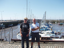
Norman and Kenny at Anstruther
About Me

Current weather at Edinburgh Airport (click for 5-day forecast)

32 comments:
Kenny and Norman
You two are doing brilliantly. The story is very entertaining and the pictures(not yet seen on the blog but ive seen them!!!) are amazing. Keep going and Kenny keep up the journal.
Good luck
Aileen x
Smashing day out boys!! Loved it and pleased to report no afters! When's the next section?
You make us workers really jealous - continue enjoying!! When's the music getting added Kenny?
The Mid has been waiting for your next report, and very enjoyable it is. Memories of 1967..Aden..Mad mitch..sunbathing...playing footie. Working on Hawker Hunters..For the 'buffs' amongst the readership. 43 Squadron were formed in 1916 at Stirling. Nickname: The Fighting Cocks.Insignia: Black gamecock Motto: Gloria Finis ('Glory is the End')
Keep up the good work boys...sorry, its not work !!
Kenny,you sure are getting into these fleurs!
Am awfy prood o' ma Cuz an' his Big Pal!
The Elder Cuz.
Beautiful wild flowers!
Keep right on to the end of the road.
Good luck
Sylv's Pal
Have tried to post a "comment" but none appeared, thus far! I was the "delightful lady passenger" who contributed to the Montrose stop on the mixed-up train on 27th July. Hope you both continue to enjoy the walk and I'll be checking your delightful blog.
Margaret
Well done guys, hope you make it round. I just feel sorry for Kenny if Norman is still drinking Peroni in the hostelries as it costs the equivalent of a fiver a pint! (As fellow Justinlees Thursday night guys will confirm)!
Whatever happened between Stonehaven and Aberdeen?
Help!!! How do I get my name to appear in "Comments"? What on earth is an URL?!!!
Still following your progress. Can't wait for the next leg.
Sylv's pal
Brilliant Sylv's pal. We've had a wee break due to holidays but we pick up again next week and walk from Aberdeen to Peterhead between Monday and Wednesday. Watch this space!
Kenny
How are you going to manage without Aitchy on your next leg?
Aileen xx
Take lots of photies of Fraserburgh please!
Still following your progress with much interest.
Sylv's pal
even though i only joined you both for 4.5 miles your company was superb and i think its a great thing you 2 guy's are doing,,, and thanks kenny for being at mine and leighs special day,,, good luck for the rest of your legs and i will be reading the blog to keep up-dated.
lee
That was great! ¡Qué alegría conocer a alguien tan estupendo!!!!! Julia. Málaga.
Oh so you are going international now for your preferred comments!!!!!
Boys, your well deserved winter break will be coming up soon. Don't let the legs stiffen up, do a few easy jukes to the lovely wee inns roon aboot - just tae keep the cogs oiled!
Kenny goes to the south of Spain with personal trainer for extra training to try and keep up with Norman in the quest of walking round the cost of Scotland. Watch this space to see if his fitness has improved.
You must be saving the best bits for last! Looking forward to next year and your progress.
Sylv's Pal
0 degrees and below today, why are the 2 o' ye no' doing the next leg now? Just kidding Cuz. Look forward to the next session on your blog. A Good New Year to you and Norman and Happy Wandering in 2010.
Oops, forgot to add my name at the end of the last comment - it was meee yer big cuz.
Sylv.
So you've walked 500 miles....... Are you "proclaiming" to walk 500 more?
Well done guys keep it going
Aileen xx
Congratulations on the 800 miles Boys - a great achievement - you are naturals!
Well done guys on your 5th successive and successful year. You're almost there.....:-))
Aileen
Most valuable and fantastic blog I really appreciate your work which you have done about the BUDGET HOTELS,many thanks and keep it up.
BUDGET HOTELS
I really love it and amazing information about the CHEAP HOTEL UK it's really good and great information well done.
CHEAP HOTEL UK
Your blog have allot of detail about the restaurant design london it's a good job.
restaurant design london
I search many blog about the Restaurant but did not get many specific detail about the this topic but your blog have allot of information about my topic which I always searching.
Restaurant
I wanted to thank you for this great read bout the hotel Your blog is one of the finest blog . Thanks for posting this informative article.
http://www.smartholidaydeals.com/
Post a Comment